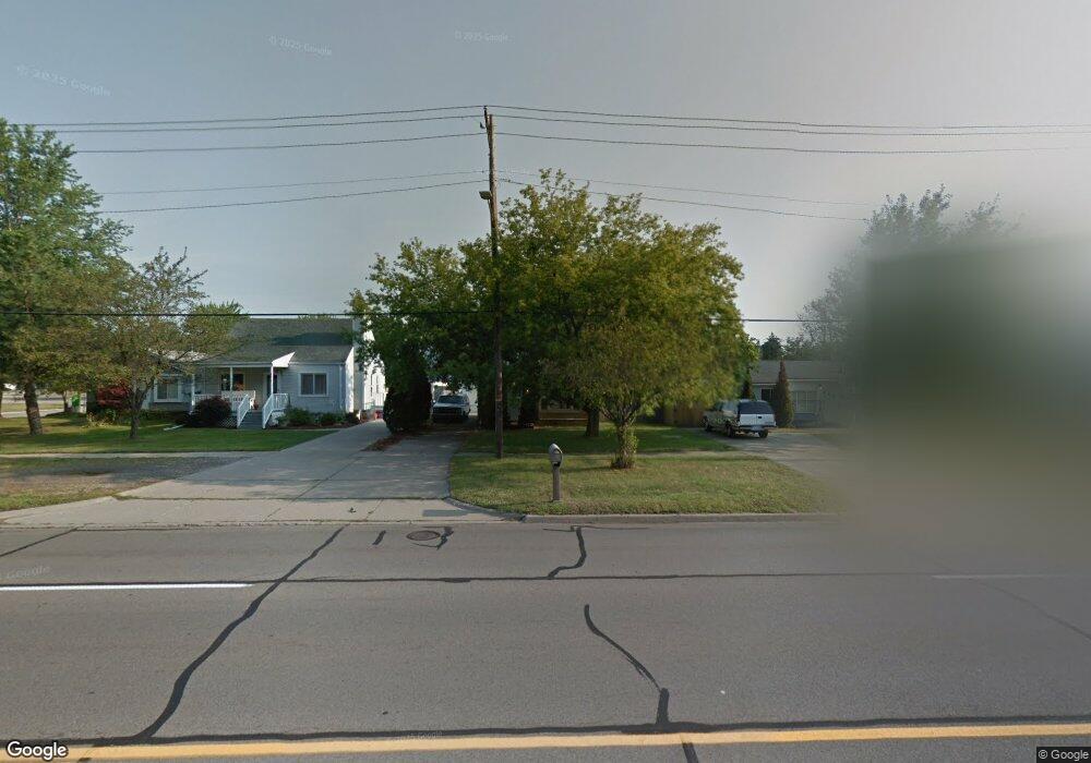
4477 E 10 Mile Rd Warren, MI 48091
Southwest Warren NeighborhoodEstimated Value: $158,000 - $208,000
3
Beds
3
Baths
1,302
Sq Ft
$140/Sq Ft
Est. Value
About This Home
This home is located at 4477 E 10 Mile Rd, Warren, MI 48091 and is currently estimated at $182,583, approximately $140 per square foot. 4477 E 10 Mile Rd is a home located in Macomb County with nearby schools including Mark C. Roose Elementary School, Center Line High School, and Wolfe Middle School.
Ownership History
Date
Name
Owned For
Owner Type
Purchase Details
Closed on
Dec 20, 2005
Sold by
Charter One Credit Corp
Bought by
Ryan On Ten Llc
Current Estimated Value
Purchase Details
Closed on
May 23, 2000
Sold by
Pruitt Scott
Bought by
Clark Brian P
Purchase Details
Closed on
Oct 7, 1994
Sold by
Michigan Land Contracts
Bought by
Pruitt Scott and Pruitt Melissa
Home Financials for this Owner
Home Financials are based on the most recent Mortgage that was taken out on this home.
Original Mortgage
$53,600
Interest Rate
10.25%
Mortgage Type
New Conventional
Create a Home Valuation Report for This Property
The Home Valuation Report is an in-depth analysis detailing your home's value as well as a comparison with similar homes in the area
Home Values in the Area
Average Home Value in this Area
Purchase History
| Date | Buyer | Sale Price | Title Company |
|---|---|---|---|
| Ryan On Ten Llc | $50,000 | Title Source Inc | |
| Clark Brian P | $104,000 | -- | |
| Pruitt Scott | $57,500 | -- |
Source: Public Records
Mortgage History
| Date | Status | Borrower | Loan Amount |
|---|---|---|---|
| Previous Owner | Pruitt Scott | $53,600 | |
| Closed | Clark Brian P | -- |
Source: Public Records
Tax History
| Year | Tax Paid | Tax Assessment Tax Assessment Total Assessment is a certain percentage of the fair market value that is determined by local assessors to be the total taxable value of land and additions on the property. | Land | Improvement |
|---|---|---|---|---|
| 2025 | $2,279 | $85,560 | $0 | $0 |
| 2024 | $22 | $83,420 | $0 | $0 |
| 2023 | $2,069 | $63,190 | $0 | $0 |
| 2022 | $2,015 | $56,630 | $0 | $0 |
| 2021 | $1,970 | $53,550 | $0 | $0 |
| 2020 | $1,906 | $52,630 | $0 | $0 |
| 2019 | $1,840 | $51,490 | $0 | $0 |
| 2018 | $1,846 | $42,770 | $0 | $0 |
| 2017 | $1,688 | $37,540 | $6,180 | $31,360 |
| 2016 | $1,679 | $37,540 | $0 | $0 |
| 2015 | $0 | $30,120 | $0 | $0 |
| 2013 | $3,505 | $27,250 | $0 | $0 |
Source: Public Records
Map
Nearby Homes
- 4225 Kiefer Ave
- 4245 Kiefer Ave
- 24609 Eureka Ave
- 24955 Beierman Ave
- 4949 E 10 Mile Rd
- 4925 E 10 Mile Rd Unit 1
- 4973 E 10 Mile Rd Unit 8
- 4510 Marr Ave
- 4251 Dolores Ave
- 24906 Patricia Ave
- 3440 E 10 Mile Rd
- 25808 Ryan Rd
- 4320 Frazho Rd
- 24756 Hill Ave
- 24025 Cunningham Ave
- 24134 Loretta Ave
- 26112 Cunningham Dr
- 4715 Shell Ct
- 24245 Patricia Ave
- 24130 Audrey Ave
- 4451 Ten Mile Rd
- 4493 E 10 Mile Rd
- 4451 E 10 Mile Rd
- 4509 E 10 Mile Rd
- 25150 Eureka Dr
- 25160 Eureka Dr
- 4541 E 10 Mile Rd
- 25170 Eureka Dr
- 4520 Kiefer Ave
- 4530 Kiefer Ave Unit 7
- 25180 Eureka Dr
- 4508 E 10 Mile Rd
- 4460 E 10 Mile Rd
- 25021 Cunningham Ave
- 25033 Cunningham Ave
- 25007 Cunningham Ave
- 25045 Cunningham Ave
- 25057 Cunningham Ave
- 25069 Cunningham Ave
- 25202 Eureka Dr
Your Personal Tour Guide
Ask me questions while you tour the home.