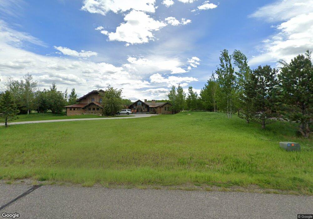
448 Quinn David Ln Bozeman, MT 59715
Estimated Value: $2,546,000 - $3,771,654
4
Beds
4
Baths
5,453
Sq Ft
$605/Sq Ft
Est. Value
About This Home
This home is located at 448 Quinn David Ln, Bozeman, MT 59715 and is currently estimated at $3,300,551, approximately $605 per square foot. 448 Quinn David Ln is a home located in Gallatin County with nearby schools including Hawthorne Elementary School, Chief Joseph Middle School, and Bozeman High School.
Ownership History
Date
Name
Owned For
Owner Type
Purchase Details
Closed on
Dec 3, 2021
Sold by
Wtgc Llc
Bought by
Easton William M
Current Estimated Value
Purchase Details
Closed on
Dec 30, 2020
Sold by
Easton Trisha Leigh and Sol Trust
Bought by
Manley Meadows Hoa Inc
Purchase Details
Closed on
Aug 2, 2018
Sold by
Easton Mark and Easton Trisha
Bought by
Easton Trisha Leigh and Sol Trust
Purchase Details
Closed on
May 27, 2008
Sold by
Mckenna John J and Mckenna Patricia M
Bought by
Easton Mark and Easton Trisha
Purchase Details
Closed on
Jan 5, 2007
Sold by
Alexander Daniel D and Alexander Kimberly A
Bought by
Mckenna John J and Mckenna Patricia M
Purchase Details
Closed on
Jul 14, 2005
Sold by
Jase Development Inc
Bought by
Alexander Daniel D and Alexander Kimberly A
Create a Home Valuation Report for This Property
The Home Valuation Report is an in-depth analysis detailing your home's value as well as a comparison with similar homes in the area
Home Values in the Area
Average Home Value in this Area
Purchase History
| Date | Buyer | Sale Price | Title Company |
|---|---|---|---|
| Easton William M | -- | Security Title Company | |
| Manley Meadows Hoa Inc | -- | None Available | |
| Easton Trisha Leigh | -- | None Available | |
| Easton Mark | -- | Security Title Company | |
| Mckenna John J | -- | Security Title Company | |
| Alexander Daniel D | -- | Montana Title & Escrow |
Source: Public Records
Tax History Compared to Growth
Tax History
| Year | Tax Paid | Tax Assessment Tax Assessment Total Assessment is a certain percentage of the fair market value that is determined by local assessors to be the total taxable value of land and additions on the property. | Land | Improvement |
|---|---|---|---|---|
| 2025 | $24,284 | $3,475,000 | $0 | $0 |
| 2024 | $19,495 | $3,112,278 | $0 | $0 |
| 2023 | $18,765 | $3,112,278 | $0 | $0 |
| 2022 | $14,110 | $2,025,269 | $0 | $0 |
| 2021 | $14,252 | $2,025,269 | $0 | $0 |
| 2020 | $15,286 | $1,974,347 | $0 | $0 |
| 2019 | $15,043 | $1,974,347 | $0 | $0 |
| 2018 | $13,725 | $1,694,349 | $0 | $0 |
| 2017 | $12,553 | $1,694,349 | $0 | $0 |
| 2016 | $11,132 | $1,415,288 | $0 | $0 |
| 2015 | $11,101 | $1,415,288 | $0 | $0 |
| 2014 | $12,219 | $914,176 | $0 | $0 |
Source: Public Records
Map
Nearby Homes
- 333 Churn Creek Dr
- 809 Cape Ave
- 1 Riverside Dr
- 3 Gallatin Dr Unit C
- Lot 2 Cos 3038 Springhill Rd
- 523 St Andrews Dr
- 557 St Andrews Dr
- 329 Gallatin Park Dr Unit 103/203
- 329 Gallatin Park Dr Unit 102/202
- 375 Gallatin Park Dr
- 369 Gallatin Park Dr
- 365 Gallatin Park Dr
- 365, 369 & 375 Gallatin Park Dr
- 3107 Augusta Dr
- 3349 N 27th Ave Unit 24
- 3321 N 27th Ave Unit 2
- 2763 Catalyst St
- 3354 Warbler Way Unit B
- 3210 Warbler Way Unit 8
- 1055 Caddie Ct
- 408 Quinn David Ln
- 474 Quinn David Ln
- 447 Quinn David Ln
- 145 Jeana Lei Ct
- 35 Jeana Lei Ct
- 453 Churn Creek Dr
- TBD Jeana Lei Ct
- 102 Jeana Lei Ct
- 410 Churn Creek Dr
- 190 Jeana Lei Ct
- TBD Quinn David Ln
- 376 Churn Creek Dr
- 645 Quinn David Ln
- 200 Jeana Lei Ct
- TBD Churn Creek Dr
- 290 Churn Creek Dr
- 349 Churn Creek Dr
- Lot 32 Churn Creek
- Lot 2 Churn Creek Dr
- 3401 McIlhattan Rd