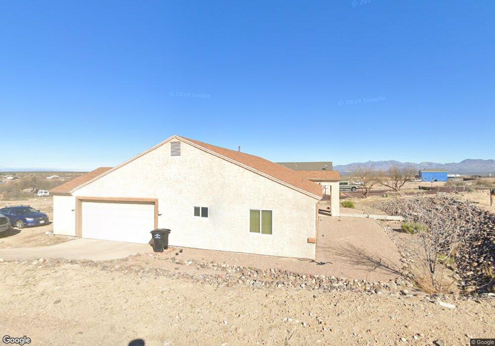
4480 S 10th Ave Safford, AZ 85546
Estimated Value: $397,000 - $428,000
--
Bed
2
Baths
2,130
Sq Ft
$195/Sq Ft
Est. Value
About This Home
This home is located at 4480 S 10th Ave, Safford, AZ 85546 and is currently estimated at $415,649, approximately $195 per square foot. 4480 S 10th Ave is a home located in Graham County with nearby schools including Dorothy Stinson School, Ruth Powell Elementary School, and Lafe Nelson School.
Ownership History
Date
Name
Owned For
Owner Type
Purchase Details
Closed on
Apr 8, 2025
Sold by
Imperial Structures Llc
Bought by
C3 Construction Llc
Current Estimated Value
Purchase Details
Closed on
Dec 6, 2021
Sold by
Mayhew Clayton D and Mayhew Felicity A
Bought by
Stevens Todd
Home Financials for this Owner
Home Financials are based on the most recent Mortgage that was taken out on this home.
Original Mortgage
$290,080
Interest Rate
3.09%
Mortgage Type
VA
Purchase Details
Closed on
Aug 13, 2014
Sold by
Hancock Lynn M and Hancock Dee L
Bought by
Mayhew Clayton D and Mayhew Felicity A
Home Financials for this Owner
Home Financials are based on the most recent Mortgage that was taken out on this home.
Original Mortgage
$128,000
Interest Rate
4.11%
Mortgage Type
New Conventional
Create a Home Valuation Report for This Property
The Home Valuation Report is an in-depth analysis detailing your home's value as well as a comparison with similar homes in the area
Home Values in the Area
Average Home Value in this Area
Purchase History
| Date | Buyer | Sale Price | Title Company |
|---|---|---|---|
| C3 Construction Llc | -- | Stewart Title & Trust Of Phoen | |
| Stevens Todd | $280,000 | Stewart Title & Tr Safford | |
| Mayhew Clayton D | $160,000 | Safford Title Agency |
Source: Public Records
Mortgage History
| Date | Status | Borrower | Loan Amount |
|---|---|---|---|
| Previous Owner | Stevens Todd | $290,080 | |
| Previous Owner | Mayhew Clayton D | $128,000 |
Source: Public Records
Tax History Compared to Growth
Tax History
| Year | Tax Paid | Tax Assessment Tax Assessment Total Assessment is a certain percentage of the fair market value that is determined by local assessors to be the total taxable value of land and additions on the property. | Land | Improvement |
|---|---|---|---|---|
| 2026 | $1,397 | -- | -- | -- |
| 2025 | $1,397 | $26,532 | $1,458 | $25,074 |
| 2024 | $1,439 | $24,694 | $978 | $23,716 |
| 2023 | $1,439 | $19,421 | $900 | $18,521 |
| 2022 | $1,409 | $15,778 | $705 | $15,073 |
| 2021 | $1,545 | $0 | $0 | $0 |
| 2020 | $1,553 | $0 | $0 | $0 |
| 2019 | $1,642 | $0 | $0 | $0 |
| 2018 | $1,548 | $0 | $0 | $0 |
| 2017 | $1,416 | $0 | $0 | $0 |
| 2016 | $1,303 | $0 | $0 | $0 |
| 2015 | $1,187 | $0 | $0 | $0 |
Source: Public Records
Map
Nearby Homes
- 0 No Address Available Unknown Unit 22424757
- 5256 S Us Hwy 191 Lot 1 -- Unit 1
- 5256 U S 191 Unit 5
- 0 Tbd Anns Ranch
- 0 Tbd Anns Ranch
- 3354 S Us Highway 191
- APN# 103-22-018
- 0 Star Fire Cir Unit 1719797
- 0 Star Fire Cir Unit 1719796
- 0 Star Fire Cir Unit 4 22415917
- 8th and Discovery --
- tbd Tbd
- tbd Tbd Unit 4
- tbd Tbd Unit 3
- tbd Tbd Unit 2
- tbd Tbd Unit 1
- 1318 W 26th St
- 1405 W 24th St
- 1919 W 26th St
- 315 W 24th St
- 4460 S 10th Ave
- 1089 W 45th St
- 4440 S 10th Ave
- 1120 W 45th St
- 4495 S 10th Ave
- 4420 S 10th Ave
- 4393 S 10th Ave
- 4380 S 10th Ave
- 4401 S 10th Ave
- 1090 W Cholla Dr
- 4344 S 10th Ave
- 1170 W Cholla Dr
- 861 W 45th St
- 4332 S 10th Ave
- 1252 W 45th St
- 1111 W Cholla Dr
- 4320 S 10th Ave
- 1096 W 45th St
- 870 W Cholla Dr
- 850 W 45th St