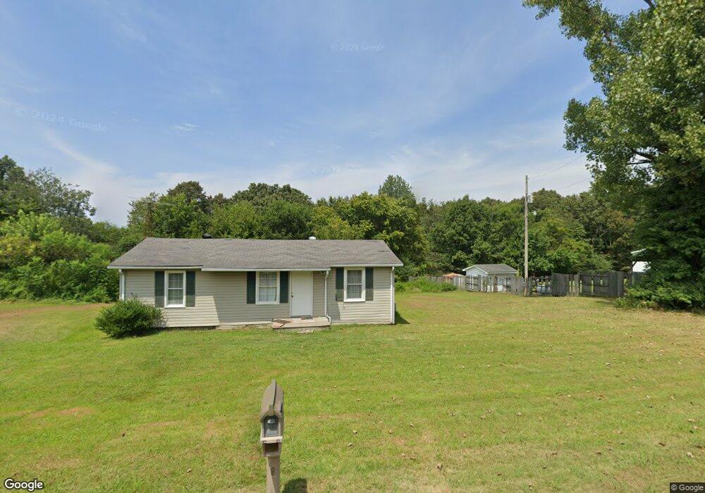
449 Bazzie Dock Rd Big Rock, TN 37023
Estimated Value: $109,814 - $301,000
2
Beds
1
Bath
874
Sq Ft
$215/Sq Ft
Est. Value
About This Home
This home is located at 449 Bazzie Dock Rd, Big Rock, TN 37023 and is currently estimated at $187,954, approximately $215 per square foot. 449 Bazzie Dock Rd is a home located in Stewart County with nearby schools including North Stewart Elementary School, Stewart County Middle School, and Stewart County High School.
Ownership History
Date
Name
Owned For
Owner Type
Purchase Details
Closed on
Jul 16, 2010
Sold by
Hsbc Bank Usa Na
Bought by
Murphy Mark
Current Estimated Value
Purchase Details
Closed on
Feb 18, 2010
Sold by
Taylor Joseph
Bought by
Hsbc Bank Usa Na
Purchase Details
Closed on
Aug 30, 2006
Bought by
Joseph Taylor
Home Financials for this Owner
Home Financials are based on the most recent Mortgage that was taken out on this home.
Original Mortgage
$50,000
Interest Rate
6.58%
Mortgage Type
Cash
Purchase Details
Closed on
Apr 16, 1997
Bought by
Sills Lisa C
Purchase Details
Closed on
Feb 24, 1997
Purchase Details
Closed on
Sep 13, 1989
Bought by
Wallace Neal B and Wallace Dianne F
Purchase Details
Closed on
Apr 14, 1989
Bought by
Jolley Wade
Create a Home Valuation Report for This Property
The Home Valuation Report is an in-depth analysis detailing your home's value as well as a comparison with similar homes in the area
Home Values in the Area
Average Home Value in this Area
Purchase History
| Date | Buyer | Sale Price | Title Company |
|---|---|---|---|
| Murphy Mark | $20,500 | -- | |
| Hsbc Bank Usa Na | $55,087 | -- | |
| Joseph Taylor | $50,000 | -- | |
| Sills Lisa C | $17,000 | -- | |
| -- | -- | -- | |
| Wallace Neal B | $1,000 | -- | |
| Jolley Wade | -- | -- |
Source: Public Records
Mortgage History
| Date | Status | Borrower | Loan Amount |
|---|---|---|---|
| Previous Owner | Jolley Wade | $50,000 |
Source: Public Records
Tax History Compared to Growth
Tax History
| Year | Tax Paid | Tax Assessment Tax Assessment Total Assessment is a certain percentage of the fair market value that is determined by local assessors to be the total taxable value of land and additions on the property. | Land | Improvement |
|---|---|---|---|---|
| 2024 | $295 | $19,825 | $3,425 | $16,400 |
| 2023 | $279 | $11,825 | $2,275 | $9,550 |
| 2022 | $279 | $11,825 | $2,275 | $9,550 |
| 2021 | $279 | $11,825 | $2,275 | $9,550 |
| 2020 | $302 | $11,825 | $2,275 | $9,550 |
| 2019 | $302 | $11,850 | $2,275 | $9,575 |
| 2018 | $302 | $11,850 | $2,275 | $9,575 |
| 2017 | $302 | $11,850 | $2,275 | $9,575 |
| 2016 | $302 | $11,850 | $2,275 | $9,575 |
| 2015 | $293 | $11,850 | $2,275 | $9,575 |
| 2014 | $322 | $11,850 | $2,275 | $9,575 |
| 2013 | $322 | $13,036 | $0 | $0 |
Source: Public Records
Map
Nearby Homes
- 234 Bazzie Dock Rd
- 242 Barn Circle Rd
- 376 Joiner Hollow Rd
- 2 Haleys Cove
- 1077 Bumpus Mills Rd
- 1394 Highway 120
- 124 Norris Hancock Rd
- 2447 Highway 120
- 124 Hayes Fork Creek Rd
- 1551 Old Highway 79 Unit 1551
- 909 Old Highway 79
- 330 Durwachter Rd
- 223 Oak Tree Dr
- 0 Stimson Rd Unit 24207833
- 0 Stimson Rd Unit RTC2944698
- 3023 Highway 120 Unit 3021
- 130 Wayne Threatt Rd
- 416 Walker Ridge Rd
- 1 Highway 79
- 239 Wayne Threatt Rd
- 447 Bazzie Dock Rd
- 446 Bazzie Dock Rd
- 441 Bazzie Dock Rd
- 479 Bazzie Dock Rd
- 420 Bazzie Dock Rd
- 517 Bazzie Dock Rd
- 153 Tosha Ln
- 533 Bazzie Dock Rd
- 538 Bazzie Dock Rd
- 567 Bazzie Dock Rd
- 361 Sandy Kay Rd
- 550 Bazzie Dock Rd
- 552 Bazzie Dock Rd
- 349 Bazzie Dock Rd
- 573 Bazzie Dock Rd
- 579 Bazzie Dock Rd Unit 573
- 188 Tosha Ln
- 574 Bazzie Dock Rd
- 591 Bazzie Dock Rd
- 353 Sandy Kay Rd