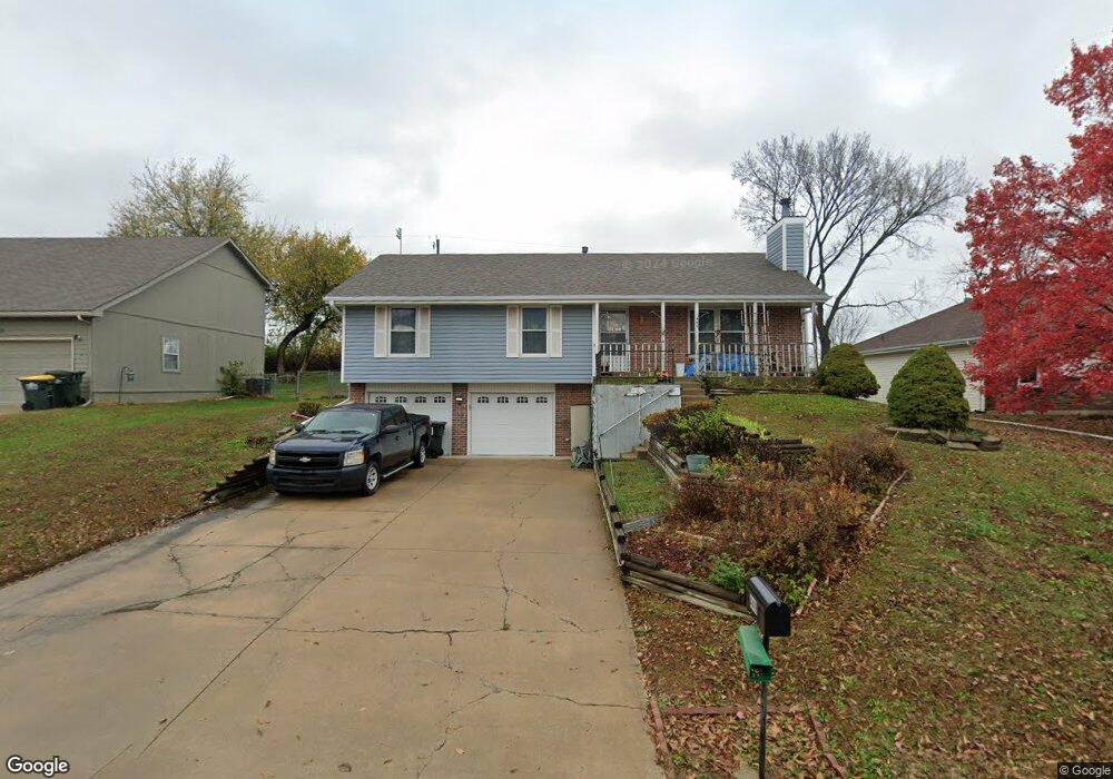
449 Hithergreen Dr Lansing, KS 66043
Estimated Value: $276,000 - $291,000
3
Beds
3
Baths
1,274
Sq Ft
$222/Sq Ft
Est. Value
About This Home
This home is located at 449 Hithergreen Dr, Lansing, KS 66043 and is currently estimated at $283,091, approximately $222 per square foot. 449 Hithergreen Dr is a home located in Leavenworth County with nearby schools including Lansing Elementary School, Lansing Middle 6-8, and Lansing High 9-12.
Ownership History
Date
Name
Owned For
Owner Type
Purchase Details
Closed on
Sep 1, 1998
Bought by
Warner Linda K
Current Estimated Value
Home Financials for this Owner
Home Financials are based on the most recent Mortgage that was taken out on this home.
Original Mortgage
$79,648
Outstanding Balance
$29,428
Interest Rate
6.92%
Mortgage Type
VA
Estimated Equity
$253,663
Create a Home Valuation Report for This Property
The Home Valuation Report is an in-depth analysis detailing your home's value as well as a comparison with similar homes in the area
Home Values in the Area
Average Home Value in this Area
Purchase History
| Date | Buyer | Sale Price | Title Company |
|---|---|---|---|
| Warner Linda K | $90,000 | -- |
Source: Public Records
Mortgage History
| Date | Status | Borrower | Loan Amount |
|---|---|---|---|
| Open | Warner Linda K | $79,648 | |
| Closed | Warner Linda K | $89,757 |
Source: Public Records
Tax History Compared to Growth
Tax History
| Year | Tax Paid | Tax Assessment Tax Assessment Total Assessment is a certain percentage of the fair market value that is determined by local assessors to be the total taxable value of land and additions on the property. | Land | Improvement |
|---|---|---|---|---|
| 2025 | $3,516 | $28,360 | $4,860 | $23,500 |
| 2024 | $3,282 | $26,505 | $3,825 | $22,680 |
| 2023 | $3,282 | $25,486 | $3,825 | $21,661 |
| 2022 | $3,156 | $23,170 | $3,056 | $20,114 |
| 2021 | $2,778 | $19,409 | $3,056 | $16,353 |
| 2020 | $2,624 | $18,055 | $3,203 | $14,852 |
| 2019 | $2,628 | $18,055 | $3,203 | $14,852 |
| 2018 | $2,397 | $16,502 | $2,654 | $13,848 |
| 2017 | $2,309 | $15,870 | $2,654 | $13,216 |
| 2016 | $2,310 | $15,870 | $2,654 | $13,216 |
| 2015 | $2,303 | $15,870 | $2,654 | $13,216 |
| 2014 | $2,183 | $15,375 | $2,654 | $12,721 |
Source: Public Records
Map
Nearby Homes
- 102 S 3rd Ct
- 104 Olive St
- 506 1st Terrace
- 218 E Kay St
- 901 S Main St
- 209 E Kay St
- 202 S Main St
- 124 S Main St
- 527 S Valley Dr
- 624 S Bittersweet Ln
- 722 Bittersweet Rd
- 922 Southfork St
- 115 W Gilman Rd
- 131 Rock Creek Loop
- 129 Brookwood St
- 811 4-H Rd
- 610 Meadowlark Rd
- 261 Holiday Dr
- 268 Holiday Dr
- 706 N 2nd St
- 451 Hithergreen Dr
- 447 Hithergreen Dr
- 445 Hithergreen Dr
- 453 Hithergreen Dr
- 582 Hithergreen Dr
- 448 Hithergreen Dr
- 450 Hithergreen Dr
- 0000 Hithergreen Dr
- 443 Hithergreen Dr
- 578 Hithergreen Dr
- 444 Hithergreen Dr
- 441 Hithergreen Dr
- 442 Hithergreen Dr
- 339 Fawn Valley St
- 0 Hithergreen Dr Unit 2084189
- 0 Hithergreen Dr Unit HMS2443188
- 574 Hithergreen Dr
- 597 Hithergreen Dr
- 439 Hithergreen Dr
- 440 Hithergreen Dr