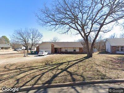
449 N Shadow Ln Sapulpa, OK 74066
Estimated Value: $179,000 - $229,000
3
Beds
2
Baths
1,661
Sq Ft
$127/Sq Ft
Est. Value
About This Home
This home is located at 449 N Shadow Ln, Sapulpa, OK 74066 and is currently estimated at $211,289, approximately $127 per square foot. 449 N Shadow Ln is a home located in Creek County with nearby schools including Sapulpa Junior High School, Sapulpa Middle School, and Sapulpa High School.
Ownership History
Date
Name
Owned For
Owner Type
Purchase Details
Closed on
Apr 13, 2018
Sold by
Secretary Of Housing And Urban Developme
Bought by
Wolf Starla Gay
Current Estimated Value
Purchase Details
Closed on
Jan 24, 2018
Sold by
Bokf N A
Bought by
The Secretary Of Hud
Purchase Details
Closed on
Oct 3, 2017
Sold by
Florer John Wesley and Florer Wesley John
Bought by
Bokf N A and Bank Of Oklahoma N A
Purchase Details
Closed on
Jul 9, 2010
Sold by
Smith Victoria L and Smith Carroll J
Bought by
Florer John Wesley
Home Financials for this Owner
Home Financials are based on the most recent Mortgage that was taken out on this home.
Original Mortgage
$109,425
Interest Rate
4.75%
Mortgage Type
FHA
Create a Home Valuation Report for This Property
The Home Valuation Report is an in-depth analysis detailing your home's value as well as a comparison with similar homes in the area
Home Values in the Area
Average Home Value in this Area
Purchase History
| Date | Buyer | Sale Price | Title Company |
|---|---|---|---|
| Wolf Starla Gay | -- | None Available | |
| The Secretary Of Hud | -- | Servicelink | |
| Bokf N A | $97,683 | None Available | |
| Florer John Wesley | $111,000 | -- |
Source: Public Records
Mortgage History
| Date | Status | Borrower | Loan Amount |
|---|---|---|---|
| Open | Wolf Starla Gay | $50,256 | |
| Open | Wolf Starla Gay | $100,300 | |
| Previous Owner | Florer John Wesley | $109,425 |
Source: Public Records
Tax History Compared to Growth
Tax History
| Year | Tax Paid | Tax Assessment Tax Assessment Total Assessment is a certain percentage of the fair market value that is determined by local assessors to be the total taxable value of land and additions on the property. | Land | Improvement |
|---|---|---|---|---|
| 2024 | $2,267 | $18,651 | $3,600 | $15,051 |
| 2023 | $2,267 | $17,763 | $3,600 | $14,163 |
| 2022 | $1,943 | $16,917 | $3,600 | $13,317 |
| 2021 | $1,912 | $16,112 | $3,600 | $12,512 |
| 2020 | $1,862 | $15,783 | $3,600 | $12,183 |
| 2019 | $1,782 | $15,032 | $3,600 | $11,432 |
| 2018 | $1,819 | $15,032 | $3,600 | $11,432 |
| 2017 | $1,620 | $14,460 | $3,600 | $10,860 |
| 2016 | $1,503 | $14,131 | $3,583 | $10,548 |
| 2015 | -- | $13,720 | $3,561 | $10,159 |
| 2014 | -- | $13,320 | $3,540 | $9,780 |
Source: Public Records
Map
Nearby Homes
- 1 N Ruble St
- 0 Line St Unit 2514767
- 1642 E Jones Ave
- 512 N Dawn Ln
- 201 Woodview Ln
- 1418 E Line Ave
- 1600 E Perkins Ave
- 1809 E Lee Ave
- 1410 E Line Ave
- 6 Mayfield St
- 21 Mayfield St
- 708 N Brown St
- 1235 E Jackson Ave N
- 1535 Cardinal Cir
- 405 N Elizabeth St
- 818 N Boyd Cir
- 617 N Elizabeth St
- 1518 Melissa Cir
- 543 N Ridgeway St
- 1401 E Mckinley Ave
- 449 N Shadow Ln
- 449 Shadow Ln
- 1814 E Denton Ave
- 443 Shadow Ln
- 443 Shadow Ln
- 1818 E Denton Ave
- 420 Foxwood Dr
- 424 Foxwood Dr
- 428 Foxwood Dr
- 416 Foxwood Dr
- 432 Foxwood Dr
- 1809 E Denton Ave
- 412 Foxwood Dr
- 1803 E Denton Ave
- 438 Shadow Ln
- 1813 E Denton Ave
- 1817 E Denton Ave
- 431 Shadow Ln
- 408 Foxwood Dr
- 423 Foxwood Dr