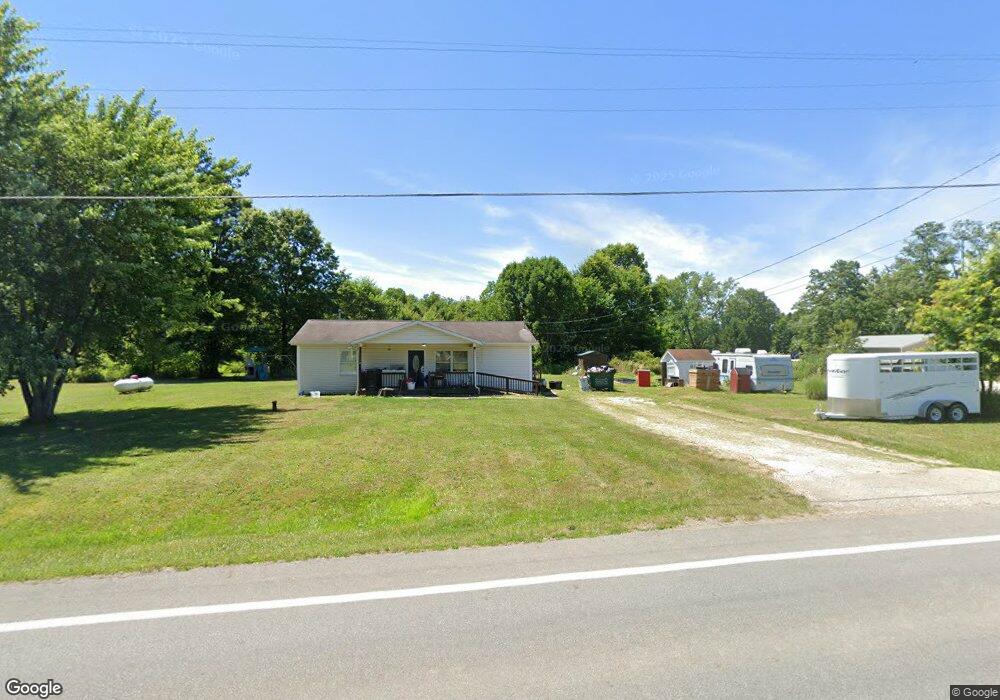
449 State Route 183 Atwater, OH 44201
Estimated Value: $198,000 - $250,000
5
Beds
2
Baths
1,744
Sq Ft
$127/Sq Ft
Est. Value
About This Home
This home is located at 449 State Route 183, Atwater, OH 44201 and is currently estimated at $221,887, approximately $127 per square foot. 449 State Route 183 is a home located in Portage County with nearby schools including Waterloo Elementary School, Waterloo Middle School, and Waterloo High School.
Ownership History
Date
Name
Owned For
Owner Type
Purchase Details
Closed on
Dec 19, 2003
Sold by
Spencer Margaret F
Bought by
Kachner Lee A and Kachner Shannon M
Current Estimated Value
Home Financials for this Owner
Home Financials are based on the most recent Mortgage that was taken out on this home.
Original Mortgage
$118,000
Outstanding Balance
$54,096
Interest Rate
5.84%
Mortgage Type
VA
Estimated Equity
$167,791
Purchase Details
Closed on
May 1, 2003
Sold by
Estate Of Alan D Spencer
Bought by
Spencer Margaret F
Home Financials for this Owner
Home Financials are based on the most recent Mortgage that was taken out on this home.
Original Mortgage
$118,000
Interest Rate
5.84%
Mortgage Type
VA
Purchase Details
Closed on
Jan 1, 1990
Bought by
Spencer Alan D
Create a Home Valuation Report for This Property
The Home Valuation Report is an in-depth analysis detailing your home's value as well as a comparison with similar homes in the area
Home Values in the Area
Average Home Value in this Area
Purchase History
| Date | Buyer | Sale Price | Title Company |
|---|---|---|---|
| Kachner Lee A | $118,200 | Midland Commerce Group | |
| Spencer Margaret F | -- | Midland Commerce Group | |
| Spencer Alan D | -- | -- |
Source: Public Records
Mortgage History
| Date | Status | Borrower | Loan Amount |
|---|---|---|---|
| Open | Kachner Lee A | $118,000 | |
| Previous Owner | Spencer Margaret F | $118,000 |
Source: Public Records
Tax History Compared to Growth
Tax History
| Year | Tax Paid | Tax Assessment Tax Assessment Total Assessment is a certain percentage of the fair market value that is determined by local assessors to be the total taxable value of land and additions on the property. | Land | Improvement |
|---|---|---|---|---|
| 2024 | $2,140 | $58,110 | $15,860 | $42,250 |
| 2023 | $2,026 | $47,600 | $11,900 | $35,700 |
| 2022 | $2,077 | $47,600 | $11,900 | $35,700 |
| 2021 | $2,052 | $47,600 | $11,900 | $35,700 |
| 2020 | $1,859 | $41,650 | $11,900 | $29,750 |
| 2019 | $1,861 | $41,650 | $11,900 | $29,750 |
| 2018 | $1,848 | $33,500 | $12,570 | $20,930 |
| 2017 | $1,568 | $33,500 | $12,570 | $20,930 |
| 2016 | $1,540 | $33,500 | $12,570 | $20,930 |
| 2015 | $1,581 | $33,500 | $12,570 | $20,930 |
| 2014 | $1,596 | $33,500 | $12,570 | $20,930 |
| 2013 | $1,612 | $33,500 | $12,570 | $20,930 |
Source: Public Records
Map
Nearby Homes
- 90 N Jefferson St
- 7374 Virginia Rd
- 14920 Mccallum Ave NE
- 6727 Waterloo Rd
- 1015 Stroup Rd
- 6453 Waterloo Rd
- 5615 Laubert Rd
- 1454 Hillcrest Dr
- 1452 Stroup Rd
- 1440 Porter Rd
- 5457 Waterloo Rd
- 14265 Reeder Ave NE
- 5296 Eberly Rd
- 12415 Snode St NE
- 0 New Milford Rd Unit 5119787
- 4829 Laubert Rd
- 0 Knoll St NE
- 13109 Edison St NE
- 0 Industry Rd
- 13004 Edison St NE
- 431 State Route 183
- 420 Ohio 183
- 434 State Route 183
- 411 State Route 183
- 478 State Route 183
- 501 State Route 183
- 452 State Route 183
- 373 State Route 183
- 494 State Route 183
- 535 State Route 183
- 508 State Route 183
- 537 State Route 183
- 372 State Route 183
- 420 State Route 183
- 568 State Route 183
- 611 State Route 183
- 296 State Route 183
- 296 State Route 183 Unit 53
- 597 State Route 183
- 6798 Virginia Rd