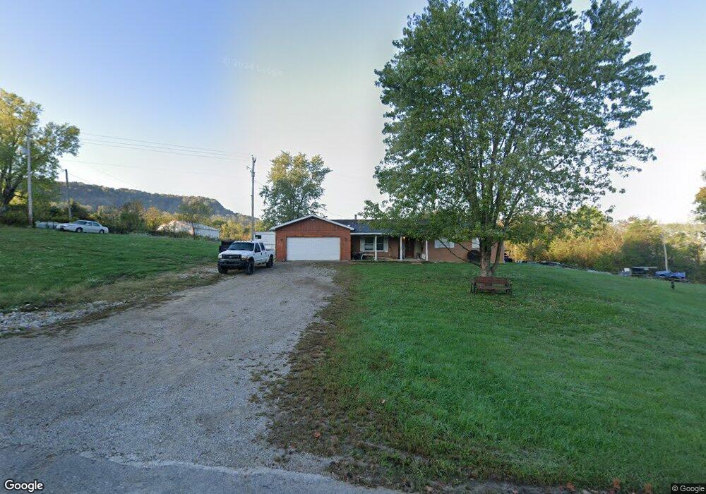
449 Weaver Rd West Union, OH 45693
Estimated Value: $172,000 - $246,000
3
Beds
1
Bath
1,320
Sq Ft
$154/Sq Ft
Est. Value
About This Home
This home is located at 449 Weaver Rd, West Union, OH 45693 and is currently estimated at $203,056, approximately $153 per square foot. 449 Weaver Rd is a home located in Adams County with nearby schools including West Union Elementary School and West Union High School.
Ownership History
Date
Name
Owned For
Owner Type
Purchase Details
Closed on
Dec 9, 2008
Sold by
Boldman Dustin
Bought by
Koening Charles J
Current Estimated Value
Purchase Details
Closed on
Jul 18, 2008
Sold by
Hall Melinda
Bought by
Boldman Dustin
Home Financials for this Owner
Home Financials are based on the most recent Mortgage that was taken out on this home.
Original Mortgage
$70,000
Interest Rate
6.5%
Mortgage Type
Balloon
Purchase Details
Closed on
Jan 1, 1990
Bought by
Vogler Darrell N
Create a Home Valuation Report for This Property
The Home Valuation Report is an in-depth analysis detailing your home's value as well as a comparison with similar homes in the area
Home Values in the Area
Average Home Value in this Area
Purchase History
| Date | Buyer | Sale Price | Title Company |
|---|---|---|---|
| Koening Charles J | $100,000 | None Available | |
| Boldman Dustin | $70,000 | None Available | |
| Vogler Darrell N | -- | -- |
Source: Public Records
Mortgage History
| Date | Status | Borrower | Loan Amount |
|---|---|---|---|
| Previous Owner | Boldman Dustin | $70,000 |
Source: Public Records
Tax History Compared to Growth
Tax History
| Year | Tax Paid | Tax Assessment Tax Assessment Total Assessment is a certain percentage of the fair market value that is determined by local assessors to be the total taxable value of land and additions on the property. | Land | Improvement |
|---|---|---|---|---|
| 2024 | $15,060 | $37,660 | $8,470 | $29,190 |
| 2023 | $9,792 | $36,230 | $8,470 | $27,760 |
| 2022 | $1,950 | $31,610 | $5,360 | $26,250 |
| 2021 | $1,211 | $31,610 | $5,360 | $26,250 |
| 2020 | $1,180 | $31,610 | $5,360 | $26,250 |
| 2019 | $1,180 | $31,610 | $5,360 | $26,250 |
| 2018 | $998 | $27,240 | $5,360 | $21,880 |
| 2017 | $981 | $27,240 | $5,360 | $21,880 |
| 2016 | $979 | $27,240 | $5,360 | $21,880 |
| 2015 | $1,028 | $29,580 | $4,310 | $25,270 |
| 2014 | $1,029 | $29,580 | $4,310 | $25,270 |
Source: Public Records
Map
Nearby Homes
- 598 Ohio 348
- 1186 Tulip Rd
- 1011 Hafer Rd
- 1064 Hafer Rd
- 1805 Waggoner Riffle Rd
- 467 Waggoner Riffle Rd
- 1460 Hamilton Rd
- 189 Hamilton Rd
- 4702 Brush Creek Rd
- 4702 Ohio Brush Creek Rd
- 858 Randalls Run Rd
- 410 Owens Rd
- 2603 Cassel Run Rd
- 108 Chirsdon Ln
- 405 Lookout View
- 1478 Robinson Hollow Rd
- 13465 State Route 41
- 1082 E Walnut St
- 216 Kurt St
- 260 Randy St
- 380 Weaver Rd
- 255 Weaver Rd
- 15387 State Route 125
- 15387 State Route 125
- 15359 State Route 125
- 15501 State Route 125
- 15556 State Route 125
- 80 Weaver Rd
- 5382 Waggoner Riffle Rd
- 14867 State Route 125
- 545 State Route 348
- 585 State Route 348
- 566 State Route 348
- 468 State Route 348
- 727 State Route 348
- 598 State Route 348
- 727 State Route 348
- 660 State Route 348
- 1179 State Route 348
- 811 State Route 348