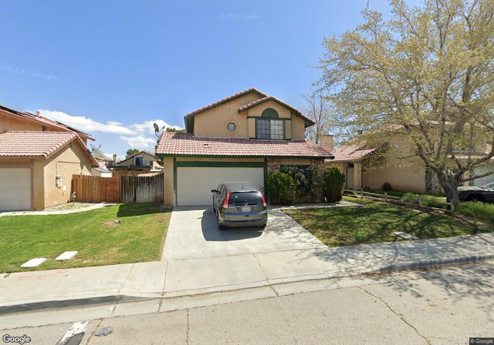
44922 Rock Island Dr Lancaster, CA 93535
East Lancaster NeighborhoodEstimated Value: $415,292 - $474,000
3
Beds
3
Baths
1,717
Sq Ft
$257/Sq Ft
Est. Value
About This Home
This home is located at 44922 Rock Island Dr, Lancaster, CA 93535 and is currently estimated at $441,573, approximately $257 per square foot. 44922 Rock Island Dr is a home located in Los Angeles County with nearby schools including Discovery Elementary School, Piute Middle School, and Eastside High School.
Ownership History
Date
Name
Owned For
Owner Type
Purchase Details
Closed on
Dec 1, 2009
Sold by
Security Title Llc
Bought by
P-130 Trust and Security Title Llc
Current Estimated Value
Purchase Details
Closed on
Aug 23, 2004
Sold by
Miller Charlene
Bought by
Security Title Llc and 44922 Rock Island Trust
Purchase Details
Closed on
Apr 20, 2004
Sold by
Miller Raymond Lloyd and Miller Trust
Bought by
Miller Raymond Lloyd
Home Financials for this Owner
Home Financials are based on the most recent Mortgage that was taken out on this home.
Original Mortgage
$112,700
Interest Rate
5.92%
Mortgage Type
Credit Line Revolving
Purchase Details
Closed on
Apr 5, 2004
Sold by
Security Title
Bought by
Miller Raymond Lloyd and Miller Trust
Home Financials for this Owner
Home Financials are based on the most recent Mortgage that was taken out on this home.
Original Mortgage
$112,700
Interest Rate
5.92%
Mortgage Type
Credit Line Revolving
Purchase Details
Closed on
Feb 5, 2004
Sold by
Koch Mildred and 44922 Rock Island Trust
Bought by
Security Title and 44922 Rock Island Trust
Purchase Details
Closed on
Apr 13, 2003
Sold by
Powell Belinda A
Bought by
Koch Mildred and 44922 Rock Island Trust
Purchase Details
Closed on
Oct 12, 1998
Sold by
Borja Sandra A and Gibbard William
Bought by
Powell Enois M
Home Financials for this Owner
Home Financials are based on the most recent Mortgage that was taken out on this home.
Original Mortgage
$80,070
Interest Rate
6.71%
Purchase Details
Closed on
Aug 11, 1998
Sold by
Powell Belinda A
Bought by
Powell Enois M
Purchase Details
Closed on
Aug 14, 1996
Sold by
Hud
Bought by
Borja Sandra A and Gibbard William
Home Financials for this Owner
Home Financials are based on the most recent Mortgage that was taken out on this home.
Original Mortgage
$90,785
Interest Rate
8.18%
Mortgage Type
FHA
Purchase Details
Closed on
May 13, 1996
Sold by
The Prudential Home Mtg Company Inc
Bought by
Hud
Purchase Details
Closed on
Apr 22, 1996
Sold by
Cote Alain M and Cote Barbara K
Bought by
The Prudential Home Mtg Company Inc
Create a Home Valuation Report for This Property
The Home Valuation Report is an in-depth analysis detailing your home's value as well as a comparison with similar homes in the area
Home Values in the Area
Average Home Value in this Area
Purchase History
We collect this data history from publicly available records. To have your information removed, we recommend requesting removal directly through your county’s website.
| Date | Buyer | Sale Price | Title Company |
|---|---|---|---|
| P-130 Trust | -- | None Available | |
| Security Title Llc | -- | -- | |
| Security Title | -- | -- | |
| Miller Raymond Lloyd | -- | Fidelity National | |
| Miller Raymond Lloyd | -- | -- | |
| Security Title | -- | -- | |
| Koch Mildred | -- | -- | |
| Koch Mildred | -- | -- | |
| Powell Enois M | $80,000 | Chicago Title Co | |
| Powell Enois M | -- | Chicago Title Co | |
| Borja Sandra A | $91,000 | First American Title Co | |
| Hud | -- | American Title | |
| The Prudential Home Mtg Company Inc | $112,731 | American Title Ins Co |
Source: Public Records
Mortgage History
We collect this data history from publicly available records. To have your information removed, we recommend requesting removal directly through your county’s website.
| Date | Status | Borrower | Loan Amount |
|---|---|---|---|
| Previous Owner | Miller Raymond Lloyd | $112,700 | |
| Previous Owner | Powell Enois M | $80,070 | |
| Previous Owner | Borja Sandra A | $90,785 |
Source: Public Records
Tax History
| Year | Tax Paid | Tax Assessment Tax Assessment Total Assessment is a certain percentage of the fair market value that is determined by local assessors to be the total taxable value of land and additions on the property. | Land | Improvement |
|---|---|---|---|---|
| 2025 | $3,139 | $145,458 | $36,392 | $109,066 |
| 2024 | $3,139 | $142,607 | $35,679 | $106,928 |
| 2023 | $3,184 | $139,812 | $34,980 | $104,832 |
| 2022 | $3,000 | $137,072 | $34,295 | $102,777 |
| 2021 | $2,616 | $134,385 | $33,623 | $100,762 |
| 2020 | $2,590 | $133,008 | $33,279 | $99,729 |
| 2019 | $2,552 | $130,401 | $32,627 | $97,774 |
| 2018 | $2,510 | $127,845 | $31,988 | $95,857 |
| 2016 | $2,387 | $122,883 | $30,747 | $92,136 |
| 2015 | $2,362 | $121,039 | $30,286 | $90,753 |
| 2014 | $2,360 | $118,669 | $29,693 | $88,976 |
Source: Public Records
Map
Nearby Homes
- 1304 E Avenue I Unit 8
- 1304 E Avenue I Unit 9
- 1304 E Avenue I Unit Spc 35
- 1609 Silvia Ave
- 44933 17th St E
- 45039 Rachel Ave
- 45050 Bevington Ave
- 0 Cor 17th Ste Ketteing St Unit 25000899
- 44920 Calston Ave
- 45628 Rachel Ave
- 44662 Foxboro Ct
- 0 Avenue I and 15th St E
- 44910 12th St E
- 45133 17th St E
- 1150 E Lancaster Blvd
- 1617 E Avenue I Unit 75
- 45064 18th St E
- 15 W 15th Stw Vic Newgrove
- 1717 E Avenue I Unit 31
- 44544 15th St E Unit 9
- 44928 Rock Island Dr
- 44916 Rock Island Dr
- 44910 Rock Island Dr
- 44934 Rock Island Dr
- 44927 Caboose Dr
- 44921 Caboose Dr
- 44931 Caboose Dr
- 44904 Rock Island Dr
- 44915 Caboose Dr
- 44937 Caboose Dr
- 44921 Rock Island Dr
- 44927 Rock Island Dr
- 44915 Rock Island Dr
- 44909 Caboose Dr
- 44935 Rock Island Dr
- 44900 Rock Island Dr
- 44909 Rock Island Dr
- 44903 Caboose Dr
- 1521 E Kildare St
- 1529 E Kildare St
Your Personal Tour Guide
Ask me questions while you tour the home.