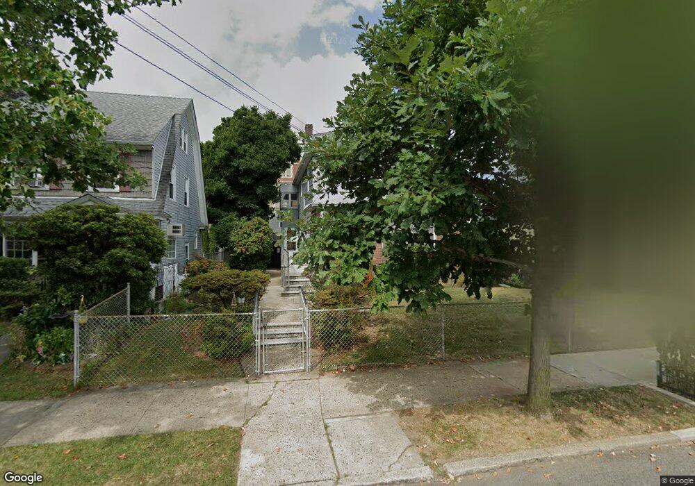
45-02 169th St Flushing, NY 11358
Flushing NeighborhoodEstimated Value: $1,243,510 - $1,424,000
Studio
1
Bath
2,172
Sq Ft
$612/Sq Ft
Est. Value
About This Home
This home is located at 45-02 169th St, Flushing, NY 11358 and is currently estimated at $1,329,378, approximately $612 per square foot. 45-02 169th St is a home located in Queens County with nearby schools including P.S. 107 Thomas A Dooley, I.S. 25 Adrien Block, and Francis Lewis High School.
Ownership History
Date
Name
Owned For
Owner Type
Purchase Details
Closed on
Sep 15, 2020
Sold by
Hunt Frederick
Bought by
Hunt Frederick and Hunt James
Current Estimated Value
Purchase Details
Closed on
Sep 13, 2006
Sold by
Estate Of Jean Leotta and Hunt Executrix Linda
Bought by
Hunt Frederick F and Hunt Linda B
Create a Home Valuation Report for This Property
The Home Valuation Report is an in-depth analysis detailing your home's value as well as a comparison with similar homes in the area
Home Values in the Area
Average Home Value in this Area
Purchase History
| Date | Buyer | Sale Price | Title Company |
|---|---|---|---|
| Hunt Frederick | -- | -- | |
| Hunt Frederick | -- | -- | |
| Hunt Frederick | -- | -- | |
| Hunt Frederick F | -- | -- | |
| Hunt Frederick F | -- | -- |
Source: Public Records
Mortgage History
| Date | Status | Borrower | Loan Amount |
|---|---|---|---|
| Closed | Hunt Frederick F | $0 |
Source: Public Records
Tax History
| Year | Tax Paid | Tax Assessment Tax Assessment Total Assessment is a certain percentage of the fair market value that is determined by local assessors to be the total taxable value of land and additions on the property. | Land | Improvement |
|---|---|---|---|---|
| 2025 | $4,734 | $58,026 | $16,194 | $41,832 |
| 2024 | $4,838 | $54,743 | $16,868 | $37,875 |
| 2023 | $10,232 | $54,743 | $15,600 | $39,143 |
| 2022 | $4,706 | $66,480 | $22,740 | $43,740 |
| 2021 | $4,734 | $66,000 | $22,740 | $43,260 |
| 2020 | $4,459 | $72,540 | $22,740 | $49,800 |
| 2019 | $4,112 | $79,140 | $22,740 | $56,400 |
| 2018 | $3,991 | $45,619 | $18,335 | $27,284 |
| 2017 | $3,919 | $44,788 | $20,625 | $24,163 |
| 2016 | $3,648 | $44,788 | $20,625 | $24,163 |
| 2015 | $2,109 | $40,296 | $22,234 | $18,062 |
| 2014 | $2,109 | $38,016 | $24,031 | $13,985 |
Source: Public Records
Map
Nearby Homes
- 43-52 169th St
- 4360 Auburndale Ln
- 43-60 Auburndale Ln
- 4564 170th St
- 4547 166th St
- 4321 172nd St
- 167-22 Northern Blvd
- 45-32 Utopia Pkwy
- 43-15 164th St
- 188-02 Northern Blvd
- 163-02 45th Ave
- 43-33 163rd St
- 45-74 164th St
- 43-58 163rd St
- 42-25 189th St
- 171-06 Bagley Ave
- 43-27 162nd St
- 3641 169th St Unit 2F
- 43-7 162nd St
- 4018 165th St
- 45-02 169th St Unit 2
- 4502 169th St
- 45-12 169th St
- 4508 169th St
- 4512 169th St
- 4503 168th St
- 4507 168th St
- 45-07 168th St
- 4516 169th St
- 169-18 45th Ave
- 169-18 45th Ave Unit 1FL
- 4378 169th St
- 4511 168th St
- 4515 168th St
- 16906 45th Ave
- 45-07 169th St
- 4377 168th St
- 4507 169th St
- 4511 169th St
- 4511 169th St