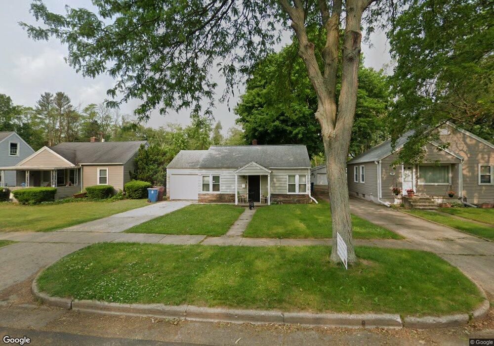
45 32nd St N Battle Creek, MI 49015
Westlake Prairieview NeighborhoodEstimated Value: $115,729 - $147,000
2
Beds
1
Bath
672
Sq Ft
$194/Sq Ft
Est. Value
About This Home
This home is located at 45 32nd St N, Battle Creek, MI 49015 and is currently estimated at $130,682, approximately $194 per square foot. 45 32nd St N is a home located in Calhoun County with nearby schools including Lakeview Middle School, Lakeview High School, and Arbor Academy.
Ownership History
Date
Name
Owned For
Owner Type
Purchase Details
Closed on
Dec 20, 2016
Sold by
Champlin Susan Rebecca
Bought by
Champlin Richard Spencer
Current Estimated Value
Purchase Details
Closed on
Jan 15, 2009
Sold by
Browne Dena
Bought by
Federal Home Loan Mortgage Corp
Purchase Details
Closed on
Feb 6, 2008
Sold by
Norcross Lawrence W and Norcross Penny
Bought by
Browne Dena
Home Financials for this Owner
Home Financials are based on the most recent Mortgage that was taken out on this home.
Original Mortgage
$35,000
Interest Rate
5.75%
Mortgage Type
Purchase Money Mortgage
Create a Home Valuation Report for This Property
The Home Valuation Report is an in-depth analysis detailing your home's value as well as a comparison with similar homes in the area
Home Values in the Area
Average Home Value in this Area
Purchase History
| Date | Buyer | Sale Price | Title Company |
|---|---|---|---|
| Champlin Richard Spencer | -- | Attorney | |
| Federal Home Loan Mortgage Corp | $38,459 | None Available | |
| Browne Dena | $35,000 | First American Title Ins Co |
Source: Public Records
Mortgage History
| Date | Status | Borrower | Loan Amount |
|---|---|---|---|
| Previous Owner | Browne Dena | $35,000 |
Source: Public Records
Tax History Compared to Growth
Tax History
| Year | Tax Paid | Tax Assessment Tax Assessment Total Assessment is a certain percentage of the fair market value that is determined by local assessors to be the total taxable value of land and additions on the property. | Land | Improvement |
|---|---|---|---|---|
| 2025 | -- | $39,700 | $0 | $0 |
| 2024 | $982 | $36,828 | $0 | $0 |
| 2023 | $1,247 | $31,841 | $0 | $0 |
| 2022 | $888 | $27,529 | $0 | $0 |
| 2021 | $1,213 | $24,769 | $0 | $0 |
| 2020 | $1,199 | $24,355 | $0 | $0 |
| 2019 | $1,142 | $21,274 | $0 | $0 |
| 2018 | $1,142 | $18,256 | $2,857 | $15,399 |
| 2017 | $1,204 | $18,158 | $0 | $0 |
| 2016 | $1,103 | $17,478 | $0 | $0 |
| 2015 | $1,082 | $16,835 | $3,603 | $13,232 |
| 2014 | $1,082 | $17,195 | $3,603 | $13,592 |
Source: Public Records
Map
Nearby Homes
- 24 31st St S
- 155 Kirkwood Ave
- 1243 Territorial Rd W
- 150 23rd St N
- 1225 Territorial Rd W
- 112 26th St S
- 141 22nd St N
- 38 22nd St N
- 88 24th St S
- 1131 Frisbie Blvd
- 1127 Frisbie Blvd
- 437 S 28th St
- 423 S 28th St
- 36 21st St N
- 248 23rd St N
- 252 23rd St N
- 17 20th St N
- 137 Apperson Rd
- 893 W Territorial Rd
- 760 Goguac St W