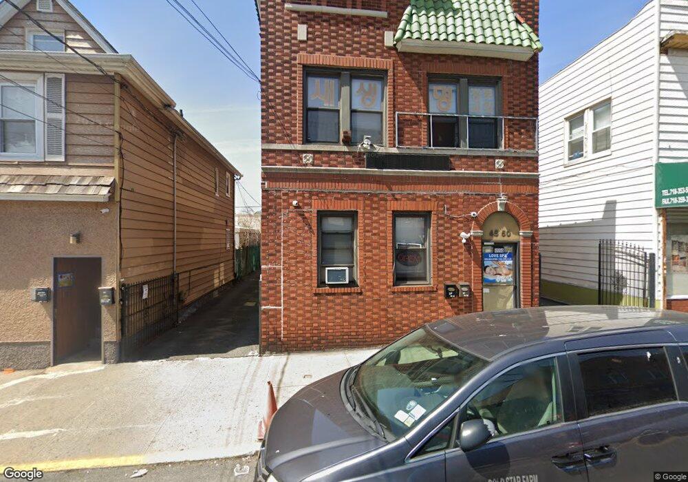
45-50 162nd St Unit 1 Flushing, NY 11358
East Flushing NeighborhoodEstimated Value: $1,444,059
Studio
--
Bath
2,640
Sq Ft
$547/Sq Ft
Est. Value
About This Home
This home is located at 45-50 162nd St Unit 1, Flushing, NY 11358 and is currently estimated at $1,444,059, approximately $546 per square foot. 45-50 162nd St Unit 1 is a home located in Queens County with nearby schools including P.S. 107 Thomas A Dooley, Rachel Carson I.S. 237Q, and Francis Lewis High School.
Ownership History
Date
Name
Owned For
Owner Type
Purchase Details
Closed on
Oct 5, 2021
Sold by
Lee Elsie Yr and Lee Yi Rong
Bought by
United 162 Holding Llc
Current Estimated Value
Home Financials for this Owner
Home Financials are based on the most recent Mortgage that was taken out on this home.
Original Mortgage
$640,000
Outstanding Balance
$584,296
Interest Rate
2.88%
Mortgage Type
Purchase Money Mortgage
Estimated Equity
$859,763
Create a Home Valuation Report for This Property
The Home Valuation Report is an in-depth analysis detailing your home's value as well as a comparison with similar homes in the area
Home Values in the Area
Average Home Value in this Area
Purchase History
| Date | Buyer | Sale Price | Title Company |
|---|---|---|---|
| United 162 Holding Llc | $1,280,000 | -- |
Source: Public Records
Mortgage History
| Date | Status | Borrower | Loan Amount |
|---|---|---|---|
| Open | United 162 Holding Llc | $640,000 |
Source: Public Records
Tax History
| Year | Tax Paid | Tax Assessment Tax Assessment Total Assessment is a certain percentage of the fair market value that is determined by local assessors to be the total taxable value of land and additions on the property. | Land | Improvement |
|---|---|---|---|---|
| 2025 | $14,229 | $122,912 | $38,031 | $84,881 |
| 2024 | $14,229 | $113,814 | $40,831 | $72,983 |
| 2023 | $13,175 | $105,383 | $34,736 | $70,647 |
| 2022 | $11,939 | $249,750 | $93,150 | $156,600 |
| 2021 | $11,970 | $242,100 | $93,150 | $148,950 |
| 2020 | $11,713 | $265,500 | $93,150 | $172,350 |
| 2019 | $10,955 | $270,000 | $93,150 | $176,850 |
| 2018 | $10,311 | $81,064 | $29,234 | $51,830 |
| 2017 | $9,547 | $75,060 | $28,826 | $46,234 |
| 2016 | $9,677 | $75,060 | $28,826 | $46,234 |
| 2015 | $5,817 | $72,729 | $35,675 | $37,054 |
| 2014 | $5,817 | $67,346 | $33,754 | $33,592 |
Source: Public Records
Map
Nearby Homes
- 45-57 160th St
- 46-12 161st St Unit 1D
- 46-12 161st St Unit 2C
- 45-74 164th St
- 163-02 45th Ave
- 46-05 158th St
- 4363 160th St
- 45-19 158th St
- 43-58 163rd St
- 4344 161st St
- 43-27 162nd St
- 43-33 163rd St
- 47-21 162nd St
- 46-43 157th St
- 43-7 162nd St
- 157-18 Laburnum Ave
- 43-04 158th St Unit 3E
- 4304 158th St Unit L4
- 4304 158th St Unit 2C
- 47-23 164th St
- 45-50 162nd St
- 45-52 162nd St
- 4550 162nd St
- 4552 162nd St Unit 3
- 4552 162nd St
- 4546 162nd St
- 4556 162nd St
- 4542 162nd St
- 45-62 162 St
- 45-62 162nd St
- 45-45 162nd St Unit B
- 45-49 162nd St Unit Rear
- 45-49 162nd St
- 45-60 162nd St
- 4560 162nd St
- 4560 162nd St Unit 2Fl
- 4560 162nd St Unit 3Fl
- 4560 162nd St
- 4538 162nd St
- 45-55 162nd St
Your Personal Tour Guide
Ask me questions while you tour the home.