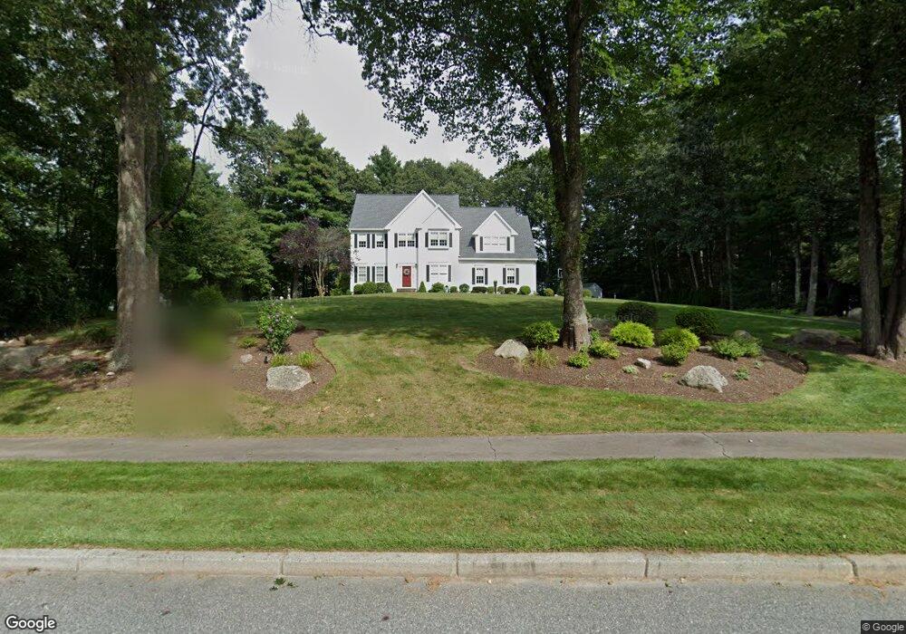
45 Alberta Ln Holliston, MA 01746
Estimated Value: $945,101 - $1,134,000
4
Beds
3
Baths
2,630
Sq Ft
$380/Sq Ft
Est. Value
About This Home
This home is located at 45 Alberta Ln, Holliston, MA 01746 and is currently estimated at $1,000,525, approximately $380 per square foot. 45 Alberta Ln is a home located in Middlesex County with nearby schools including Placentino Elementary School, Miller Elementary School, and Robert H. Adams Middle School.
Ownership History
Date
Name
Owned For
Owner Type
Purchase Details
Closed on
Oct 30, 2024
Sold by
Donlin Gary P and Donlin Patricia R
Bought by
Donlin Ft and Donlin
Current Estimated Value
Purchase Details
Closed on
Mar 19, 1997
Sold by
Jones Richard T and Jones Terrylyn T
Bought by
Donlin Gary P and Donlin Patricia R
Home Financials for this Owner
Home Financials are based on the most recent Mortgage that was taken out on this home.
Original Mortgage
$287,900
Interest Rate
7.68%
Mortgage Type
Purchase Money Mortgage
Purchase Details
Closed on
Sep 7, 1994
Sold by
Cedar Brook Rt and Raduano
Bought by
Jones Richard T and Jones Terrilynn T
Home Financials for this Owner
Home Financials are based on the most recent Mortgage that was taken out on this home.
Original Mortgage
$250,000
Interest Rate
8.54%
Mortgage Type
Purchase Money Mortgage
Create a Home Valuation Report for This Property
The Home Valuation Report is an in-depth analysis detailing your home's value as well as a comparison with similar homes in the area
Home Values in the Area
Average Home Value in this Area
Purchase History
| Date | Buyer | Sale Price | Title Company |
|---|---|---|---|
| Donlin Ft | -- | None Available | |
| Donlin Ft | -- | None Available | |
| Donlin Gary P | $359,900 | -- | |
| Jones Richard T | $334,900 | -- |
Source: Public Records
Mortgage History
| Date | Status | Borrower | Loan Amount |
|---|---|---|---|
| Previous Owner | Jones Richard T | $258,000 | |
| Previous Owner | Jones Richard T | $20,000 | |
| Previous Owner | Jones Richard T | $287,900 | |
| Previous Owner | Jones Richard T | $250,000 |
Source: Public Records
Tax History
| Year | Tax Paid | Tax Assessment Tax Assessment Total Assessment is a certain percentage of the fair market value that is determined by local assessors to be the total taxable value of land and additions on the property. | Land | Improvement |
|---|---|---|---|---|
| 2025 | $13,104 | $894,500 | $285,600 | $608,900 |
| 2024 | $12,967 | $861,000 | $285,600 | $575,400 |
| 2023 | $12,526 | $813,400 | $285,600 | $527,800 |
| 2022 | $11,973 | $688,900 | $285,600 | $403,300 |
| 2021 | $12,018 | $673,300 | $270,000 | $403,300 |
| 2020 | $12,051 | $639,300 | $254,800 | $384,500 |
| 2019 | $11,821 | $627,800 | $247,200 | $380,600 |
| 2018 | $11,721 | $627,800 | $247,200 | $380,600 |
| 2017 | $11,606 | $626,700 | $260,000 | $366,700 |
| 2016 | $11,453 | $609,500 | $242,800 | $366,700 |
| 2015 | $11,333 | $584,800 | $210,000 | $374,800 |
Source: Public Records
Map
Nearby Homes
- 358 Underwood St
- 48 Hemlock Dr
- 4 Bullard Cir
- 45 Wendy Ln
- Lot 2 Hanlon Rd
- 23 Cedar Farms Rd
- 261 Rolling Meadow Dr
- 22 Greenview Dr
- 154 Union St
- 880 Washington St
- 147 N Mill St
- 56 Fisher St
- 26 Timber Crest Dr
- 1366 Washington St
- 8 Liberty Rd
- 40 Timber Crest Dr
- 66 Lakeshore Dr
- 19 Sycamore Way
- 0 Hill St
- 4 Emerald Dr
Your Personal Tour Guide
Ask me questions while you tour the home.