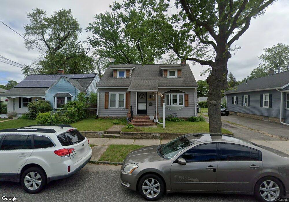
45 Barber St Springfield, MA 01109
Pine Point NeighborhoodEstimated Value: $242,000 - $279,000
3
Beds
1
Bath
1,302
Sq Ft
$204/Sq Ft
Est. Value
About This Home
This home is located at 45 Barber St, Springfield, MA 01109 and is currently estimated at $265,916, approximately $204 per square foot. 45 Barber St is a home located in Hampden County with nearby schools including Thomas M Balliet Elementary School, John J Duggan Middle, and Roger L. Putnam Vocational Technical Academy.
Ownership History
Date
Name
Owned For
Owner Type
Purchase Details
Closed on
Apr 23, 1993
Sold by
Lemay Edward C and Drumm Patricia R
Bought by
Woods Douglas A
Current Estimated Value
Home Financials for this Owner
Home Financials are based on the most recent Mortgage that was taken out on this home.
Original Mortgage
$67,207
Interest Rate
7.45%
Mortgage Type
Purchase Money Mortgage
Create a Home Valuation Report for This Property
The Home Valuation Report is an in-depth analysis detailing your home's value as well as a comparison with similar homes in the area
Home Values in the Area
Average Home Value in this Area
Purchase History
| Date | Buyer | Sale Price | Title Company |
|---|---|---|---|
| Woods Douglas A | $66,500 | -- |
Source: Public Records
Mortgage History
| Date | Status | Borrower | Loan Amount |
|---|---|---|---|
| Open | Woods Douglas A | $62,748 | |
| Closed | Woods Douglas A | $67,207 |
Source: Public Records
Tax History
| Year | Tax Paid | Tax Assessment Tax Assessment Total Assessment is a certain percentage of the fair market value that is determined by local assessors to be the total taxable value of land and additions on the property. | Land | Improvement |
|---|---|---|---|---|
| 2025 | $3,465 | $221,000 | $40,500 | $180,500 |
| 2024 | $2,929 | $182,400 | $33,800 | $148,600 |
| 2023 | $2,728 | $160,000 | $30,700 | $129,300 |
| 2022 | $2,712 | $144,100 | $28,700 | $115,400 |
| 2021 | $2,510 | $132,800 | $26,100 | $106,700 |
| 2020 | $2,291 | $117,300 | $26,100 | $91,200 |
| 2019 | $2,125 | $108,000 | $26,100 | $81,900 |
| 2018 | $2,249 | $114,300 | $26,100 | $88,200 |
| 2017 | $2,161 | $109,900 | $24,100 | $85,800 |
| 2016 | $1,832 | $93,200 | $24,100 | $69,100 |
| 2015 | $1,847 | $93,900 | $24,100 | $69,800 |
Source: Public Records
Map
Nearby Homes
Your Personal Tour Guide
Ask me questions while you tour the home.