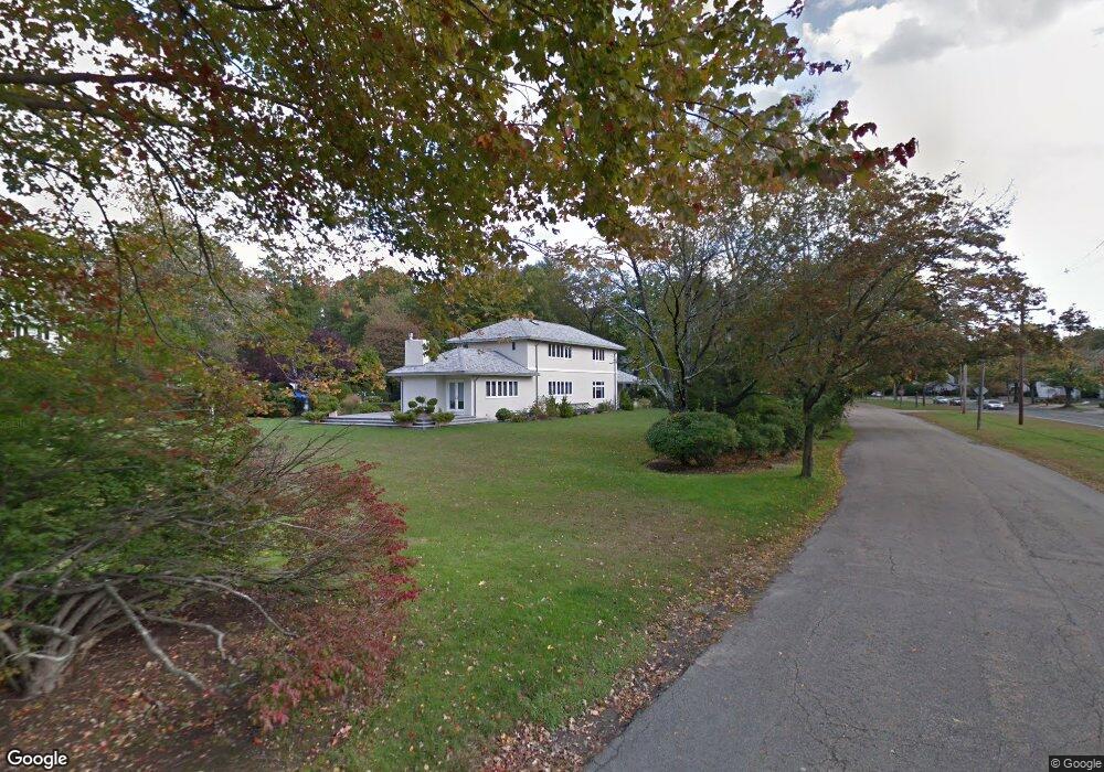
45 Bristol Rd West Newton, MA 02465
West Newton NeighborhoodEstimated Value: $2,779,000 - $3,324,000
4
Beds
4
Baths
3,260
Sq Ft
$946/Sq Ft
Est. Value
About This Home
This home is located at 45 Bristol Rd, West Newton, MA 02465 and is currently estimated at $3,085,572, approximately $946 per square foot. 45 Bristol Rd is a home located in Middlesex County with nearby schools including Peirce Elementary School, F.A. Day Middle School, and Newton North High School.
Ownership History
Date
Name
Owned For
Owner Type
Purchase Details
Closed on
Jun 28, 2016
Sold by
Vara Holli P
Bought by
Bristol Road T
Current Estimated Value
Purchase Details
Closed on
Jul 10, 2013
Sold by
Bristol Road T and Vara Henry D
Bought by
Vara Henry D
Home Financials for this Owner
Home Financials are based on the most recent Mortgage that was taken out on this home.
Original Mortgage
$295,200
Interest Rate
3.83%
Mortgage Type
New Conventional
Purchase Details
Closed on
Jun 4, 2010
Sold by
Vara Holli P
Bought by
Bristol Road T and Vara Henry D
Purchase Details
Closed on
Jun 12, 2009
Sold by
Bristol Road T and Vara Henry D
Bought by
Vara Holli P
Home Financials for this Owner
Home Financials are based on the most recent Mortgage that was taken out on this home.
Original Mortgage
$311,000
Interest Rate
4.82%
Mortgage Type
Purchase Money Mortgage
Create a Home Valuation Report for This Property
The Home Valuation Report is an in-depth analysis detailing your home's value as well as a comparison with similar homes in the area
Home Values in the Area
Average Home Value in this Area
Purchase History
| Date | Buyer | Sale Price | Title Company |
|---|---|---|---|
| Bristol Road T | -- | -- | |
| Vara Henry D | -- | -- | |
| Bristol Road T | -- | -- | |
| Vara Holli P | -- | -- |
Source: Public Records
Mortgage History
| Date | Status | Borrower | Loan Amount |
|---|---|---|---|
| Previous Owner | Vara Henry D | $295,200 | |
| Previous Owner | Vara Holli P | $311,000 |
Source: Public Records
Tax History Compared to Growth
Tax History
| Year | Tax Paid | Tax Assessment Tax Assessment Total Assessment is a certain percentage of the fair market value that is determined by local assessors to be the total taxable value of land and additions on the property. | Land | Improvement |
|---|---|---|---|---|
| 2025 | $28,527 | $2,910,900 | $1,503,200 | $1,407,700 |
| 2024 | $27,583 | $2,826,100 | $1,459,400 | $1,366,700 |
| 2023 | $26,601 | $2,613,100 | $1,160,500 | $1,452,600 |
| 2022 | $25,453 | $2,419,500 | $1,074,500 | $1,345,000 |
| 2021 | $24,560 | $2,282,500 | $1,013,700 | $1,268,800 |
| 2020 | $23,829 | $2,282,500 | $1,013,700 | $1,268,800 |
| 2019 | $23,157 | $2,216,000 | $984,200 | $1,231,800 |
| 2018 | $22,459 | $2,075,700 | $878,500 | $1,197,200 |
| 2017 | $21,775 | $1,958,200 | $828,800 | $1,129,400 |
| 2016 | $20,827 | $1,830,100 | $774,600 | $1,055,500 |
| 2015 | $19,858 | $1,710,400 | $723,900 | $986,500 |
Source: Public Records
Map
Nearby Homes
- 350 Chestnut St
- 40 Bristol Rd
- 1388 Commonwealth Ave Unit 4
- 386 Chestnut St
- 1364 Commonwealth Ave
- 1356 Commonwealth Ave
- 1395 Commonwealth Ave
- 1350 Commonwealth Ave
- 1350 Commonwealth Ave
- 1404 Commonwealth Ave
- 340 Chestnut St
- 396 Chestnut St
- 1344 Commonwealth Ave
- 1400 Commonwealth Ave
- 16 Bristol Rd
- 1325 Commonwealth Ave
- 1415 Commonwealth Ave
- 65 Fuller St
- 53 Fuller St
- 1338 Commonwealth Ave