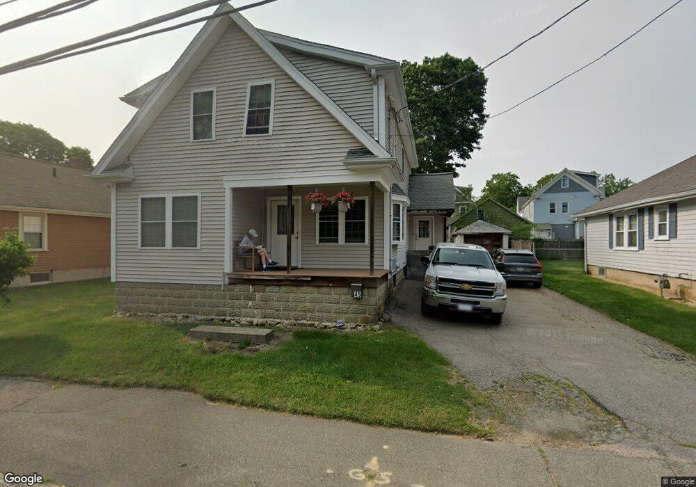
45 Brookside Ave Brockton, MA 02301
Campello NeighborhoodEstimated Value: $463,000 - $555,000
5
Beds
2
Baths
1,980
Sq Ft
$264/Sq Ft
Est. Value
About This Home
This home is located at 45 Brookside Ave, Brockton, MA 02301 and is currently estimated at $522,711, approximately $263 per square foot. 45 Brookside Ave is a home located in Plymouth County with nearby schools including Gilmore Elementary School, Davis K-8 School, and John F. Kennedy Elementary School.
Ownership History
Date
Name
Owned For
Owner Type
Purchase Details
Closed on
Nov 29, 2004
Sold by
Mahoney David P
Bought by
Oreilly Kirk J
Current Estimated Value
Home Financials for this Owner
Home Financials are based on the most recent Mortgage that was taken out on this home.
Original Mortgage
$180,000
Outstanding Balance
$90,264
Interest Rate
5.75%
Mortgage Type
Purchase Money Mortgage
Estimated Equity
$432,447
Purchase Details
Closed on
Mar 26, 1999
Sold by
Dunhol Rt
Bought by
Mahoney David P
Purchase Details
Closed on
Oct 18, 1996
Sold by
Department Of Housing & Urban Dev
Bought by
Dunn Patricia A
Purchase Details
Closed on
Oct 23, 1995
Sold by
Fleet Natl Bk
Bought by
Department Of Housing & Urban Dev
Purchase Details
Closed on
May 23, 1995
Sold by
Holliday Sharon A and Murawski Lisa A
Bought by
Fleet Natl Bk
Purchase Details
Closed on
Jun 28, 1991
Sold by
Sherman Lucy M and Sherman Clara M
Bought by
Holliday Sharon A and Murawski Lisa A
Create a Home Valuation Report for This Property
The Home Valuation Report is an in-depth analysis detailing your home's value as well as a comparison with similar homes in the area
Home Values in the Area
Average Home Value in this Area
Purchase History
| Date | Buyer | Sale Price | Title Company |
|---|---|---|---|
| Oreilly Kirk J | $210,000 | -- | |
| Mahoney David P | $85,000 | -- | |
| Dunn Patricia A | $49,994 | -- | |
| Department Of Housing & Urban Dev | $85,151 | -- | |
| Fleet Natl Bk | $116,922 | -- | |
| Holliday Sharon A | $85,100 | -- |
Source: Public Records
Mortgage History
| Date | Status | Borrower | Loan Amount |
|---|---|---|---|
| Open | Holliday Sharon A | $180,000 | |
| Previous Owner | Holliday Sharon A | $2,278 |
Source: Public Records
Tax History
| Year | Tax Paid | Tax Assessment Tax Assessment Total Assessment is a certain percentage of the fair market value that is determined by local assessors to be the total taxable value of land and additions on the property. | Land | Improvement |
|---|---|---|---|---|
| 2025 | $5,267 | $434,900 | $135,000 | $299,900 |
| 2024 | $4,935 | $410,600 | $135,000 | $275,600 |
| 2023 | $4,967 | $382,700 | $101,300 | $281,400 |
| 2022 | $4,993 | $357,400 | $91,800 | $265,600 |
| 2021 | $4,531 | $312,500 | $75,800 | $236,700 |
| 2020 | $4,147 | $273,700 | $71,600 | $202,100 |
| 2019 | $3,806 | $244,900 | $69,000 | $175,900 |
| 2018 | $3,538 | $220,300 | $69,000 | $151,300 |
| 2017 | $3,487 | $216,600 | $69,000 | $147,600 |
| 2016 | $3,635 | $209,400 | $66,900 | $142,500 |
| 2015 | $3,084 | $169,900 | $66,900 | $103,000 |
| 2014 | $3,048 | $168,100 | $66,900 | $101,200 |
Source: Public Records
Map
Nearby Homes
- 35 Longworth Ave Unit 25
- 25 Longworth Ave Unit 4
- 15 Longworth Ave Unit 226
- 9 Longworth Ave Unit 135
- 9 Longworth Ave Unit 113
- 47 Southworth St
- 15 Market St
- 26 South St
- 34 South St
- 115 Market St
- 326 Copeland St
- 223 Clinton St Unit 16
- 23 E Chestnut St
- 24 E Chestnut St
- 60 Tremont St
- 25 Tremont St
- 65 Tremont St
- 41 Riverview St
- 12 Finny's Way
- 936 Warren Ave
- 47 Brookside Ave
- 41 Brookside Ave
- 22 Kenwood St
- 28 Kenwood St
- 35 Brookside Ave
- 16 Kenwood St
- 16 Kenwood St Unit 2
- 44 Brookside Ave
- 57 Brookside Ave
- 38 Brookside Ave
- 29 Brookside Ave
- 12 Kenwood St
- 32 Brookside Ave
- 32 Brookside Ave Unit B
- 61 Brookside Ave
- 25 Brookside Ave
- 25 Brookside Ave Unit 1st
- 8 Kenwood St
- 0 Irvington St
- 27 Brookside Ave Unit 271
Your Personal Tour Guide
Ask me questions while you tour the home.