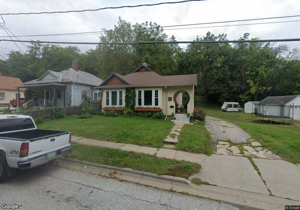
45 Canning St Council Bluffs, IA 51503
Downtown Council Bluffs NeighborhoodEstimated Value: $121,000 - $211,000
2
Beds
1
Bath
1,019
Sq Ft
$173/Sq Ft
Est. Value
About This Home
This home is located at 45 Canning St, Council Bluffs, IA 51503 and is currently estimated at $176,512, approximately $173 per square foot. 45 Canning St is a home located in Pottawattamie County with nearby schools including Hoover Elementary School, Gerald W. Kirn Middle School, and Abraham Lincoln High School.
Ownership History
Date
Name
Owned For
Owner Type
Purchase Details
Closed on
Feb 4, 2021
Sold by
Crookham John S
Bought by
Revocable Trust and Somers
Current Estimated Value
Purchase Details
Closed on
Jan 28, 2021
Sold by
Revocable Trust
Bought by
Djd Investments Llc
Purchase Details
Closed on
Jan 27, 2021
Sold by
Revocable Trust
Bought by
Djd Investments Llc
Purchase Details
Closed on
Feb 28, 2011
Sold by
Mether Maxine
Bought by
Somers Zachary W and Shaw Tabbatha N
Home Financials for this Owner
Home Financials are based on the most recent Mortgage that was taken out on this home.
Original Mortgage
$53,605
Interest Rate
4.78%
Mortgage Type
FHA
Create a Home Valuation Report for This Property
The Home Valuation Report is an in-depth analysis detailing your home's value as well as a comparison with similar homes in the area
Home Values in the Area
Average Home Value in this Area
Purchase History
| Date | Buyer | Sale Price | Title Company |
|---|---|---|---|
| Revocable Trust | -- | -- | |
| Djd Investments Llc | -- | None Listed On Document | |
| Djd Investments Llc | -- | None Listed On Document | |
| Somers Zachary W | $55,000 | Clear Title & Abstract Llc |
Source: Public Records
Mortgage History
| Date | Status | Borrower | Loan Amount |
|---|---|---|---|
| Previous Owner | Somers Zachary W | $53,605 |
Source: Public Records
Tax History Compared to Growth
Tax History
| Year | Tax Paid | Tax Assessment Tax Assessment Total Assessment is a certain percentage of the fair market value that is determined by local assessors to be the total taxable value of land and additions on the property. | Land | Improvement |
|---|---|---|---|---|
| 2025 | $2,318 | $139,200 | $21,300 | $117,900 |
| 2024 | $2,318 | $125,300 | $18,600 | $106,700 |
| 2023 | $2,290 | $125,300 | $18,600 | $106,700 |
| 2022 | $1,878 | $89,000 | $20,000 | $69,000 |
| 2021 | $2,766 | $89,000 | $20,000 | $69,000 |
| 2020 | $1,760 | $79,700 | $17,000 | $62,700 |
| 2019 | $1,660 | $79,700 | $17,000 | $62,700 |
| 2018 | $1,624 | $73,119 | $13,145 | $59,974 |
| 2017 | $1,648 | $73,119 | $13,145 | $59,974 |
| 2015 | $1,606 | $73,119 | $13,145 | $59,974 |
| 2014 | $1,608 | $73,119 | $13,145 | $59,974 |
Source: Public Records
Map
Nearby Homes
- 222 Locust Lodge Ave
- 440 Simms Ave
- 118 Euclid Ave
- 269 Elmwood Dr
- 415 Midland Dr
- 601 Forest Dr
- 52 Gould Ave
- 1542 N Broadway
- 212 Highland Dr
- 1426 Mcpherson Ave
- 638 Simms Ave
- 216 Morningside Ave
- 28 Cooper Ave
- 400 Frank St
- 155 S Linden Ave
- 603 Hillcrest Ave
- 162 N Linden Ave
- 335 Logan St
- 111 Union St
- 2231 N Broadway
- 47 Canning St
- 105 Canning St
- 25 Canning St
- 35 Canning St
- 109 Canning St
- 17 Canning St
- 28 Canning St
- 24 Canning St
- 1288 E Pierce St
- 9 Canning St
- 18 Canning St
- 1304 Canning St
- 12 Canning St
- 1308 Canning St
- 1274 E Pierce St
- 1312 Canning St
- 1270 E Pierce St
- 1273 E Pierce St
- 1269 E Pierce St
- 1267 E Pierce St