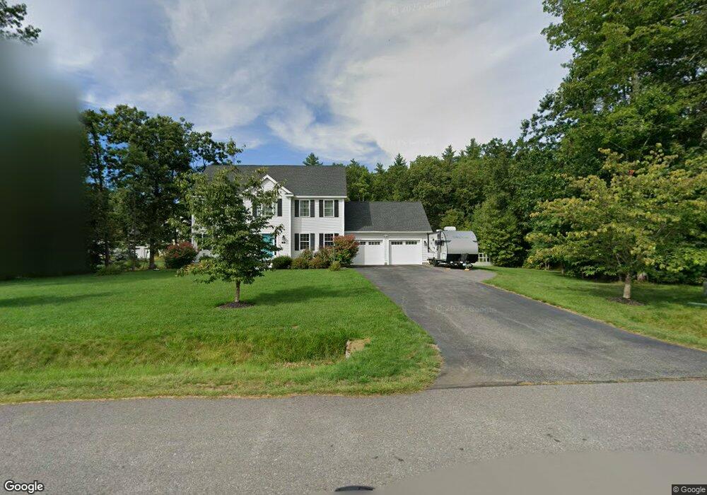
45 Chapman St Dunstable, MA 01827
Estimated Value: $804,170 - $988,000
4
Beds
3
Baths
2,288
Sq Ft
$399/Sq Ft
Est. Value
About This Home
This home is located at 45 Chapman St, Dunstable, MA 01827 and is currently estimated at $913,543, approximately $399 per square foot. 45 Chapman St is a home with nearby schools including Groton Dunstable Regional High School.
Ownership History
Date
Name
Owned For
Owner Type
Purchase Details
Closed on
Mar 27, 2017
Sold by
Awmw Llc
Bought by
Dillon Charles A and Dillon Daisy K
Current Estimated Value
Home Financials for this Owner
Home Financials are based on the most recent Mortgage that was taken out on this home.
Original Mortgage
$515,610
Outstanding Balance
$428,595
Interest Rate
4.17%
Mortgage Type
New Conventional
Estimated Equity
$484,948
Purchase Details
Closed on
Aug 5, 2015
Sold by
Loftis Dunstable Llc
Bought by
Awmw Llc
Home Financials for this Owner
Home Financials are based on the most recent Mortgage that was taken out on this home.
Original Mortgage
$1,040,000
Interest Rate
4.03%
Mortgage Type
Purchase Money Mortgage
Create a Home Valuation Report for This Property
The Home Valuation Report is an in-depth analysis detailing your home's value as well as a comparison with similar homes in the area
Home Values in the Area
Average Home Value in this Area
Purchase History
| Date | Buyer | Sale Price | Title Company |
|---|---|---|---|
| Dillon Charles A | $572,900 | -- | |
| Awmw Llc | $1,080,000 | -- |
Source: Public Records
Mortgage History
| Date | Status | Borrower | Loan Amount |
|---|---|---|---|
| Open | Dillon Charles A | $515,610 | |
| Previous Owner | Awmw Llc | $1,040,000 |
Source: Public Records
Tax History Compared to Growth
Tax History
| Year | Tax Paid | Tax Assessment Tax Assessment Total Assessment is a certain percentage of the fair market value that is determined by local assessors to be the total taxable value of land and additions on the property. | Land | Improvement |
|---|---|---|---|---|
| 2025 | $9,981 | $725,900 | $212,400 | $513,500 |
| 2024 | $9,533 | $682,900 | $196,000 | $486,900 |
| 2023 | $9,470 | $632,600 | $196,000 | $436,600 |
| 2022 | $9,094 | $596,300 | $196,000 | $400,300 |
| 2021 | $9,603 | $585,200 | $209,400 | $375,800 |
| 2020 | $9,599 | $570,000 | $209,400 | $360,600 |
| 2019 | $9,414 | $551,800 | $209,400 | $342,400 |
| 2018 | $9,245 | $527,100 | $209,400 | $317,700 |
| 2017 | $2,042 | $120,000 | $120,000 | $0 |
| 2016 | $1,218 | $73,600 | $73,600 | $0 |
| 2015 | $1,203 | $71,900 | $71,900 | $0 |
| 2014 | $1,213 | $76,900 | $76,900 | $0 |
Source: Public Records
Map
Nearby Homes
- 452 River St
- 5 June St
- 139 Nashua Rd
- 102A Nashua Rd
- 80A Nashua Rd
- 147 Nashua Rd
- 23 Shawnee Rd Unit 23
- 170 Nashua Rd
- 11 Shawnee Rd
- 46 Lowell Rd
- 38 Tarbell St Unit 5B
- 24-A 34-A Dow St
- 9 Tarbell St
- 28-30 Groton St
- 208 North St
- 8 Jamie Rd
- 4 Parker Hill Way Unit C
- 8 Tucker Park Unit D
- 38 Lorna St
- 10 Tucker St
- Lot 9 Chapman St
- 49 Chapman St
- 32 Chapman St
- 57 Chapman St
- 33 Chapman St
- 24 Chapman St Unit Lot 4
- 24 Chapman St
- Lot 15 Chapman St
- 18 Chapman St
- 10 Chapman St
- 40 Chapman St
- 3 Chapman St
- 67 Chapman St
- 46 Chapman St
- 4 Chapman St Unit lot 1
- 4 Chapman St
- 71 Chapman St
- Lot 17 Chapman St
- 50 Chapman St
- 73 Chapman St