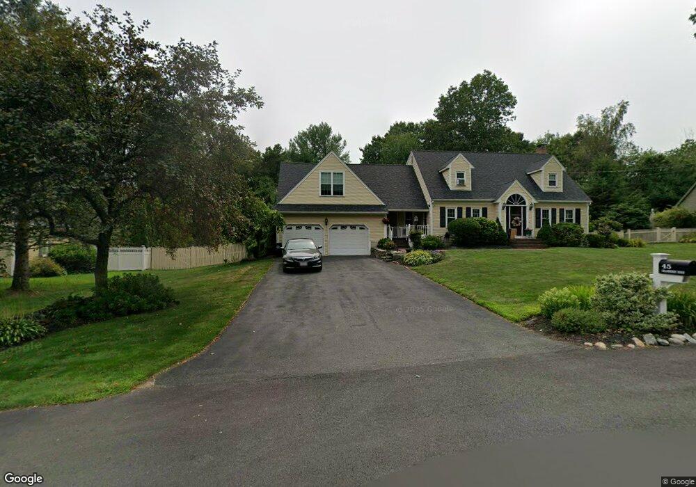
45 Cranberry Rd North Attleboro, MA 02760
North Attleboro NeighborhoodEstimated Value: $826,626 - $872,000
4
Beds
3
Baths
2,379
Sq Ft
$356/Sq Ft
Est. Value
About This Home
This home is located at 45 Cranberry Rd, North Attleboro, MA 02760 and is currently estimated at $847,157, approximately $356 per square foot. 45 Cranberry Rd is a home located in Bristol County with nearby schools including North Attleboro High School, Cadence Academy Preschool - North Attleborough, and St John The Evangelist School.
Ownership History
Date
Name
Owned For
Owner Type
Purchase Details
Closed on
Jun 26, 2002
Sold by
Haney William P and Haney Elizabeth A
Bought by
Wells Patrick J and Wells Kathleen
Current Estimated Value
Home Financials for this Owner
Home Financials are based on the most recent Mortgage that was taken out on this home.
Original Mortgage
$246,000
Interest Rate
6.92%
Mortgage Type
Purchase Money Mortgage
Purchase Details
Closed on
Nov 16, 1992
Sold by
Cannata David G
Bought by
Haney William P and Haney Elizabeth A
Home Financials for this Owner
Home Financials are based on the most recent Mortgage that was taken out on this home.
Original Mortgage
$176,400
Interest Rate
7.88%
Mortgage Type
Purchase Money Mortgage
Create a Home Valuation Report for This Property
The Home Valuation Report is an in-depth analysis detailing your home's value as well as a comparison with similar homes in the area
Home Values in the Area
Average Home Value in this Area
Purchase History
| Date | Buyer | Sale Price | Title Company |
|---|---|---|---|
| Wells Patrick J | $380,000 | -- | |
| Haney William P | $196,000 | -- |
Source: Public Records
Mortgage History
| Date | Status | Borrower | Loan Amount |
|---|---|---|---|
| Open | Wells Patrick J | $315,000 | |
| Closed | Wells Patrick J | $246,000 | |
| Previous Owner | Wells Patrick J | $40,000 | |
| Previous Owner | Haney William P | $176,400 |
Source: Public Records
Tax History Compared to Growth
Tax History
| Year | Tax Paid | Tax Assessment Tax Assessment Total Assessment is a certain percentage of the fair market value that is determined by local assessors to be the total taxable value of land and additions on the property. | Land | Improvement |
|---|---|---|---|---|
| 2025 | $8,669 | $735,300 | $156,500 | $578,800 |
| 2024 | $8,364 | $724,800 | $163,000 | $561,800 |
| 2023 | $8,331 | $651,400 | $163,000 | $488,400 |
| 2022 | $7,720 | $554,200 | $169,500 | $384,700 |
| 2021 | $7,563 | $530,000 | $169,500 | $360,500 |
| 2020 | $7,349 | $512,100 | $169,500 | $342,600 |
| 2019 | $7,130 | $500,700 | $154,100 | $346,600 |
| 2018 | $6,398 | $479,600 | $160,100 | $319,500 |
| 2017 | $5,901 | $446,400 | $160,100 | $286,300 |
| 2016 | $5,978 | $452,200 | $184,300 | $267,900 |
| 2015 | $5,439 | $413,900 | $184,300 | $229,600 |
| 2014 | $5,019 | $379,100 | $153,400 | $225,700 |
Source: Public Records
Map
Nearby Homes
- 36 Cranberry Rd
- 122 Mary Ann Way
- 47 Old Farm Rd
- 6 Colts Way
- 115 Westfield Dr
- 11 Buckthorn Ln
- 1730 West St
- 11 Landry Ave
- 10 Sleepy Hollow Cir
- 57 Vine St
- 613 Lindsey St
- 16 Raymond Hall Dr
- 546 Towne St
- 6 Cedar Creek Dr
- 20 Sperry Ln
- Lot 2 Jeffrey Dr
- Lot 5 Jeffrey Dr
- 451R Gilbert St
- 70 Sperry Ln Unit Lot 11
- 116 George St
- 55 Cranberry Rd
- 35 Cranberry Rd
- 26 Debora Rd
- 36 Debora Rd
- 46 Cranberry Rd
- 16 Mary Ann Way
- 12 Debora Rd
- 20 Debora Rd Unit 20
- 20 Debora Rd
- 56 Cranberry Rd
- 22 Debora Rd Unit 22
- 65 Cranberry Rd
- LOT 9 Magnolia
- L-27 Quail Creek Rd
- LOT 3 Hickory Rd Lot 3
- G5 B A Dr Unit G5
- LOT 61 Hazelwood 130 E Wash
- 6 Mary Ann Way
- 10 Debora Rd
- 19 Debora Rd