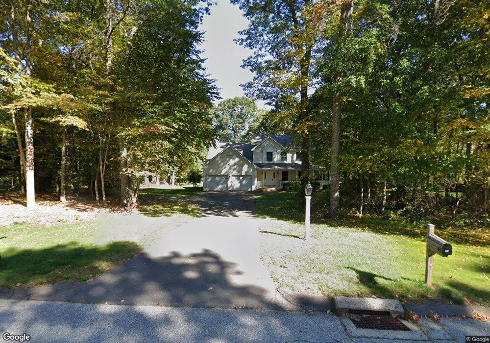
45 Doe Run Tolland, CT 06084
Estimated Value: $520,000 - $707,000
4
Beds
3
Baths
2,034
Sq Ft
$289/Sq Ft
Est. Value
About This Home
This home is located at 45 Doe Run, Tolland, CT 06084 and is currently estimated at $587,025, approximately $288 per square foot. 45 Doe Run is a home located in Tolland County with nearby schools including Birch Grove Primary School, Tolland Intermediate School, and Tolland Middle School.
Ownership History
Date
Name
Owned For
Owner Type
Purchase Details
Closed on
Apr 20, 1998
Sold by
Amato Francis and Amato Patricia
Bought by
Moriarty Steven and Moriarty Susan
Current Estimated Value
Home Financials for this Owner
Home Financials are based on the most recent Mortgage that was taken out on this home.
Original Mortgage
$174,000
Outstanding Balance
$32,023
Interest Rate
6.75%
Mortgage Type
Unknown
Estimated Equity
$555,002
Purchase Details
Closed on
Mar 7, 1997
Sold by
B & L Dev
Bought by
Amato Francis and Amato Patricia
Home Financials for this Owner
Home Financials are based on the most recent Mortgage that was taken out on this home.
Original Mortgage
$209,000
Interest Rate
7.77%
Mortgage Type
Unknown
Create a Home Valuation Report for This Property
The Home Valuation Report is an in-depth analysis detailing your home's value as well as a comparison with similar homes in the area
Home Values in the Area
Average Home Value in this Area
Purchase History
| Date | Buyer | Sale Price | Title Company |
|---|---|---|---|
| Moriarty Steven | $240,000 | -- | |
| Moriarty Steven | $240,000 | -- | |
| Amato Francis | $50,000 | -- | |
| Amato Francis | $50,000 | -- |
Source: Public Records
Mortgage History
| Date | Status | Borrower | Loan Amount |
|---|---|---|---|
| Open | Amato Francis | $174,000 | |
| Closed | Amato Francis | $174,000 | |
| Previous Owner | Amato Francis | $209,000 |
Source: Public Records
Tax History Compared to Growth
Tax History
| Year | Tax Paid | Tax Assessment Tax Assessment Total Assessment is a certain percentage of the fair market value that is determined by local assessors to be the total taxable value of land and additions on the property. | Land | Improvement |
|---|---|---|---|---|
| 2025 | $8,655 | $318,300 | $84,400 | $233,900 |
| 2024 | $8,234 | $218,000 | $80,400 | $137,600 |
| 2023 | $8,082 | $216,500 | $80,400 | $136,100 |
| 2022 | $7,920 | $216,500 | $80,400 | $136,100 |
| 2021 | $8,034 | $216,500 | $80,400 | $136,100 |
| 2020 | $7,805 | $216,500 | $80,400 | $136,100 |
| 2019 | $8,079 | $224,100 | $82,900 | $141,200 |
| 2018 | $7,844 | $224,100 | $82,900 | $141,200 |
| 2017 | $7,662 | $224,100 | $82,900 | $141,200 |
| 2016 | $7,662 | $224,100 | $82,900 | $141,200 |
| 2015 | $7,476 | $224,100 | $82,900 | $141,200 |
| 2014 | $7,294 | $234,900 | $92,100 | $142,800 |
Source: Public Records
Map
Nearby Homes
- 487 Buff Cap Rd
- 5 Melissa Way
- 745 Old Stafford Rd
- 644 Buff Cap Rd
- 8 Neff Hill Rd
- 71 Neff Hill Rd
- 15 Usher Ridge
- 68 Usher Ridge
- 36 Usher Ridge
- 110 Neff Hill Rd
- 130 Neff Hill Rd
- 105 Neff Hill Rd
- 137 Neff Hill Rd
- 77 Neff Hill Rd
- 84 Neff Hill Rd
- 476 Old Stafford Rd
- 0 Tolland Turnpike
- 68 Cook Rd
- 0 Tolland Stage Rd Unit 24101836
- 110 Schofield Rd