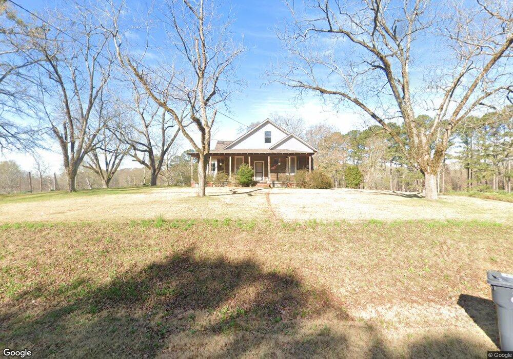
45 Eunice Harris Rd Lagrange, GA 30240
Estimated Value: $223,000 - $295,000
3
Beds
1
Bath
2,172
Sq Ft
$116/Sq Ft
Est. Value
About This Home
This home is located at 45 Eunice Harris Rd, Lagrange, GA 30240 and is currently estimated at $251,932, approximately $115 per square foot. 45 Eunice Harris Rd is a home with nearby schools including Ethel W. Kight Elementary School, Hollis Hand Elementary School, and Franklin Forest Elementary School.
Ownership History
Date
Name
Owned For
Owner Type
Purchase Details
Closed on
Jan 24, 1994
Sold by
Thrower Samford E Mary P
Bought by
Haines Diane Thrower
Current Estimated Value
Purchase Details
Closed on
Dec 30, 1993
Sold by
Thrower Samford E and Thrower Mary P
Bought by
Thrower Samford E Mary P
Purchase Details
Closed on
Dec 29, 1993
Sold by
Thrower Samford E
Bought by
Thrower Samford E and Thrower Mary P
Purchase Details
Closed on
Mar 7, 1970
Sold by
Harris Eunice Aka Harris Eunic
Bought by
Thrower Samford E
Purchase Details
Closed on
Aug 23, 1968
Sold by
Stephens Hazel
Bought by
Harris Eunice Aka Harris Eunic
Purchase Details
Closed on
Jan 1, 1928
Sold by
Federal Land Bank
Bought by
Stephens Hazel
Purchase Details
Closed on
Dec 1, 1926
Sold by
Hutchinson Robert
Bought by
Federal Land Bank
Create a Home Valuation Report for This Property
The Home Valuation Report is an in-depth analysis detailing your home's value as well as a comparison with similar homes in the area
Purchase History
| Date | Buyer | Sale Price | Title Company |
|---|---|---|---|
| Haines Diane Thrower | -- | -- | |
| Thrower Samford E Mary P | -- | -- | |
| Thrower Samford E | -- | -- | |
| Thrower Samford E | -- | -- | |
| Harris Eunice Aka Harris Eunic | $1,800 | -- | |
| Stephens Hazel | -- | -- | |
| Federal Land Bank | -- | -- |
Source: Public Records
Tax History
| Year | Tax Paid | Tax Assessment Tax Assessment Total Assessment is a certain percentage of the fair market value that is determined by local assessors to be the total taxable value of land and additions on the property. | Land | Improvement |
|---|---|---|---|---|
| 2025 | $1,793 | $69,904 | $9,560 | $60,344 |
| 2024 | $1,686 | $63,800 | $9,560 | $54,240 |
| 2023 | $1,059 | $964 | $0 | $964 |
| 2022 | $1,498 | $55,648 | $9,560 | $46,088 |
| 2021 | $1,611 | $55,388 | $7,720 | $47,668 |
| 2020 | $747 | $26,760 | $7,720 | $19,040 |
| 2019 | $752 | $26,920 | $7,720 | $19,200 |
| 2018 | $760 | $25,200 | $7,720 | $17,480 |
| 2017 | $700 | $25,200 | $7,720 | $17,480 |
Source: Public Records
Map
Nearby Homes
- 440 & 448 Kimbrough Rd
- 4.5 ACRES Whatley Rd N
- 0 Deming St Unit 10550189
- 0 Salem Rd Tract 2 Unit 10675187
- 200 Cheyenne Dr
- 203 Shawnee Dr
- 4004 White Oak Ln
- 217 Highland Trail
- 104 Bridlewood Dr
- 135 Planters Ridge Dr
- 104 Dogwood Point
- 336 Whitaker Rd
- 124 Foxdale Dr
- 104 Spring Valley Dr
- 213 Linda Ln
- 117 Brookwood Dr
- 226 Linda Ln
- 641 Whitaker Rd
- 223 Pinehaven Dr
- 509 Connie Dr
- 131 Eunice Harris Rd
- 47 E Angela Dr
- 313 Vernon Ferry Rd
- 301 Vernon Ferry Rd
- 91 E Angela Dr
- 2 AC Angela Dr
- 54 E Angela Dr
- 70 E Angela Dr
- 271 Vernon Ferry Rd
- 454 Vernon Ferry Rd
- 0 Vernon Ferry Rd Unit 8913177
- 238 Elane Cir
- 3712 Robert Hayes Rd
- 81 Log Cabin Dr
- 95 Log Cabin Dr
- 90 E Angela Dr
- E Angela Dr
- 257 Vernon Ferry Rd
- 130 E Angela Dr
- 470 Vernon Ferry Rd
Your Personal Tour Guide
Ask me questions while you tour the home.