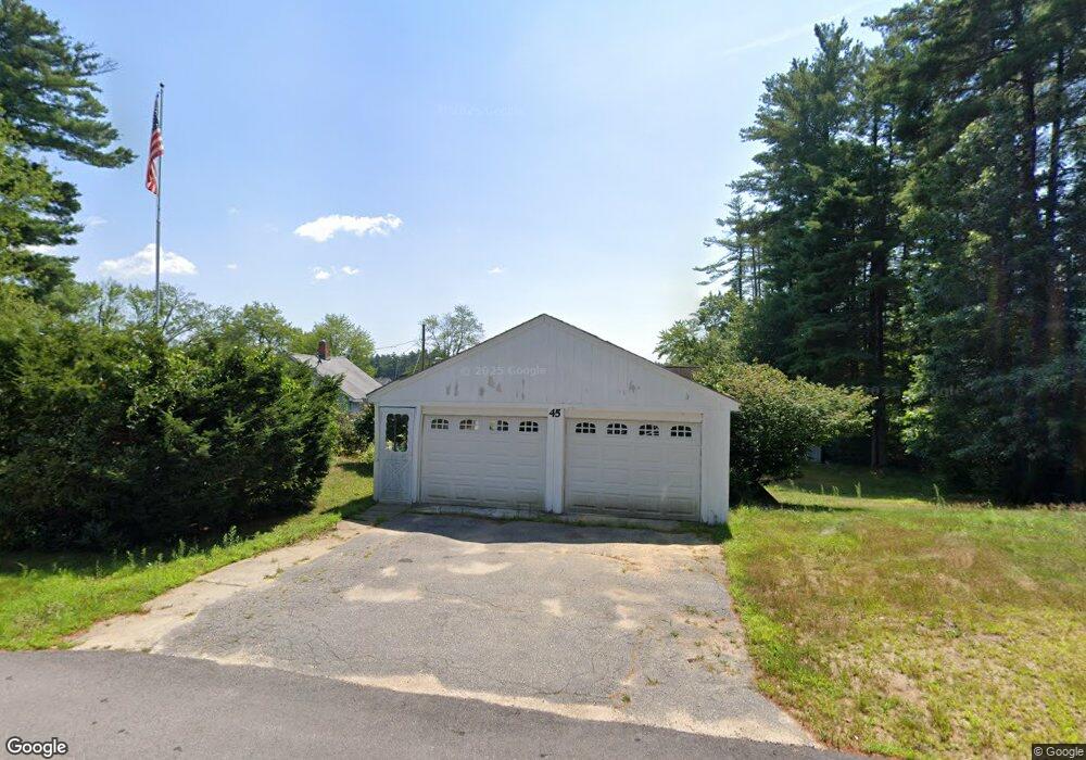
45 Flint Pond Dr Hollis, NH 03049
Hollis NeighborhoodEstimated Value: $366,000 - $410,000
1
Bed
1
Bath
708
Sq Ft
$548/Sq Ft
Est. Value
About This Home
This home is located at 45 Flint Pond Dr, Hollis, NH 03049 and is currently estimated at $387,798, approximately $547 per square foot. 45 Flint Pond Dr is a home with nearby schools including Hollis Primary School, Hollis Upper Elementary School, and Hollis-Brookline Middle School.
Ownership History
Date
Name
Owned For
Owner Type
Purchase Details
Closed on
Jan 12, 2000
Sold by
Pombrio Emma M
Bought by
Moran Ronald Bruce and Moran Ann-Marie
Current Estimated Value
Create a Home Valuation Report for This Property
The Home Valuation Report is an in-depth analysis detailing your home's value as well as a comparison with similar homes in the area
Home Values in the Area
Average Home Value in this Area
Purchase History
| Date | Buyer | Sale Price | Title Company |
|---|---|---|---|
| Moran Ronald Bruce | $99,900 | -- |
Source: Public Records
Mortgage History
| Date | Status | Borrower | Loan Amount |
|---|---|---|---|
| Open | Moran Ronald Bruce | $128,350 | |
| Closed | Moran Ronald Bruce | $45,000 | |
| Closed | Moran Ronald Bruce | $132,000 | |
| Closed | Moran Ronald Bruce | $128,500 |
Source: Public Records
Tax History Compared to Growth
Tax History
| Year | Tax Paid | Tax Assessment Tax Assessment Total Assessment is a certain percentage of the fair market value that is determined by local assessors to be the total taxable value of land and additions on the property. | Land | Improvement |
|---|---|---|---|---|
| 2024 | $5,335 | $300,900 | $165,600 | $135,300 |
| 2023 | $5,013 | $300,900 | $165,600 | $135,300 |
| 2022 | $6,791 | $300,900 | $165,600 | $135,300 |
| 2021 | $4,209 | $185,400 | $106,100 | $79,300 |
| 2020 | $4,298 | $185,400 | $106,100 | $79,300 |
| 2019 | $4,283 | $185,400 | $106,100 | $79,300 |
| 2018 | $4,018 | $185,400 | $106,100 | $79,300 |
| 2017 | $3,489 | $150,700 | $92,300 | $58,400 |
| 2016 | $3,531 | $150,700 | $92,300 | $58,400 |
| 2015 | $3,469 | $150,700 | $92,300 | $58,400 |
| 2014 | $3,486 | $150,700 | $92,300 | $58,400 |
| 2013 | $3,391 | $148,600 | $92,300 | $56,300 |
Source: Public Records
Map
Nearby Homes
- 10 Hobart Ln
- 199 Pine Hill Rd
- 0 Nartoff Rd
- 32 Sumner Ln
- 118 Broad St
- 40-40A Pine Hill Rd
- 93 Rideout Rd
- 77 Broad St
- 11 Rideout Rd
- 95 Wright Rd
- 7 Lovejoy Ln
- 28 Bartemus Trail Unit U210
- 80 Bartemus Trail Unit U229
- 22 Cathedral Cir
- 5 Mark St
- 1 Fieldstone Dr
- 38 Dianne St
- 6 Cornwall Ln Unit 7
- 45 Long Hill Rd
- 4 Nelson St
- 47 Flint Pond Dr
- 49-5 Flint Pond Dr
- 44 Flint Pond Dr
- 49-E Flint Pond Dr
- 46 Flint Pond Dr
- 49-3 Flint Pond Dr
- 51 Flint Pond Dr
- 42 Flint Pond Dr
- 43 Flint Pond Dr
- 48 Flint Pond Dr
- 41 Flint Pond Dr
- 53 Flint Pond Dr
- 39-2 Flint Pond Dr
- 39-B Flint Pond Dr
- 50 Flint Pond Dr
- 55 Flint Pond Dr
- 39-A Flint Pond Dr
- 35 Flint Pond Dr
- 52 Flint Pond Dr
- 57 Flint Pond Dr