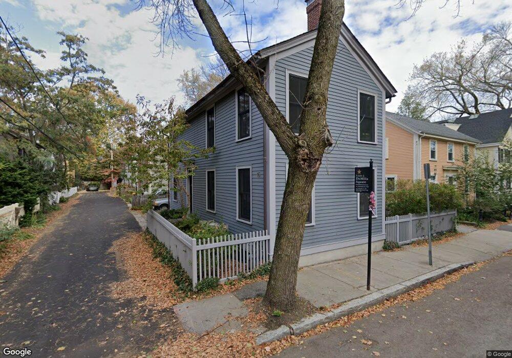
45 Foster St Cambridge, MA 02138
West Cambridge NeighborhoodEstimated Value: $1,867,000 - $2,927,000
3
Beds
3
Baths
2,098
Sq Ft
$1,193/Sq Ft
Est. Value
About This Home
This home is located at 45 Foster St, Cambridge, MA 02138 and is currently estimated at $2,503,796, approximately $1,193 per square foot. 45 Foster St is a home located in Middlesex County with nearby schools including St Peter School, Buckingham Browne & Nichols School, and Shady Hill School.
Ownership History
Date
Name
Owned For
Owner Type
Purchase Details
Closed on
Nov 20, 2007
Sold by
Curtis Matthew W
Bought by
John E Greenup Ret and Greenup John E
Current Estimated Value
Purchase Details
Closed on
Aug 11, 2006
Sold by
Theresa Gidari Lt and Leone Dominic M
Bought by
Curtis Matthew W
Home Financials for this Owner
Home Financials are based on the most recent Mortgage that was taken out on this home.
Original Mortgage
$440,000
Interest Rate
6.8%
Mortgage Type
Purchase Money Mortgage
Purchase Details
Closed on
Jun 1, 2006
Sold by
Gidari Theresa
Bought by
Theresa Gidari Lt and Leone Dominic M
Create a Home Valuation Report for This Property
The Home Valuation Report is an in-depth analysis detailing your home's value as well as a comparison with similar homes in the area
Home Values in the Area
Average Home Value in this Area
Purchase History
| Date | Buyer | Sale Price | Title Company |
|---|---|---|---|
| John E Greenup Ret | $605,000 | -- | |
| Curtis Matthew W | $550,000 | -- | |
| Theresa Gidari Lt | -- | -- |
Source: Public Records
Mortgage History
| Date | Status | Borrower | Loan Amount |
|---|---|---|---|
| Previous Owner | Curtis Matthew W | $440,000 |
Source: Public Records
Tax History
| Year | Tax Paid | Tax Assessment Tax Assessment Total Assessment is a certain percentage of the fair market value that is determined by local assessors to be the total taxable value of land and additions on the property. | Land | Improvement |
|---|---|---|---|---|
| 2025 | $13,122 | $2,066,500 | $890,300 | $1,176,200 |
| 2024 | $12,007 | $2,028,200 | $902,300 | $1,125,900 |
| 2023 | $11,437 | $1,951,700 | $870,600 | $1,081,100 |
| 2022 | $10,821 | $1,827,900 | $871,200 | $956,700 |
| 2021 | $10,331 | $1,765,900 | $857,900 | $908,000 |
| 2020 | $9,756 | $1,696,700 | $836,500 | $860,200 |
| 2019 | $9,171 | $1,543,900 | $733,500 | $810,400 |
| 2018 | $9,448 | $1,502,100 | $729,200 | $772,900 |
| 2017 | $9,425 | $1,452,200 | $729,200 | $723,000 |
| 2016 | $9,093 | $1,300,900 | $641,300 | $659,600 |
| 2015 | $10,119 | $1,294,000 | $589,800 | $704,200 |
| 2014 | $10,312 | $1,230,600 | $536,200 | $694,400 |
Source: Public Records
Map
Nearby Homes
- 46 Foster St
- 35 Willard St
- 3 Berkeley Place
- 992 Memorial Dr Unit 106
- 1010 Memorial Dr Unit 6F
- 5 Brewer St Unit 5
- 153 Brattle St
- 4 Craigie St Unit 2
- 985 Memorial Dr Unit 603
- 985 Memorial Dr Unit 303
- 22 Concord Ave Unit 10
- 22 Concord Ave Unit 11
- 14 Concord Ave Unit 624
- 157 Brattle St
- 984 Memorial Dr Unit 984-503
- 159 Brattle St
- 130 Mount Auburn St Unit 309
- 44 Garden St
- 172 Brattle St
- 58 Shepard St
Your Personal Tour Guide
Ask me questions while you tour the home.