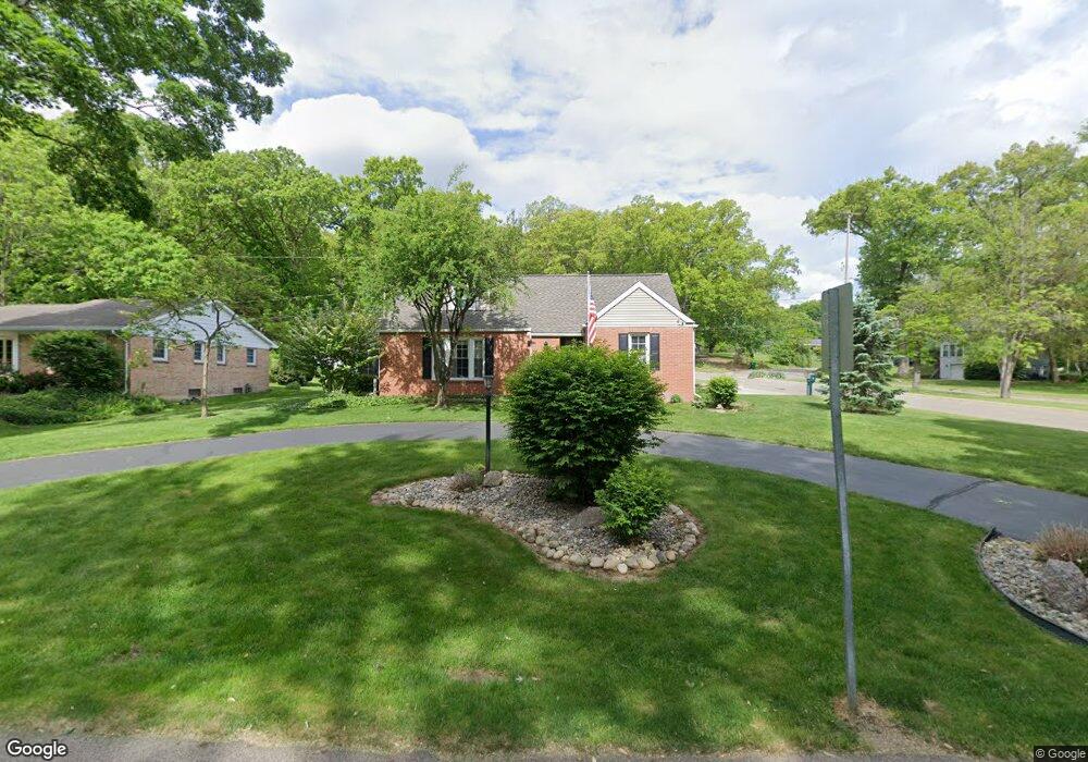
45 Garden Ave N Battle Creek, MI 49017
Estimated Value: $224,000 - $274,000
4
Beds
2
Baths
2,156
Sq Ft
$111/Sq Ft
Est. Value
About This Home
This home is located at 45 Garden Ave N, Battle Creek, MI 49017 and is currently estimated at $239,610, approximately $111 per square foot. 45 Garden Ave N is a home located in Calhoun County with nearby schools including Pennfield Purdy School, Pennfield Dunlap Elementary School, and Pennfield Middle School.
Ownership History
Date
Name
Owned For
Owner Type
Purchase Details
Closed on
Mar 31, 2004
Sold by
Mason Rick A and Mason Donna L
Bought by
Sutliff Pauline M
Current Estimated Value
Home Financials for this Owner
Home Financials are based on the most recent Mortgage that was taken out on this home.
Original Mortgage
$125,000
Outstanding Balance
$58,782
Interest Rate
5.65%
Mortgage Type
Purchase Money Mortgage
Estimated Equity
$180,828
Purchase Details
Closed on
May 1, 1992
Purchase Details
Closed on
Nov 1, 1988
Create a Home Valuation Report for This Property
The Home Valuation Report is an in-depth analysis detailing your home's value as well as a comparison with similar homes in the area
Home Values in the Area
Average Home Value in this Area
Purchase History
| Date | Buyer | Sale Price | Title Company |
|---|---|---|---|
| Sutliff Pauline M | $142,000 | Chicago Title Of Michigan | |
| -- | $78,000 | -- | |
| -- | $74,900 | -- |
Source: Public Records
Mortgage History
| Date | Status | Borrower | Loan Amount |
|---|---|---|---|
| Open | Sutliff Pauline M | $125,000 |
Source: Public Records
Tax History Compared to Growth
Tax History
| Year | Tax Paid | Tax Assessment Tax Assessment Total Assessment is a certain percentage of the fair market value that is determined by local assessors to be the total taxable value of land and additions on the property. | Land | Improvement |
|---|---|---|---|---|
| 2025 | $2,497 | $87,500 | $0 | $0 |
| 2024 | $1,111 | $79,900 | $0 | $0 |
| 2023 | $2,152 | $68,020 | $0 | $0 |
| 2022 | $1,008 | $61,110 | $0 | $0 |
| 2021 | $2,160 | $58,370 | $0 | $0 |
| 2020 | $2,122 | $59,620 | $0 | $0 |
| 2019 | $2,052 | $55,120 | $0 | $0 |
| 2018 | $1,850 | $53,370 | $6,790 | $46,580 |
| 2017 | $0 | $50,800 | $0 | $0 |
| 2016 | $0 | $44,890 | $0 | $0 |
| 2015 | -- | $37,790 | $8,024 | $29,766 |
| 2014 | -- | $37,780 | $8,024 | $29,756 |
Source: Public Records
Map
Nearby Homes
- 1731 Capital Ave NE
- 125 Sunset Blvd W
- 110 Harriet Ln
- 52 Thorncroft Ave
- 0 Hopkins St
- 6722 Morgan Rd E
- 21 Bradley St
- 19687 East Ave N
- 0 Capital Ave NE
- 731 Roosevelt Ave E
- 561 Garrison Rd
- 115 Briars Farm Ln
- 40 Oxford St
- 955 Capital Ave NE
- 31 Oxford St
- V/L Parkview Ave
- 202 Viking Dr
- 6329 Purdy Dr
- 117 Old Lantern Trail
- 208 Glendale Ave
- 43 Garden Ave N
- 33 Sunset Blvd W
- 44 Garden Ave N
- 57 Garden Ave N
- 41 Garden Ave N
- 56 Garden Ave N
- 29 Sunset Blvd W
- 100 Sunset Blvd W
- 205 Dogwood Trail
- 43 Hillside Dr
- 42 Garden Ave N
- 61 Garden Ave N
- 61 Garden Ave N
- 30 Sunset Blvd W
- 39 Garden Ave N
- 38 Garden Ave N
- 65 Garden Ave N
- 104 Sunset Blvd W
- 101 Sunset Blvd W
- 206 Dogwood Trail