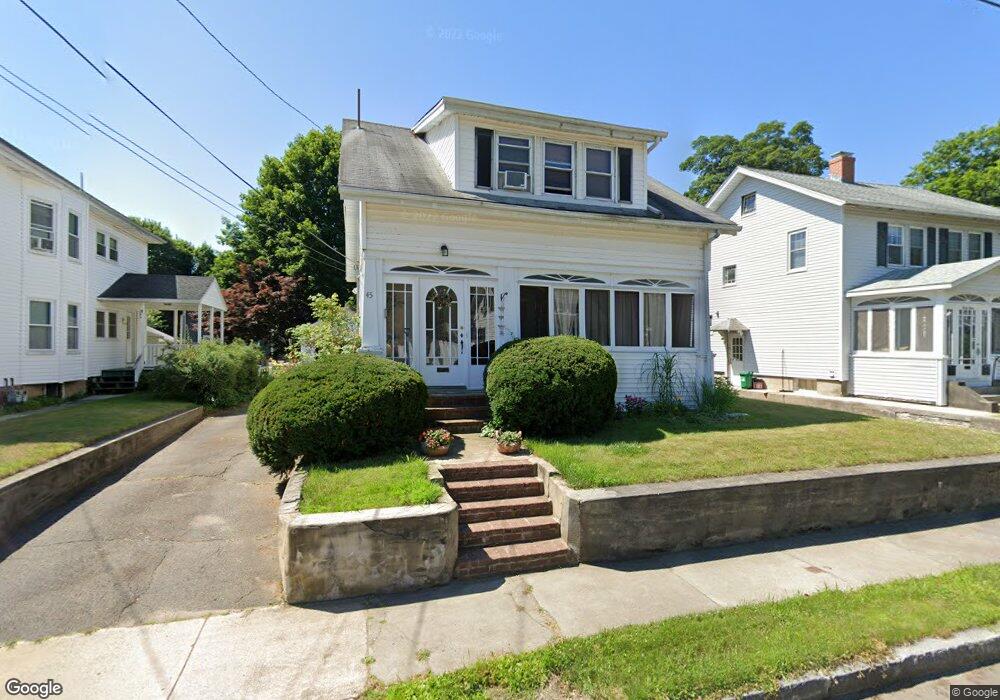
45 Gorman Rd Framingham, MA 01702
Estimated Value: $512,000 - $618,000
3
Beds
2
Baths
1,107
Sq Ft
$510/Sq Ft
Est. Value
About This Home
This home is located at 45 Gorman Rd, Framingham, MA 01702 and is currently estimated at $564,535, approximately $509 per square foot. 45 Gorman Rd is a home located in Middlesex County with nearby schools including Framingham High School, Christa McAuliffe Charter School, and Happy Hollow School.
Ownership History
Date
Name
Owned For
Owner Type
Purchase Details
Closed on
Mar 29, 1999
Sold by
Malek David A and Chandler-Malek Donna
Bought by
Thomas David O and Thomas Irena
Current Estimated Value
Purchase Details
Closed on
Dec 8, 1994
Sold by
Rja Rt and Rogers Mary E Y
Bought by
Chandler-Malek Donna and Malek David A
Purchase Details
Closed on
Mar 30, 1990
Sold by
Rogers Andrew J
Bought by
Rja Rt
Create a Home Valuation Report for This Property
The Home Valuation Report is an in-depth analysis detailing your home's value as well as a comparison with similar homes in the area
Home Values in the Area
Average Home Value in this Area
Purchase History
| Date | Buyer | Sale Price | Title Company |
|---|---|---|---|
| Thomas David O | $180,000 | -- | |
| Chandler-Malek Donna | $122,500 | -- | |
| Chandler-Malek Donna | $122,500 | -- | |
| Rja Rt | $125,000 | -- | |
| Rja Rt | $125,000 | -- |
Source: Public Records
Mortgage History
| Date | Status | Borrower | Loan Amount |
|---|---|---|---|
| Open | Rja Rt | $166,521 | |
| Closed | Rja Rt | $163,000 |
Source: Public Records
Tax History Compared to Growth
Tax History
| Year | Tax Paid | Tax Assessment Tax Assessment Total Assessment is a certain percentage of the fair market value that is determined by local assessors to be the total taxable value of land and additions on the property. | Land | Improvement |
|---|---|---|---|---|
| 2025 | $5,060 | $423,800 | $215,500 | $208,300 |
| 2024 | $4,886 | $392,100 | $193,000 | $199,100 |
| 2023 | $4,664 | $356,300 | $173,000 | $183,300 |
| 2022 | $4,347 | $316,400 | $157,100 | $159,300 |
| 2021 | $4,223 | $300,600 | $151,000 | $149,600 |
| 2020 | $4,125 | $275,400 | $131,300 | $144,100 |
| 2019 | $4,017 | $261,200 | $127,600 | $133,600 |
| 2018 | $3,941 | $241,500 | $120,700 | $120,800 |
| 2017 | $3,653 | $218,600 | $117,300 | $101,300 |
| 2016 | $3,530 | $203,100 | $113,600 | $89,500 |
| 2015 | $3,646 | $204,600 | $111,400 | $93,200 |
Source: Public Records
Map
Nearby Homes
- 369 Grant St Unit 3
- 369 Grant St Unit 1
- 369 Grant St
- 369 Grant St Unit 2
- 693 Concord St
- 29 Aberdeen Rd
- 34 Burdette Ave
- 21 Wilson Dr
- 391 Concord St
- 8 Old Conn Path
- 128 Warren Rd
- 126 Bishop Dr
- 155 Bishop Dr
- 108 Warren Rd
- 92 Old Connecticut Path
- 4 Mclaughlin St Unit 3
- 36 Porter Rd
- 144 Old Connecticut Path
- Lot 2A Murray Hill Rd
- Lot 3 Murray Hill Rd
- 49 Gorman Rd
- 39 Gorman Rd
- 43 Gorman Rd Unit Front
- 55 Gorman Rd
- 48 Belvidere Ave
- 52 Belvidere Ave
- 44 Belvidere Ave
- 56 Belvidere Ave
- 35 Gorman Rd
- 40 Belvidere Ave
- 48 Gorman Rd
- 46 Gorman Rd
- 52 Gorman Rd
- 54 Gorman Rd Unit 2
- 36 Belvidere Ave
- 57 Gorman Rd
- 57 Gorman Rd Unit 3
- 57 Gorman Rd Unit 2
- 36 Gorman Rd
- 31 Gorman Rd