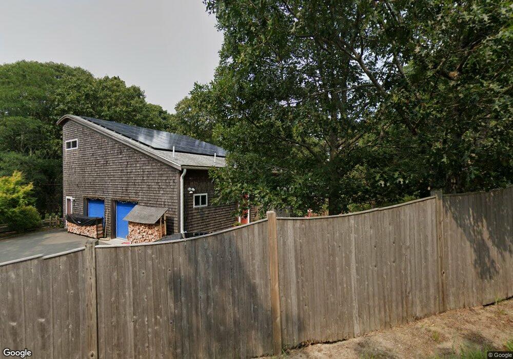
45 Lawrence Rd Unit TURTLE Wellfleet, MA 02667
Estimated Value: $834,000 - $2,355,000
4
Beds
3
Baths
3,040
Sq Ft
$585/Sq Ft
Est. Value
About This Home
This home is located at 45 Lawrence Rd Unit TURTLE, Wellfleet, MA 02667 and is currently estimated at $1,778,503, approximately $585 per square foot. 45 Lawrence Rd Unit TURTLE is a home located in Barnstable County with nearby schools including Wellfleet Elementary School, Nauset Regional Middle School, and Nauset Regional High School.
Ownership History
Date
Name
Owned For
Owner Type
Purchase Details
Closed on
Apr 29, 2024
Sold by
Gauthier Martin M and Gauthier Susan S
Bought by
Martin and Martin Susan Gauthier
Current Estimated Value
Purchase Details
Closed on
May 29, 2014
Sold by
David H Ernst T H and David Thompson
Bought by
Gauthier Martin M and Gauthier Susan S
Purchase Details
Closed on
May 2, 2005
Sold by
Ernst David H and Ernst Rachel J
Bought by
David H Ernst T H and David Ernst
Create a Home Valuation Report for This Property
The Home Valuation Report is an in-depth analysis detailing your home's value as well as a comparison with similar homes in the area
Home Values in the Area
Average Home Value in this Area
Purchase History
| Date | Buyer | Sale Price | Title Company |
|---|---|---|---|
| Martin | -- | None Available | |
| Martin | -- | None Available | |
| Martin | -- | None Available | |
| Gauthier Martin M | $901,500 | -- | |
| Gauthier Martin M | $901,500 | -- | |
| David H Ernst T H | -- | -- | |
| David H Ernst T H | -- | -- |
Source: Public Records
Tax History Compared to Growth
Tax History
| Year | Tax Paid | Tax Assessment Tax Assessment Total Assessment is a certain percentage of the fair market value that is determined by local assessors to be the total taxable value of land and additions on the property. | Land | Improvement |
|---|---|---|---|---|
| 2025 | $14,152 | $1,990,500 | $1,147,900 | $842,600 |
| 2024 | $13,055 | $1,911,400 | $1,093,200 | $818,200 |
| 2023 | $11,553 | $1,659,900 | $926,500 | $733,400 |
| 2022 | $10,413 | $1,338,400 | $812,700 | $525,700 |
| 2021 | $4,486 | $1,201,100 | $725,600 | $475,500 |
| 2020 | $9,267 | $1,195,700 | $742,000 | $453,700 |
| 2019 | $9,119 | $1,179,700 | $742,000 | $437,700 |
| 2018 | $8,411 | $1,171,400 | $742,000 | $429,400 |
| 2017 | $3,278 | $1,167,900 | $742,000 | $425,900 |
| 2016 | $6,713 | $982,800 | $411,100 | $571,700 |
| 2015 | $5,692 | $839,600 | $278,900 | $560,700 |
Source: Public Records
Map
Nearby Homes
- 40 Old Long Pond Rd
- 240 Gross Hill Rd
- 49 Oak Valley Rd
- 50 Higgins Ln
- 10 Bank St
- 20 Bank St
- 30 Harbor View Cir
- 135 Marven Way
- 256 Browns Neck Rd
- 35 Holbrook Ave
- 225 Coles Neck Rd
- 164 Kendrick Ave Unit B
- 164 Kendrick Ave Unit C
- 260 Kendrick Ave Unit 4
- 320 Coles Neck Rd
- 65 Belding Way
- 100 E Hill Rd
- 30 Sam Hollow Rd
- 345 Cove Rd
- 7 Arrowhead Farm Rd
- 45 Lawrence Rd
- 25 Old Long Pond Rd
- 15 Old Long Pond Rd
- 45 Old Long Pond Rd
- 36 Gross Hill Rd
- 2896 State 6 Hwy
- 56 Gross Hill Rd
- 10 Lawrence Rd
- 70 Gross Hill Rd
- 60 Old Long Pond Rd
- 10 Cemetary Rd
- 84 Gross Hill Rd
- 55 Old Long Pond Rd
- 80 Old Long Pond Rd
- 100 Lawrence Rd
- 96 Gross Hill Rd
- 15 Cemetary Rd
- 21 Cemetary Rd
- 110 Gross Hill Rd
- 70 Dalmas Trail