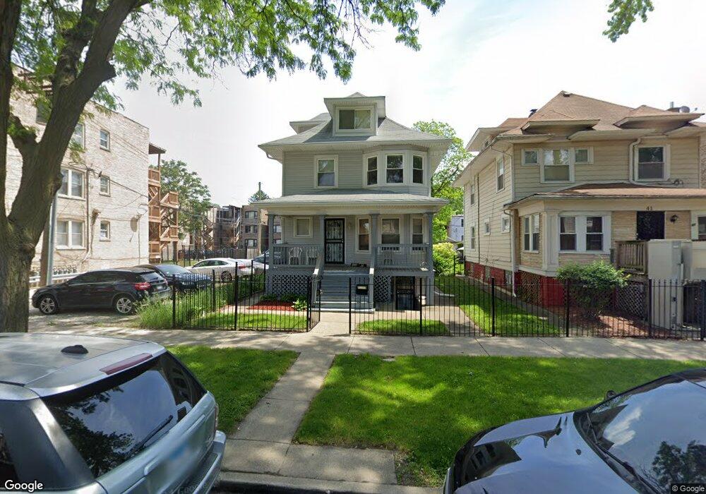
45 N Lorel Ave Chicago, IL 60644
Austin NeighborhoodEstimated Value: $260,000 - $384,000
5
Beds
2
Baths
2,621
Sq Ft
$120/Sq Ft
Est. Value
About This Home
This home is located at 45 N Lorel Ave, Chicago, IL 60644 and is currently estimated at $315,598, approximately $120 per square foot. 45 N Lorel Ave is a home located in Cook County with nearby schools including Depriest Elementary School, Catalyst Charter-Circle Rock Elementary School, and Moving Everest Charter School.
Ownership History
Date
Name
Owned For
Owner Type
Purchase Details
Closed on
Mar 29, 1997
Sold by
George Albert and George Naomi
Bought by
George Albert and George Naomi
Current Estimated Value
Home Financials for this Owner
Home Financials are based on the most recent Mortgage that was taken out on this home.
Original Mortgage
$55,000
Interest Rate
7.63%
Create a Home Valuation Report for This Property
The Home Valuation Report is an in-depth analysis detailing your home's value as well as a comparison with similar homes in the area
Home Values in the Area
Average Home Value in this Area
Purchase History
| Date | Buyer | Sale Price | Title Company |
|---|---|---|---|
| George Albert | -- | -- |
Source: Public Records
Mortgage History
| Date | Status | Borrower | Loan Amount |
|---|---|---|---|
| Closed | George Albert | $55,000 |
Source: Public Records
Tax History
| Year | Tax Paid | Tax Assessment Tax Assessment Total Assessment is a certain percentage of the fair market value that is determined by local assessors to be the total taxable value of land and additions on the property. | Land | Improvement |
|---|---|---|---|---|
| 2025 | $640 | $22,000 | $4,548 | $17,452 |
| 2024 | $640 | $22,000 | $4,548 | $17,452 |
| 2023 | $585 | $9,001 | $3,601 | $5,400 |
| 2022 | $585 | $9,001 | $3,601 | $5,400 |
| 2021 | $470 | $8,999 | $3,600 | $5,399 |
| 2020 | $1,268 | $19,572 | $3,221 | $16,351 |
| 2019 | $1,264 | $21,747 | $3,221 | $18,526 |
| 2018 | $1,245 | $21,747 | $3,221 | $18,526 |
| 2017 | $1,333 | $17,604 | $2,842 | $14,762 |
| 2016 | $2,669 | $17,604 | $2,842 | $14,762 |
| 2015 | $2,402 | $17,604 | $2,842 | $14,762 |
| 2014 | $1,716 | $13,652 | $2,653 | $10,999 |
| 2013 | $1,663 | $13,652 | $2,653 | $10,999 |
Source: Public Records
Map
Nearby Homes
- 1100 S Menard St
- 4855 W Jackson Blvd
- 118 N Long Ave
- 144 N Laramie Ave
- 206 N Lockwood Ave
- 4607 W Madison St
- 139 N Laramie Ave
- 206 N Leamington Ave
- 174 N Leclaire Ave
- 217 N Leamington Ave
- 5037 W West End Ave
- 5055 W Madison St Unit 507
- 5033 W Washington Blvd
- 332 N Lorel Ave
- 5100 W Quincy St
- 46 N Central Ave
- 5038 W Fulton St
- 5026 W Fulton St
- 4948 W Washington Blvd
- 175 N Lavergne Ave
- 47 N Lorel Ave
- 41 N Lorel Ave
- 37 N Lorel Ave
- 51 N Lorel Ave
- 31 N Lorel Ave
- 35 N Lorel Ave
- 5315 W Washington Blvd
- 42 N Lockwood Ave
- 48 N Lockwood Ave
- 53 N Lorel Ave
- 40 N Lockwood Ave
- 40 N Lockwood Ave Unit 1
- 38 N Lockwood Ave
- 38 N Lockwood Ave
- 5311 N Washington St Unit 3
- 5311 N Washington St Unit 2
- 5311 N Washington St Unit G
- 27 N Lorel Ave Unit 1
- 5325 W Washington Blvd
- 5301 W Washington Blvd Unit 521
Your Personal Tour Guide
Ask me questions while you tour the home.