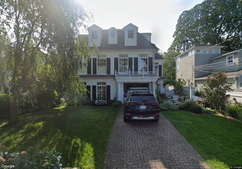
45 Pine Point Rd Norwalk, CT 06853
Rowayton NeighborhoodEstimated Value: $3,256,000 - $3,685,000
4
Beds
4
Baths
4,000
Sq Ft
$857/Sq Ft
Est. Value
About This Home
This home is located at 45 Pine Point Rd, Norwalk, CT 06853 and is currently estimated at $3,429,329, approximately $857 per square foot. 45 Pine Point Rd is a home located in Fairfield County with nearby schools including Rowayton Elementary School, Roton Middle School, and Brien Mcmahon High School.
Ownership History
Date
Name
Owned For
Owner Type
Purchase Details
Closed on
Apr 3, 2013
Sold by
Wessner Laura
Bought by
Wagner Christopher and Wagner Cara B
Current Estimated Value
Purchase Details
Closed on
Mar 26, 1993
Sold by
Kinsolving Charles
Bought by
Policastro Lawrence and Wessner Laura
Create a Home Valuation Report for This Property
The Home Valuation Report is an in-depth analysis detailing your home's value as well as a comparison with similar homes in the area
Home Values in the Area
Average Home Value in this Area
Purchase History
| Date | Buyer | Sale Price | Title Company |
|---|---|---|---|
| Wagner Christopher | $1,537,500 | -- | |
| Wagner Christopher | $1,537,500 | -- | |
| Policastro Lawrence | $290,000 | -- | |
| Policastro Lawrence | $290,000 | -- |
Source: Public Records
Mortgage History
| Date | Status | Borrower | Loan Amount |
|---|---|---|---|
| Open | Policastro Lawrence | $1,520,000 | |
| Closed | Policastro Lawrence | $110,000 |
Source: Public Records
Tax History
| Year | Tax Paid | Tax Assessment Tax Assessment Total Assessment is a certain percentage of the fair market value that is determined by local assessors to be the total taxable value of land and additions on the property. | Land | Improvement |
|---|---|---|---|---|
| 2025 | $38,932 | $1,738,640 | $983,420 | $755,220 |
| 2024 | $38,332 | $1,738,640 | $983,420 | $755,220 |
| 2023 | $28,590 | $1,194,970 | $522,590 | $672,380 |
| 2022 | $27,407 | $1,194,970 | $522,590 | $672,380 |
| 2021 | $26,492 | $1,194,970 | $522,590 | $672,380 |
| 2020 | $26,590 | $1,194,970 | $522,590 | $672,380 |
| 2019 | $25,566 | $1,194,970 | $522,590 | $672,380 |
| 2018 | $27,425 | $1,133,550 | $541,800 | $591,750 |
| 2017 | $26,425 | $1,133,550 | $541,800 | $591,750 |
| 2016 | $26,004 | $1,133,550 | $541,800 | $591,750 |
| 2015 | $25,902 | $1,133,550 | $541,800 | $591,750 |
| 2014 | $25,420 | $1,133,550 | $541,800 | $591,750 |
Source: Public Records
Map
Nearby Homes
- 22 Ensign Rd
- 24 Westmere Ave
- 6 Richmond Rd
- 22 Harstrom Place
- 166 Rowayton Ave Unit 2
- 17 Contentment Island Rd
- 3 Bittersweet Trail
- 18 Tokeneke Trail
- 14 5 Mile River Rd
- 3 Hilltop Rd
- 40 Tory Hill Ln
- 10 Cross Rd
- 5 Little Brook Rd
- 18 Winding Ln
- 9 Arnold Ln
- 40 Arnold Ln
- 119 Rowayton Woods Dr Unit 119
- 6 Acorn Ln
- 9 Knollwood Rd
- 2 Red Rose Cir
- 41 Pine Point Rd
- 51 Pine Point Rd
- 42 Pine Point Rd
- 40 Pine Point Rd
- 131 Pine Point Rd Unit 131
- 38 Pine Point Rd
- 39 Pine Point Rd
- 3 Gull Rd
- 16 Ensign Rd
- 36 Pine Point Rd
- 14 Ensign Rd
- 37 Pine Point Rd
- 24 Ensign Rd
- 2 Nylked Terrace
- 12 Ensign Rd
- 8 Ensign Rd
- 35 Pine Point Rd
- 17 Ensign Rd
- 1 Nylked Terrace
- 15 Ensign Rd
Your Personal Tour Guide
Ask me questions while you tour the home.