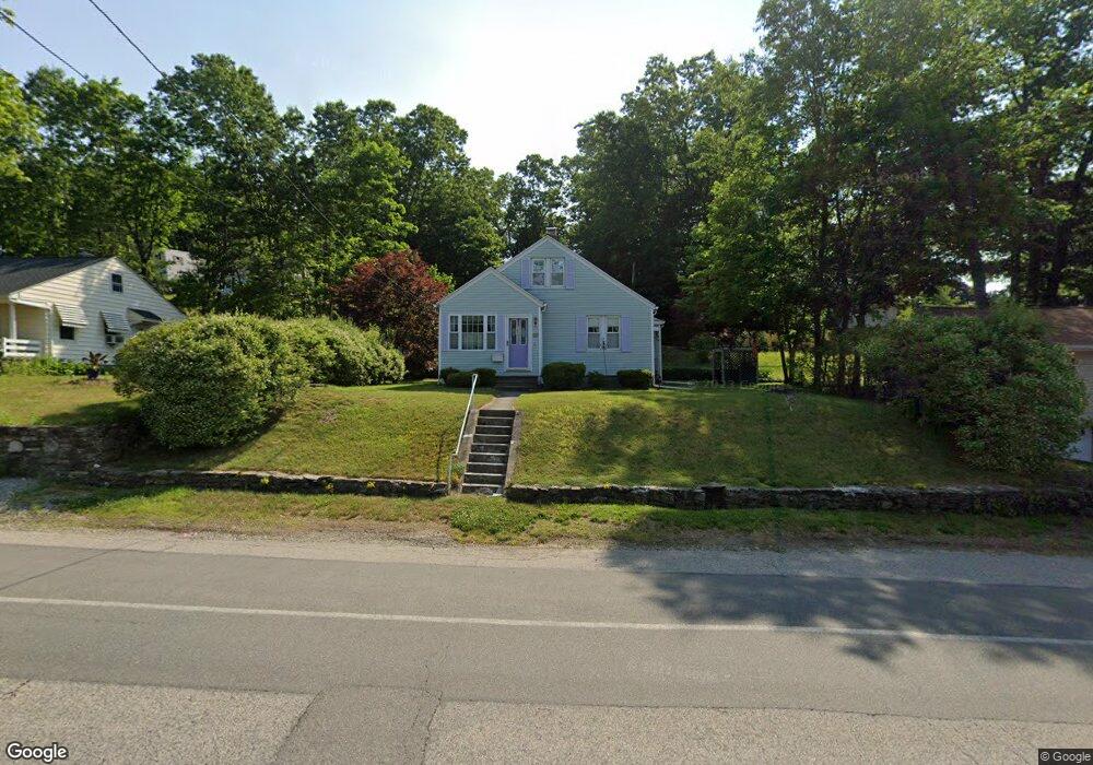
45 Pinehurst Ave Auburn, MA 01501
Stoneville NeighborhoodEstimated Value: $392,626 - $424,000
2
Beds
2
Baths
1,395
Sq Ft
$293/Sq Ft
Est. Value
About This Home
This home is located at 45 Pinehurst Ave, Auburn, MA 01501 and is currently estimated at $409,157, approximately $293 per square foot. 45 Pinehurst Ave is a home located in Worcester County with nearby schools including Auburn Senior High School and Shrewsbury Montessori School - Auburn Campus.
Ownership History
Date
Name
Owned For
Owner Type
Purchase Details
Closed on
Jun 30, 1989
Sold by
Aktiv Kaisa S
Bought by
Lariviere Sharon
Current Estimated Value
Home Financials for this Owner
Home Financials are based on the most recent Mortgage that was taken out on this home.
Original Mortgage
$90,000
Interest Rate
10.56%
Mortgage Type
Purchase Money Mortgage
Create a Home Valuation Report for This Property
The Home Valuation Report is an in-depth analysis detailing your home's value as well as a comparison with similar homes in the area
Home Values in the Area
Average Home Value in this Area
Purchase History
| Date | Buyer | Sale Price | Title Company |
|---|---|---|---|
| Lariviere Sharon | $103,000 | -- |
Source: Public Records
Mortgage History
| Date | Status | Borrower | Loan Amount |
|---|---|---|---|
| Closed | Lariviere Sharon | $72,700 | |
| Closed | Lariviere Sharon | $90,000 |
Source: Public Records
Tax History
| Year | Tax Paid | Tax Assessment Tax Assessment Total Assessment is a certain percentage of the fair market value that is determined by local assessors to be the total taxable value of land and additions on the property. | Land | Improvement |
|---|---|---|---|---|
| 2025 | $47 | $326,300 | $99,800 | $226,500 |
| 2024 | $4,522 | $302,900 | $94,200 | $208,700 |
| 2023 | $4,492 | $282,900 | $85,600 | $197,300 |
| 2022 | $4,033 | $239,800 | $80,900 | $158,900 |
| 2021 | $3,788 | $208,800 | $71,400 | $137,400 |
| 2020 | $3,729 | $207,400 | $71,400 | $136,000 |
| 2019 | $3,597 | $195,300 | $66,500 | $128,800 |
| 2018 | $684 | $183,900 | $62,200 | $121,700 |
| 2017 | $604 | $175,800 | $56,400 | $119,400 |
| 2016 | $2,943 | $162,700 | $58,200 | $104,500 |
| 2015 | $2,667 | $154,500 | $58,200 | $96,300 |
| 2014 | $2,735 | $158,200 | $55,500 | $102,700 |
Source: Public Records
Map
Nearby Homes
- 177 Boyce St
- 5 Commonwealth Ave
- 99 Clover St
- 25 Vinal St Unit 28
- 25 Vinal St Unit 26
- 25 Vinal St Unit 29
- 25 Vinal St Unit 30
- 27 Havana Rd
- 177 Oxford St N
- 35 Genessee St Unit E
- 315 Stafford St
- 11 Hulbert Rd Unit 13
- 19-20 Williams St
- 40 Bryn Mawr Ave
- 6 Buron Terrace
- 103 Henshaw St
- 1-9 Helens Way
- 55 Grandview Ave
- 31-33 Walsh Ave
- 33 Walsh Ave
- 47 Pinehurst Ave
- 47 Pinehurst Ave Unit 1
- 41 Pinehurst Ave
- 39 Marilyn Dr
- 42 Pinehurst Ave
- 45 Marilyn Dr
- 40 Pinehurst Ave
- 44 Pinehurst Ave
- 39 Pinehurst Ave
- 37 Marilyn Dr
- 46 Pinehurst Ave
- 38 Pinehurst Ave
- 35 Marilyn Dr
- 51 Pinehurst Ave
- 37 Pinehurst Ave
- 36 Pinehurst Ave
- 3 Carroll St
- 18 Otis St
- 48 Pinehurst Ave
- 5 Carroll St
Your Personal Tour Guide
Ask me questions while you tour the home.