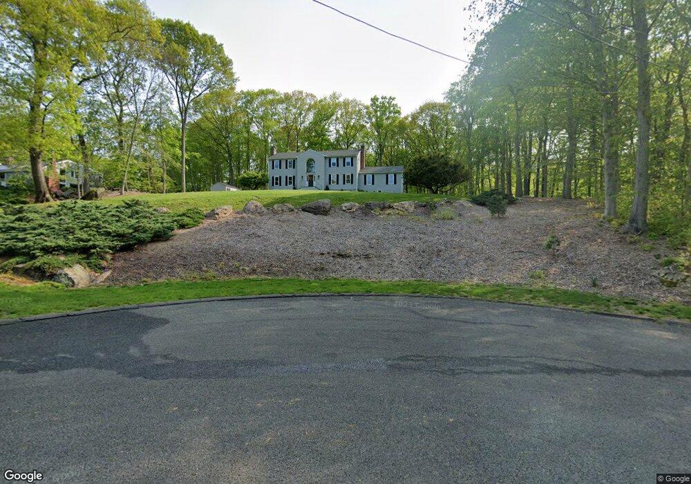
45 Reilly Rd Unit RNT Easton, CT 06612
Estimated Value: $906,000 - $1,130,593
4
Beds
4
Baths
3,652
Sq Ft
$286/Sq Ft
Est. Value
About This Home
This home is located at 45 Reilly Rd Unit RNT, Easton, CT 06612 and is currently estimated at $1,042,898, approximately $285 per square foot. 45 Reilly Rd Unit RNT is a home located in Fairfield County with nearby schools including Samuel Staples Elementary School, Helen Keller Middle School, and Joel Barlow High School.
Ownership History
Date
Name
Owned For
Owner Type
Purchase Details
Closed on
Feb 27, 2020
Sold by
Vontell Bonnie A
Bought by
Tortora Mary P
Current Estimated Value
Home Financials for this Owner
Home Financials are based on the most recent Mortgage that was taken out on this home.
Original Mortgage
$350,000
Outstanding Balance
$310,560
Interest Rate
3.6%
Mortgage Type
Purchase Money Mortgage
Estimated Equity
$732,338
Purchase Details
Closed on
May 20, 1992
Sold by
Dime Svg Bk Ny
Bought by
Vontell Robert J
Purchase Details
Closed on
Feb 25, 1988
Sold by
Eoanou John
Bought by
Varotsis John
Create a Home Valuation Report for This Property
The Home Valuation Report is an in-depth analysis detailing your home's value as well as a comparison with similar homes in the area
Home Values in the Area
Average Home Value in this Area
Purchase History
| Date | Buyer | Sale Price | Title Company |
|---|---|---|---|
| Tortora Mary P | $470,000 | None Available | |
| Tortora Mary P | $470,000 | None Available | |
| Vontell Robert J | $390,000 | -- | |
| Varotsis John | $625,000 | -- |
Source: Public Records
Mortgage History
| Date | Status | Borrower | Loan Amount |
|---|---|---|---|
| Open | Tortora Mary P | $350,000 | |
| Closed | Tortora Mary P | $350,000 | |
| Previous Owner | Varotsis John | $575,000 | |
| Previous Owner | Varotsis John | $300,000 | |
| Previous Owner | Varotsis John | $214,000 |
Source: Public Records
Tax History Compared to Growth
Tax History
| Year | Tax Paid | Tax Assessment Tax Assessment Total Assessment is a certain percentage of the fair market value that is determined by local assessors to be the total taxable value of land and additions on the property. | Land | Improvement |
|---|---|---|---|---|
| 2025 | $15,895 | $512,750 | $177,170 | $335,580 |
| 2024 | $14,857 | $502,950 | $177,170 | $325,780 |
| 2023 | $14,565 | $502,950 | $177,170 | $325,780 |
| 2022 | $14,304 | $502,950 | $177,170 | $325,780 |
| 2021 | $14,019 | $433,360 | $174,030 | $259,330 |
| 2020 | $13,434 | $433,360 | $174,030 | $259,330 |
| 2019 | $17,973 | $433,360 | $174,030 | $259,330 |
| 2018 | $13,599 | $433,360 | $174,030 | $259,330 |
| 2017 | $14,466 | $433,360 | $174,030 | $259,330 |
| 2016 | $13,274 | $430,820 | $203,480 | $227,340 |
| 2015 | $13,088 | $430,820 | $203,480 | $227,340 |
| 2014 | $12,882 | $430,820 | $203,480 | $227,340 |
Source: Public Records
Map
Nearby Homes
- 159 Blue Bell Ln
- 550 Rolling Hills Dr
- 48 Sunset Rd
- 43 Hall Rd
- 305 Sport Hill Rd
- 66 Morehouse Rd
- 35 Sturbridge Rd
- 63 Flat Rock Dr
- 301 Weeping Willow Ln
- 26 Wendy Rd
- 32 Adirondack Trail
- 28 Primrose Ln
- 68 Hawthorne Dr
- 227 Autumn Ridge Rd
- 83 Buck Hill Rd
- 178 Autumn Ridge Rd
- 545 Shrub Oak Ln
- 76 Burr St
- 12 Cherry Hill Rd
- 71 Schiller Rd
- 45 Reilly Rd
- 39 Reilly Rd
- 48 Far Horizon Dr
- 46 Reilly Rd
- 42 Far Horizon Dr
- 33 Reilly Rd
- 36 Reilly Rd
- 48 Reilly Rd
- 52 Far Horizon Dr
- 25 Reilly Rd
- 32 Far Horizon Dr
- 286 Morehouse Rd
- 30 Fensky Rd
- 26 Reilly Rd
- 60 Fawn Rd
- 266 Morehouse Rd
- 276 Morehouse Rd
- 62 Far Horizon Dr
- 40 Far Horizon Dr
- 40 Far Horizon Dr Unit 2