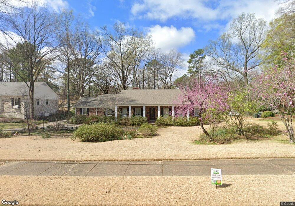
45 S Yates Rd Memphis, TN 38120
Audubon Park NeighborhoodEstimated Value: $527,311 - $746,000
3
Beds
3
Baths
4,200
Sq Ft
$145/Sq Ft
Est. Value
About This Home
This home is located at 45 S Yates Rd, Memphis, TN 38120 and is currently estimated at $610,828, approximately $145 per square foot. 45 S Yates Rd is a home located in Shelby County with nearby schools including White Station Elementary School, White Station Middle, and White Station High.
Ownership History
Date
Name
Owned For
Owner Type
Purchase Details
Closed on
Apr 28, 2009
Sold by
Mccormick Michael C and Mccormick Paula F
Bought by
Boughter John D and Valli Jennifer
Current Estimated Value
Home Financials for this Owner
Home Financials are based on the most recent Mortgage that was taken out on this home.
Original Mortgage
$285,600
Outstanding Balance
$181,998
Interest Rate
5.01%
Mortgage Type
Purchase Money Mortgage
Estimated Equity
$428,830
Purchase Details
Closed on
Mar 27, 1995
Bought by
Mccorm Michael C and Mccorm F
Create a Home Valuation Report for This Property
The Home Valuation Report is an in-depth analysis detailing your home's value as well as a comparison with similar homes in the area
Home Values in the Area
Average Home Value in this Area
Purchase History
| Date | Buyer | Sale Price | Title Company |
|---|---|---|---|
| Boughter John D | $357,000 | Home Surety Title & Escrow L | |
| Mccorm Michael C | $152,327 | -- |
Source: Public Records
Mortgage History
| Date | Status | Borrower | Loan Amount |
|---|---|---|---|
| Open | Boughter John D | $285,600 |
Source: Public Records
Tax History Compared to Growth
Tax History
| Year | Tax Paid | Tax Assessment Tax Assessment Total Assessment is a certain percentage of the fair market value that is determined by local assessors to be the total taxable value of land and additions on the property. | Land | Improvement |
|---|---|---|---|---|
| 2025 | $4,014 | $140,925 | $23,800 | $117,125 |
| 2024 | $4,014 | $118,400 | $21,600 | $96,800 |
| 2023 | $7,213 | $118,400 | $21,600 | $96,800 |
| 2022 | $7,213 | $118,400 | $21,600 | $96,800 |
| 2021 | $7,297 | $118,400 | $21,600 | $96,800 |
| 2020 | $7,203 | $99,400 | $21,600 | $77,800 |
| 2019 | $7,203 | $99,400 | $21,600 | $77,800 |
| 2018 | $7,203 | $99,400 | $21,600 | $77,800 |
| 2017 | $4,085 | $99,400 | $21,600 | $77,800 |
| 2016 | $4,003 | $91,600 | $0 | $0 |
| 2014 | $4,221 | $96,600 | $0 | $0 |
Source: Public Records
Map
Nearby Homes
- 5575 Walnut Grove Rd
- 5680 N Angela Rd
- 19 E Yates Rd S
- 5676 Walnut Grove Place
- 5690 Walnut Grove Rd
- 5532 Gwynne Rd
- 5649 Normandy Rd
- 5681 Normandy Rd
- 50 Grove Dale St
- 5504 Normandy Rd
- 5516 Sycamore Grove Ln
- 5429 Walnut Grove Rd
- 5429 Normandy Rd
- 5395 Gwynne Rd
- 5385 Walnut Grove Rd
- 5737 Buxbriar Ave
- 5702 Buxbriar Ave
- 5467 Collingwood Cove
- 5881 Brierglen Ave
- 320 S Yates Rd
- 45 S Yates Rd
- 65 S Yates Rd
- 50 Shady Glen Rd
- 62 Shady Glen Rd
- 17 N East Yates Rd
- 38 Shady Glen Rd
- 38 S Yates Rd
- 50 S Yates Rd
- 74 Shady Glen Rd
- 28 Shady Glen Rd
- 68 S Yates Rd
- 86 Shady Glen Rd
- 9 S Yates Rd
- 5644 Gwynne Cove
- 5585 Walnut Grove Rd
- 5647 Gwynne Cove
- 5625 Walnut Grove Rd
- 84 S Yates Rd
- 107 S Yates Rd
- 63 Shady Glen Rd