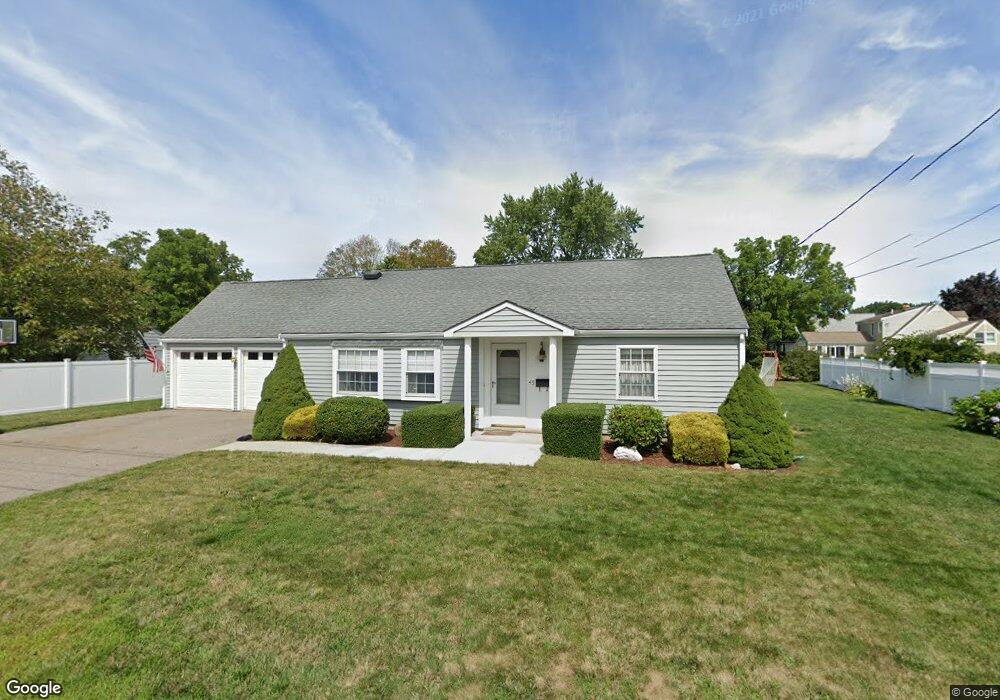
45 Spring St Mansfield, MA 02048
Estimated Value: $636,089 - $703,000
3
Beds
2
Baths
1,649
Sq Ft
$397/Sq Ft
Est. Value
About This Home
This home is located at 45 Spring St, Mansfield, MA 02048 and is currently estimated at $654,772, approximately $397 per square foot. 45 Spring St is a home located in Bristol County with nearby schools including Everett W. Robinson Elementary School, Jordan/Jackson Elementary School, and Harold L. Qualters Middle School.
Ownership History
Date
Name
Owned For
Owner Type
Purchase Details
Closed on
Jan 31, 2002
Sold by
Reasoner Carolyn
Bought by
Degirolamo Thomas P and Degirolamo Tara A
Current Estimated Value
Home Financials for this Owner
Home Financials are based on the most recent Mortgage that was taken out on this home.
Original Mortgage
$152,000
Interest Rate
7.15%
Mortgage Type
Purchase Money Mortgage
Create a Home Valuation Report for This Property
The Home Valuation Report is an in-depth analysis detailing your home's value as well as a comparison with similar homes in the area
Home Values in the Area
Average Home Value in this Area
Purchase History
| Date | Buyer | Sale Price | Title Company |
|---|---|---|---|
| Degirolamo Thomas P | $160,000 | -- |
Source: Public Records
Mortgage History
| Date | Status | Borrower | Loan Amount |
|---|---|---|---|
| Open | Degirolamo Thomas P | $170,000 | |
| Closed | Degirolamo Thomas P | $152,000 | |
| Previous Owner | Degirolamo Thomas P | $24,000 | |
| Previous Owner | Degirolamo Thomas P | $5,000 |
Source: Public Records
Tax History
| Year | Tax Paid | Tax Assessment Tax Assessment Total Assessment is a certain percentage of the fair market value that is determined by local assessors to be the total taxable value of land and additions on the property. | Land | Improvement |
|---|---|---|---|---|
| 2025 | $6,542 | $496,700 | $225,700 | $271,000 |
| 2024 | $5,963 | $441,700 | $225,700 | $216,000 |
| 2023 | $5,829 | $413,700 | $225,700 | $188,000 |
| 2022 | $5,646 | $372,200 | $209,000 | $163,200 |
| 2021 | $5,502 | $358,200 | $182,900 | $175,300 |
| 2020 | $5,287 | $344,200 | $174,200 | $170,000 |
| 2019 | $5,030 | $330,500 | $145,100 | $185,400 |
| 2018 | $4,696 | $301,600 | $138,300 | $163,300 |
| 2017 | $4,608 | $306,800 | $134,300 | $172,500 |
| 2016 | $4,544 | $294,900 | $127,900 | $167,000 |
| 2015 | $4,145 | $267,400 | $127,900 | $139,500 |
Source: Public Records
Map
Nearby Homes
- 44 Fairfield Park Unit 44
- 28 Court St
- 150 Rumford Ave Unit 110
- 46 Hope St
- 266 N Main St Unit 3
- 152 Central St
- 22 Pleasant St Unit C
- 81 Chilson Ave
- 1 Deer Path Ln
- 166 Chauncy St
- 73-75 Draper Ave
- 460 Ware St
- 571 Ware St
- 14 Windchime Dr
- 619 N Main St
- 4 Concetta Cir
- 356 Central St
- 19 Barberry Rd
- 212 Mill St
- 250 Mansfield Ave Unit 11
Your Personal Tour Guide
Ask me questions while you tour the home.