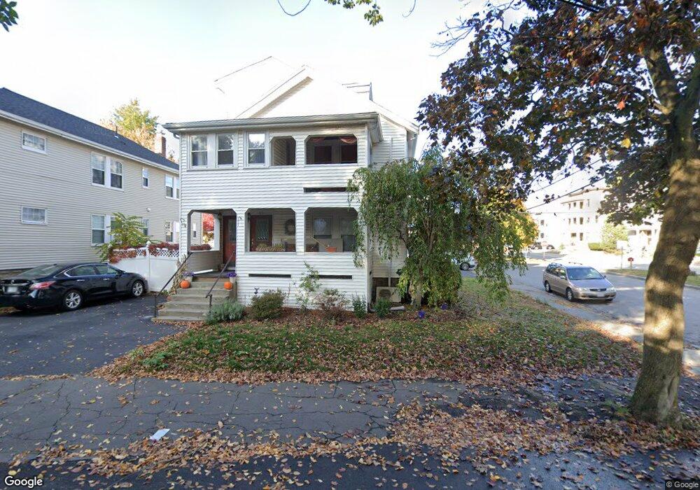
45 Unity Ave Unit 47 Belmont, MA 02478
Cushing Square NeighborhoodEstimated Value: $1,294,000 - $1,726,744
4
Beds
2
Baths
2,904
Sq Ft
$494/Sq Ft
Est. Value
About This Home
This home is located at 45 Unity Ave Unit 47, Belmont, MA 02478 and is currently estimated at $1,435,686, approximately $494 per square foot. 45 Unity Ave Unit 47 is a home located in Middlesex County with nearby schools including Roger Wellington Elementary School, Winthrop L Chenery Middle School, and Belmont High School.
Ownership History
Date
Name
Owned For
Owner Type
Purchase Details
Closed on
Apr 28, 1992
Sold by
Est Yphantis Irene P and Yphantis Alexander
Bought by
Lundgren Patrick E and Lundgren Jane
Current Estimated Value
Home Financials for this Owner
Home Financials are based on the most recent Mortgage that was taken out on this home.
Original Mortgage
$160,000
Interest Rate
8.78%
Mortgage Type
Purchase Money Mortgage
Create a Home Valuation Report for This Property
The Home Valuation Report is an in-depth analysis detailing your home's value as well as a comparison with similar homes in the area
Home Values in the Area
Average Home Value in this Area
Purchase History
| Date | Buyer | Sale Price | Title Company |
|---|---|---|---|
| Lundgren Patrick E | $140,000 | -- |
Source: Public Records
Mortgage History
| Date | Status | Borrower | Loan Amount |
|---|---|---|---|
| Open | Lundgren Patrick E | $100,000 | |
| Open | Lundgren Jane | $413,100 | |
| Closed | Lundgren Jane | $292,000 | |
| Closed | Lundgren Patrick E | $40,000 | |
| Closed | Lundgren Patrick E | $50,000 | |
| Closed | Lundgren Patrick E | $167,500 | |
| Closed | Lundgren Patrick E | $160,000 |
Source: Public Records
Tax History Compared to Growth
Tax History
| Year | Tax Paid | Tax Assessment Tax Assessment Total Assessment is a certain percentage of the fair market value that is determined by local assessors to be the total taxable value of land and additions on the property. | Land | Improvement |
|---|---|---|---|---|
| 2025 | $15,992 | $1,404,000 | $748,000 | $656,000 |
| 2024 | $14,953 | $1,416,000 | $1,026,000 | $390,000 |
| 2023 | $14,871 | $1,323,000 | $968,000 | $355,000 |
| 2022 | $14,057 | $1,216,000 | $885,000 | $331,000 |
| 2021 | $14,033 | $1,216,000 | $877,000 | $339,000 |
| 2020 | $12,045 | $1,095,000 | $707,000 | $388,000 |
| 2019 | $11,157 | $956,000 | $542,000 | $414,000 |
| 2018 | $10,643 | $876,000 | $469,000 | $407,000 |
| 2017 | $9,962 | $785,000 | $387,000 | $398,000 |
| 2016 | $9,822 | $782,000 | $387,000 | $395,000 |
| 2015 | $8,501 | $659,000 | $345,000 | $314,000 |
Source: Public Records
Map
Nearby Homes
- 67-69 Berwick St
- 69 Marlboro St Unit 1
- 175 Belmont St
- 5 Marlboro St
- 33 Woodleigh Rd
- 125-127 Elm St
- 37 Fresh Pond Place Unit 37
- 15 Edgecliff Rd
- 29 Edward Sullivan Rd
- 11 Fresh Pond Place Unit 11
- 130 Cushing St Unit 1
- 130 Cushing St Unit 2
- 354 School St Unit 354
- 81 Winsor Ave
- 95 Cushing St
- 43 Irma Ave Unit 43
- 27 Appleton St
- 29 Cushing St Unit 1
- 66 Holworthy St
- 87 Holworthy St Unit 3
- 51 Unity Ave
- 49 Unity Ave Unit 49
- 49 Unity Ave Unit 1
- 49 Unity Ave
- 52 Park Rd
- 53 Unity Ave
- 54 Park Rd
- 54 Park Rd Unit 2
- 54 Park Rd Unit 1
- 52 Grove St
- 50 Grove St
- 70 Unity Ave Unit 70A
- 70 Unity Ave Unit 2
- 70a Unity Ave Unit A
- 70 Unity Ave Unit A
- 68 Unity Ave Unit 2
- 68 Unity Ave Unit 1
- 68 Unity Ave Unit 68-2
- 68 Unity Ave Unit 68-1
- 48 Grove St Unit 48