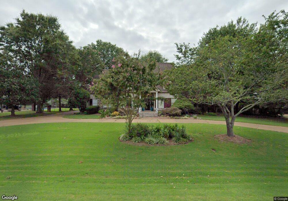
45 White Plains Dr Jackson, TN 38305
Estimated Value: $742,635 - $884,000
4
Beds
5
Baths
5,471
Sq Ft
$145/Sq Ft
Est. Value
About This Home
This home is located at 45 White Plains Dr, Jackson, TN 38305 and is currently estimated at $791,878, approximately $144 per square foot. 45 White Plains Dr is a home located in Madison County with nearby schools including Pope School, Northeast Middle School, and North Side High School.
Ownership History
Date
Name
Owned For
Owner Type
Purchase Details
Closed on
Jul 31, 2013
Sold by
Vraney George
Bought by
Mullins Terry W and Mullins Lissa S
Current Estimated Value
Home Financials for this Owner
Home Financials are based on the most recent Mortgage that was taken out on this home.
Original Mortgage
$368,000
Outstanding Balance
$270,030
Interest Rate
4.29%
Mortgage Type
Commercial
Estimated Equity
$521,848
Purchase Details
Closed on
Jun 27, 2003
Sold by
Fendler Donald B
Bought by
George Vraney
Home Financials for this Owner
Home Financials are based on the most recent Mortgage that was taken out on this home.
Original Mortgage
$277,500
Interest Rate
5.3%
Purchase Details
Closed on
Sep 14, 1999
Bought by
Fendler Donald B
Purchase Details
Closed on
Aug 9, 1994
Bought by
Jackson Mark Allen
Purchase Details
Closed on
Jan 15, 1988
Bought by
W P W Inc
Create a Home Valuation Report for This Property
The Home Valuation Report is an in-depth analysis detailing your home's value as well as a comparison with similar homes in the area
Purchase History
| Date | Buyer | Sale Price | Title Company |
|---|---|---|---|
| Mullins Terry W | $460,000 | -- | |
| George Vraney | $370,000 | -- | |
| Fendler Donald B | $368,500 | -- | |
| Jackson Mark Allen | $30,000 | -- | |
| W P W Inc | -- | -- |
Source: Public Records
Mortgage History
| Date | Status | Borrower | Loan Amount |
|---|---|---|---|
| Open | Mullins Terry W | $368,000 | |
| Previous Owner | W P W Inc | $277,500 |
Source: Public Records
Tax History
| Year | Tax Paid | Tax Assessment Tax Assessment Total Assessment is a certain percentage of the fair market value that is determined by local assessors to be the total taxable value of land and additions on the property. | Land | Improvement |
|---|---|---|---|---|
| 2025 | $2,753 | $146,950 | $12,500 | $134,450 |
| 2024 | $2,753 | $146,950 | $12,500 | $134,450 |
| 2022 | $5,121 | $146,950 | $12,500 | $134,450 |
| 2021 | $5,239 | $121,500 | $10,000 | $111,500 |
| 2020 | $5,239 | $121,500 | $10,000 | $111,500 |
| 2019 | $5,239 | $121,500 | $10,000 | $111,500 |
| 2018 | $5,239 | $121,500 | $10,000 | $111,500 |
| 2017 | $4,549 | $103,100 | $10,000 | $93,100 |
| 2016 | $4,240 | $103,100 | $10,000 | $93,100 |
| 2015 | $4,239 | $103,100 | $10,000 | $93,100 |
| 2014 | $4,239 | $103,100 | $10,000 | $93,100 |
Source: Public Records
Map
Nearby Homes
- 119 Stonehenge Dr
- 85 Weatheridge Dr
- 11 Deer Pointe
- 292 Copper Creek Dr
- 49 Northwyke Dr
- 57 Wakefield Cove
- 50 Windfield Cove
- 42 Wilmington Cove
- 221 Greenhill Dr
- 51 Crownpointe Cove
- 100 Crest Ridge Dr
- 465 Shadow Ridge Dr
- 00 Sterling Farm Dr
- 0 - A Sterling Farm Dr
- 9 Dayton Cove
- 0 - N Highway 45 Bypass Frontage
- 669 Walker Rd
- 59 Livingston Way
- 35 Hampstead Cove
- 2949 Highway 45 Bypass Frontage Rd
- 35 White Plains Dr
- 57 White Plains Dr
- 46 White Plains Dr
- 19 White Plains Dr
- 67 White Plains Dr
- 58 White Plains Dr
- 36 White Plains Dr
- 70 White Plains Dr
- 20 White Plains Dr
- 79 White Plains Dr
- 9 White Plains Dr
- 14 White Plains Dr
- 82 White Plains Dr
- 8 White Plains Dr
- 73 Mcclellan Rd
- 87 White Plains Dr
- 63 Poplar Plains Dr
- 71 Poplar Plains Dr
- 55 Poplar Plains Dr
- 131 Pleasant Plains Rd
Your Personal Tour Guide
Ask me questions while you tour the home.