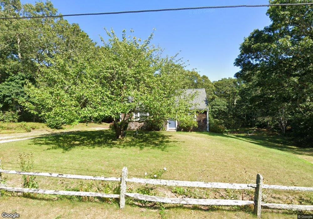
45 William Maker Way Brewster, MA 02631
Estimated Value: $576,000 - $649,881
4
Beds
1
Bath
1,296
Sq Ft
$484/Sq Ft
Est. Value
About This Home
This home is located at 45 William Maker Way, Brewster, MA 02631 and is currently estimated at $626,720, approximately $483 per square foot. 45 William Maker Way is a home located in Barnstable County with nearby schools including Stony Brook Elementary School, Eddy Elementary School, and Nauset Regional Middle School.
Ownership History
Date
Name
Owned For
Owner Type
Purchase Details
Closed on
Mar 31, 2004
Sold by
King Holly M and King Walter K
Bought by
King Holly M
Current Estimated Value
Purchase Details
Closed on
Jun 14, 1991
Sold by
Fish Eugene J
Bought by
King Walter K and King Holly M
Create a Home Valuation Report for This Property
The Home Valuation Report is an in-depth analysis detailing your home's value as well as a comparison with similar homes in the area
Home Values in the Area
Average Home Value in this Area
Purchase History
| Date | Buyer | Sale Price | Title Company |
|---|---|---|---|
| King Holly M | -- | -- | |
| King Walter K | $100,000 | -- |
Source: Public Records
Mortgage History
| Date | Status | Borrower | Loan Amount |
|---|---|---|---|
| Open | King Walter K | $215,000 | |
| Previous Owner | King Walter K | $136,000 | |
| Previous Owner | King Walter K | $39,760 | |
| Previous Owner | King Walter K | $101,400 |
Source: Public Records
Tax History
| Year | Tax Paid | Tax Assessment Tax Assessment Total Assessment is a certain percentage of the fair market value that is determined by local assessors to be the total taxable value of land and additions on the property. | Land | Improvement |
|---|---|---|---|---|
| 2025 | $3,790 | $550,800 | $265,500 | $285,300 |
| 2024 | $3,539 | $519,700 | $250,400 | $269,300 |
| 2023 | $3,269 | $467,700 | $223,600 | $244,100 |
| 2022 | $3,063 | $390,200 | $186,300 | $203,900 |
| 2021 | $2,935 | $342,100 | $161,900 | $180,200 |
| 2020 | $3,911 | $333,500 | $161,900 | $171,600 |
| 2019 | $3,659 | $323,400 | $155,700 | $167,700 |
| 2018 | $2,619 | $317,100 | $155,700 | $161,400 |
| 2017 | $3,362 | $308,800 | $155,700 | $153,100 |
| 2016 | $2,496 | $296,100 | $152,700 | $143,400 |
| 2015 | $2,409 | $291,600 | $149,700 | $141,900 |
Source: Public Records
Map
Nearby Homes
- 737 Thousand Oaks Dr
- 58 Aunt Molls Ridge Rd
- 337 Jonathans Way
- 274 Commons Way
- 184 Barons Way
- 16 Commons Way
- 0 Commons Way Unit 22504099
- 13 Mill Pond Rd
- 204 Eaton Ln Unit 204
- 127 Eaton Ln Unit 127
- 52 Eaton Ln Unit (52)
- 958 Long Pond Rd
- 14 Howland Cir Unit 14
- 100 Fletcher Ln Unit E
- 60 Fletcher Ln Unit H
- 63 Trevor Ln Unit 63
- 16 Partridge Ln
- 33 Pine Orchard Rd
- 15 Elijah's Woods
- 3 Stephen Hopkins Rd
- 29 William Maker Way
- 0 William Maker Way
- 69 William Maker Way
- 30 William Maker Way
- 23 Priscilla Way
- 426 Freemans Way
- 438 Freemans Way
- 66 William Maker Way
- 446 Freemans Way
- 404 Freemans Way
- 20 Priscilla Way
- 96 William Maker Way
- 123 William Maker Way
- 394 Freemans Way
- 78 William Maker Way
- 282 Governor Bradford Rd
- 36 Priscilla Way
- 270 Governor Bradford Rd
- 8 White Oak Trail
- 3 White Trail Dr