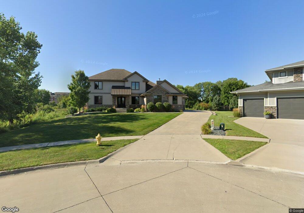
450 66th Ct West Des Moines, IA 50266
Estimated Value: $688,000 - $1,005,455
4
Beds
6
Baths
3,169
Sq Ft
$260/Sq Ft
Est. Value
About This Home
This home is located at 450 66th Ct, West Des Moines, IA 50266 and is currently estimated at $825,114, approximately $260 per square foot. 450 66th Ct is a home with nearby schools including Brookview Elementary School, South Middle School, and Prairieview Middle School.
Ownership History
Date
Name
Owned For
Owner Type
Purchase Details
Closed on
Jun 13, 2013
Sold by
Krm Properties Llc
Bought by
Carlisle Todd and Carlisle Michelle
Current Estimated Value
Home Financials for this Owner
Home Financials are based on the most recent Mortgage that was taken out on this home.
Original Mortgage
$409,488
Outstanding Balance
$289,332
Interest Rate
3.34%
Mortgage Type
New Conventional
Estimated Equity
$535,782
Purchase Details
Closed on
Mar 1, 2013
Sold by
Krm Development Llc
Bought by
Krm Properties Llc
Home Financials for this Owner
Home Financials are based on the most recent Mortgage that was taken out on this home.
Original Mortgage
$500,000
Interest Rate
3.38%
Mortgage Type
Construction
Create a Home Valuation Report for This Property
The Home Valuation Report is an in-depth analysis detailing your home's value as well as a comparison with similar homes in the area
Home Values in the Area
Average Home Value in this Area
Purchase History
| Date | Buyer | Sale Price | Title Company |
|---|---|---|---|
| Carlisle Todd | $650,000 | None Available | |
| Krm Properties Llc | -- | None Available |
Source: Public Records
Mortgage History
| Date | Status | Borrower | Loan Amount |
|---|---|---|---|
| Open | Carlisle Todd | $409,488 | |
| Previous Owner | Krm Properties Llc | $500,000 |
Source: Public Records
Tax History Compared to Growth
Tax History
| Year | Tax Paid | Tax Assessment Tax Assessment Total Assessment is a certain percentage of the fair market value that is determined by local assessors to be the total taxable value of land and additions on the property. | Land | Improvement |
|---|---|---|---|---|
| 2024 | $13,312 | $821,910 | $100,000 | $721,910 |
| 2023 | $13,312 | $821,910 | $100,000 | $721,910 |
| 2022 | $12,824 | $719,860 | $100,000 | $619,860 |
| 2021 | $12,824 | $701,980 | $85,000 | $616,980 |
| 2020 | $12,188 | $646,610 | $85,000 | $561,610 |
| 2019 | $12,708 | $646,610 | $85,000 | $561,610 |
| 2018 | $12,708 | $642,520 | $85,000 | $557,520 |
| 2017 | $13,168 | $642,520 | $85,000 | $557,520 |
| 2016 | $12,856 | $640,500 | $80,000 | $560,500 |
| 2015 | $12,472 | $640,500 | $0 | $0 |
| 2014 | $308 | $16,250 | $0 | $0 |
Source: Public Records
Map
Nearby Homes
- 6440 Ep True Pkwy Unit 3205
- 6440 Ep True Pkwy Unit 2205
- 6440 Ep True Pkwy Unit 1108
- 6980 Cody Dr Unit 43
- 6980 Cody Dr Unit 17
- 6255 Beechtree Dr Unit 5302
- 6255 Beechtree Dr Unit 4302
- 6255 Beechtree Dr Unit 4203
- 6374 Beechtree Dr
- 204 Cambridge Dr
- 900 67th St Unit 805
- 681 63rd St
- 7153 Cody Dr
- 7143 Dakota Dr
- 7126 Aspen Dr
- 6285 Wistful Vista Dr
- 6800 Ashworth Rd Unit 306
- 6204 Aspen Dr
- 950 67th St Unit 412
- 950 67th St Unit 321
- 472 66th Ct
- 461 66th Ct
- 504 66th Ct
- 485 66th Ct
- 509 66th Ct
- 568 66th Ct
- 530 66th Ct
- 525 66th Ct
- 547 66th Ct
- 6720 Cody Dr
- 6744 Cody Dr
- 6768 Cody Dr
- 6630 Cody Dr Unit 4204
- 6630 Cody Dr Unit 10204
- 6630 Cody Dr Unit 10203
- 6630 Cody Dr Unit 10202
- 6630 Cody Dr Unit 10201
- 6630 Cody Dr Unit 10104
- 6630 Cody Dr Unit 10103
- 6630 Cody Dr Unit 10102