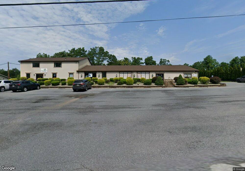
450 Interchange Rd Lehighton, PA 18235
Estimated Value: $913,910
4
Beds
2
Baths
1,800
Sq Ft
$508/Sq Ft
Est. Value
About This Home
This home is located at 450 Interchange Rd, Lehighton, PA 18235 and is currently estimated at $913,910, approximately $507 per square foot. 450 Interchange Rd is a home located in Carbon County with nearby schools including Lehighton Area High School, Sts. Peter & Paul School, and Valley Ridge Academy.
Ownership History
Date
Name
Owned For
Owner Type
Purchase Details
Closed on
Dec 28, 2007
Sold by
Barilla Richard S and Barilla Robert J
Bought by
National General Properties Inc
Current Estimated Value
Home Financials for this Owner
Home Financials are based on the most recent Mortgage that was taken out on this home.
Original Mortgage
$386,000
Outstanding Balance
$245,044
Interest Rate
6.27%
Mortgage Type
Commercial
Estimated Equity
$668,866
Create a Home Valuation Report for This Property
The Home Valuation Report is an in-depth analysis detailing your home's value as well as a comparison with similar homes in the area
Home Values in the Area
Average Home Value in this Area
Purchase History
| Date | Buyer | Sale Price | Title Company |
|---|---|---|---|
| National General Properties Inc | $455,000 | None Available |
Source: Public Records
Mortgage History
| Date | Status | Borrower | Loan Amount |
|---|---|---|---|
| Open | National General Properties Inc | $386,000 |
Source: Public Records
Tax History Compared to Growth
Tax History
| Year | Tax Paid | Tax Assessment Tax Assessment Total Assessment is a certain percentage of the fair market value that is determined by local assessors to be the total taxable value of land and additions on the property. | Land | Improvement |
|---|---|---|---|---|
| 2025 | $13,934 | $181,900 | $28,305 | $153,595 |
| 2024 | $13,207 | $181,900 | $28,305 | $153,595 |
| 2023 | $13,070 | $181,900 | $28,305 | $153,595 |
| 2022 | $13,070 | $181,900 | $28,305 | $153,595 |
| 2021 | $12,363 | $181,900 | $28,305 | $153,595 |
| 2020 | $12,363 | $181,900 | $28,305 | $153,595 |
| 2019 | $11,818 | $181,900 | $28,305 | $153,595 |
| 2018 | $11,818 | $181,900 | $28,305 | $153,595 |
| 2017 | $11,818 | $181,900 | $28,305 | $153,595 |
| 2016 | -- | $181,900 | $28,305 | $153,595 |
| 2015 | -- | $181,900 | $28,305 | $153,595 |
| 2014 | -- | $181,900 | $28,305 | $153,595 |
Source: Public Records
Map
Nearby Homes
- 361 Court St Unit REAR
- 361 Court St
- 20 Court St
- 95 Franklin Heights Rd
- 0 Fairyland Rd Unit PM-136987
- 142 Bankway St
- 8 Lentz Ave
- 134 Bridge St
- 230 S 2nd St
- 236 S 2nd St
- 216 North St Unit 218
- 600 N Harrity Rd
- 119 S 3rd St
- 196 S 3rd St
- 260 S 3rd St
- 231 Coal St
- 215 N 4th St
- 432 N 3rd St
- 230 Carbon St
- 413 N 4th St
- 444 Interchange Rd
- 450 Interchange Rd Unit 103
- 183 Eberts Ln
- 355 Birch Dr
- 445 Main Rd
- 530 Interchange Rd
- 476 Interchange Rd
- 530 Interchange Rd
- 252 Maple Ave
- 0 Douglas St Unit 6-440
- 0 Douglas St Unit PM-95832
- 91 Bear Dr
- 0 Douglas St Unit PACC2001100
- 0 Douglas St Unit 690457
- 8447 Interchange Rd
- 421 Birch Dr
- 306 Maple Ave
- 435 Main Rd
- 415 Main Rd
- 421 Main Rd