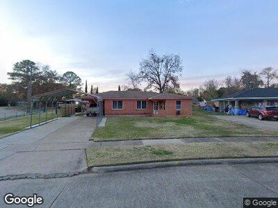
450 Mohawk Trail Shreveport, LA 71107
Freestate-North Highlands NeighborhoodEstimated Value: $69,000 - $85,429
3
Beds
2
Baths
1,344
Sq Ft
$59/Sq Ft
Est. Value
About This Home
This home is located at 450 Mohawk Trail, Shreveport, LA 71107 and is currently estimated at $78,857, approximately $58 per square foot. 450 Mohawk Trail is a home located in Caddo Parish with nearby schools including Cherokee Park Elementary School, Fairfield Magnet School, and Claiborne Fundamental Elementary School.
Ownership History
Date
Name
Owned For
Owner Type
Purchase Details
Closed on
Feb 14, 2007
Sold by
Secretary Of Hud
Bought by
Simpson Clyde
Current Estimated Value
Home Financials for this Owner
Home Financials are based on the most recent Mortgage that was taken out on this home.
Original Mortgage
$50,963
Outstanding Balance
$31,300
Interest Rate
6.17%
Mortgage Type
FHA
Estimated Equity
$47,821
Purchase Details
Closed on
Mar 1, 2006
Sold by
Douglas Irene Teague
Bought by
Us Bank Na
Create a Home Valuation Report for This Property
The Home Valuation Report is an in-depth analysis detailing your home's value as well as a comparison with similar homes in the area
Home Values in the Area
Average Home Value in this Area
Purchase History
| Date | Buyer | Sale Price | Title Company |
|---|---|---|---|
| Simpson Clyde | -- | None Available | |
| Us Bank Na | $45,000 | None Available |
Source: Public Records
Mortgage History
| Date | Status | Borrower | Loan Amount |
|---|---|---|---|
| Open | Simpson Clyde | $50,963 |
Source: Public Records
Tax History Compared to Growth
Tax History
| Year | Tax Paid | Tax Assessment Tax Assessment Total Assessment is a certain percentage of the fair market value that is determined by local assessors to be the total taxable value of land and additions on the property. | Land | Improvement |
|---|---|---|---|---|
| 2024 | $877 | $5,626 | $843 | $4,783 |
| 2023 | $858 | $5,386 | $803 | $4,583 |
| 2022 | $858 | $5,386 | $803 | $4,583 |
| 2021 | $845 | $5,386 | $803 | $4,583 |
| 2020 | $845 | $5,386 | $803 | $4,583 |
| 2019 | $866 | $5,356 | $803 | $4,553 |
| 2018 | $0 | $5,356 | $803 | $4,553 |
| 2017 | $880 | $5,356 | $803 | $4,553 |
| 2015 | -- | $5,170 | $800 | $4,370 |
| 2014 | -- | $5,170 | $800 | $4,370 |
| 2013 | -- | $5,170 | $800 | $4,370 |
Source: Public Records
Map
Nearby Homes
- 401 Seneca Trail
- 470 Mayfair Dr
- 1136 Arncliff Dr
- 726 Tecumseh Trail
- 118 Mayfair Dr
- 731 Summitt St
- 0 N Hearne Ave
- 0 Silver Point Dr Unit 20833957
- 0 Silver Point Dr Unit 3 20803133
- 0 Silver Point Dr Unit 11 20803059
- 0 Silver Point Dr Unit 7 20803008
- 0 Silver Point Dr Unit 5A 20802976
- 0 Silver Point Dr Unit 4 20796401
- 4925 N Market St
- 000 N Market St
- 0 Hwy 1 Unit 20677067
- 0 Hwy 1 Unit 20326562
- 802 Deer Park Rd
- 1500 Traffic St
- 719, Lot11 Caddo St
- 450 Mohawk Trail
- 446 Mohawk Trail
- 453 Chickasaw Trail
- 449 Chickasaw Trail
- 401 Indian Trail
- 442 Mohawk Trail
- 445 Chickasaw Trail
- 449 Mohawk Trail
- 445 Mohawk Trail
- 405 Indian Trail
- 441 Chickasaw Trail
- 438 Mohawk Trail
- 441 Mohawk Trail
- 454 Seneca Trail
- 460 Seneca Trail
- 437 Mohawk Trail
- 450 Seneca Trail
- 434 Mohawk Trail
- 458 Chickasaw Trail
- 464 Seneca Trail