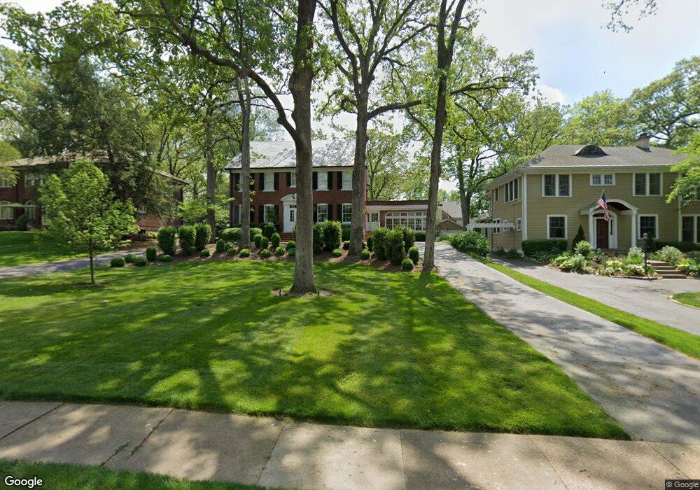
450 Somerset Ave Saint Louis, MO 63119
Estimated Value: $1,186,219 - $1,454,000
4
Beds
4
Baths
3,800
Sq Ft
$347/Sq Ft
Est. Value
About This Home
This home is located at 450 Somerset Ave, Saint Louis, MO 63119 and is currently estimated at $1,320,055, approximately $347 per square foot. 450 Somerset Ave is a home located in St. Louis County with nearby schools including Clark Elementary School, Hixson Middle School, and Webster Groves High School.
Ownership History
Date
Name
Owned For
Owner Type
Purchase Details
Closed on
Dec 30, 2002
Sold by
Meegan Kevin D and Meegan Lisa S
Bought by
Dolan Douglas K and Dolan Ellen L
Current Estimated Value
Home Financials for this Owner
Home Financials are based on the most recent Mortgage that was taken out on this home.
Original Mortgage
$480,900
Outstanding Balance
$186,124
Interest Rate
4.87%
Estimated Equity
$1,133,931
Purchase Details
Closed on
Dec 14, 2001
Sold by
Fletcher James Warren and Fletcher Mary Bernadette
Bought by
Meegan Kevin D and Meegan Lisa S
Home Financials for this Owner
Home Financials are based on the most recent Mortgage that was taken out on this home.
Original Mortgage
$411,000
Interest Rate
6.39%
Create a Home Valuation Report for This Property
The Home Valuation Report is an in-depth analysis detailing your home's value as well as a comparison with similar homes in the area
Home Values in the Area
Average Home Value in this Area
Purchase History
| Date | Buyer | Sale Price | Title Company |
|---|---|---|---|
| Dolan Douglas K | $601,500 | -- | |
| Meegan Kevin D | -- | -- |
Source: Public Records
Mortgage History
| Date | Status | Borrower | Loan Amount |
|---|---|---|---|
| Open | Dolan Douglas K | $480,900 | |
| Previous Owner | Meegan Kevin D | $411,000 | |
| Closed | Dolan Douglas K | $60,150 |
Source: Public Records
Tax History Compared to Growth
Tax History
| Year | Tax Paid | Tax Assessment Tax Assessment Total Assessment is a certain percentage of the fair market value that is determined by local assessors to be the total taxable value of land and additions on the property. | Land | Improvement |
|---|---|---|---|---|
| 2025 | $11,754 | $208,860 | $92,070 | $116,790 |
| 2024 | $11,754 | $169,790 | $75,890 | $93,900 |
| 2023 | $11,754 | $169,790 | $75,890 | $93,900 |
| 2022 | $12,856 | $173,400 | $75,890 | $97,510 |
| 2021 | $12,811 | $173,400 | $75,890 | $97,510 |
| 2020 | $11,647 | $146,800 | $67,470 | $79,330 |
| 2019 | $11,563 | $146,800 | $67,470 | $79,330 |
| 2018 | $12,524 | $141,270 | $48,550 | $92,720 |
| 2017 | $12,439 | $141,270 | $48,550 | $92,720 |
| 2016 | $11,340 | $123,120 | $38,990 | $84,130 |
| 2015 | $11,410 | $123,120 | $38,990 | $84,130 |
| 2014 | $12,500 | $131,270 | $23,410 | $107,860 |
Source: Public Records
Map
Nearby Homes
- 600 S Berry Rd
- 514 S Gore Ave
- 340 Gray Ave
- 200 Blackmer Place
- 368 S Gore Ave
- 144 S Rock Hill Rd
- 1139 Hawken Place Unit 6
- 156 Gray Ave
- 432 Reavis Place Unit 20
- 127 Webster Woods Dr
- 904 Trellis Ln
- 426 S Maple Ave
- 1353 Webster Path Dr
- 12 Webster Acres
- 147 Firwood Dr
- 125 E Frisco Ave
- 1316 Webster Forest Ct
- 134 Firwood Dr
- 203 E Jackson Rd
- 26 Webster Oaks Dr
- 444 Somerset Ave
- 460 Somerset Ave
- 438 Somerset Ave
- 504 Sherwood Dr
- 457 Yorkshire Place
- 457 Baker Ave
- 459 Somerset Ave
- 520 Sherwood Dr
- 424 Somerset Ave
- 458 Sherwood Dr
- 433 Baker Ave
- 424 Yorkshire Place
- 429 Somerset Ave
- 454 Sherwood Dr
- 412 Somerset Ave
- 431 Yorkshire Place
- 456 Baker Ave
- 420 Yorkshire Place
- 427 Baker Ave
- 606 Sherwood Dr