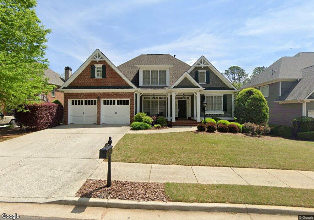
450 Wallis Farm Way Marietta, GA 30064
West Cobb NeighborhoodEstimated Value: $713,573 - $788,000
4
Beds
6
Baths
3,468
Sq Ft
$214/Sq Ft
Est. Value
About This Home
This home is located at 450 Wallis Farm Way, Marietta, GA 30064 and is currently estimated at $741,643, approximately $213 per square foot. 450 Wallis Farm Way is a home located in Cobb County with nearby schools including Hayes Elementary School, Pine Mountain Middle School, and Kennesaw Mountain High School.
Ownership History
Date
Name
Owned For
Owner Type
Purchase Details
Closed on
Jun 4, 2019
Sold by
Etheredge Peggy
Bought by
Stubbs Marvin G and Stubbs Michelle A
Current Estimated Value
Home Financials for this Owner
Home Financials are based on the most recent Mortgage that was taken out on this home.
Original Mortgage
$282,600
Outstanding Balance
$248,475
Interest Rate
4.1%
Mortgage Type
New Conventional
Estimated Equity
$493,169
Purchase Details
Closed on
Sep 14, 2004
Sold by
Rh Homes Dev Llc
Bought by
Etheredge Lee B and Etheredge Peggy
Home Financials for this Owner
Home Financials are based on the most recent Mortgage that was taken out on this home.
Original Mortgage
$300,000
Interest Rate
5.25%
Mortgage Type
New Conventional
Create a Home Valuation Report for This Property
The Home Valuation Report is an in-depth analysis detailing your home's value as well as a comparison with similar homes in the area
Home Values in the Area
Average Home Value in this Area
Purchase History
| Date | Buyer | Sale Price | Title Company |
|---|---|---|---|
| Stubbs Marvin G | $471,000 | -- | |
| Etheredge Lee B | $440,000 | -- |
Source: Public Records
Mortgage History
| Date | Status | Borrower | Loan Amount |
|---|---|---|---|
| Open | Stubbs Marvin G | $282,600 | |
| Previous Owner | Etheredge Lee B | $300,000 |
Source: Public Records
Tax History Compared to Growth
Tax History
| Year | Tax Paid | Tax Assessment Tax Assessment Total Assessment is a certain percentage of the fair market value that is determined by local assessors to be the total taxable value of land and additions on the property. | Land | Improvement |
|---|---|---|---|---|
| 2024 | $6,218 | $239,268 | $34,000 | $205,268 |
| 2023 | $5,675 | $239,268 | $34,000 | $205,268 |
| 2022 | $5,468 | $202,908 | $34,000 | $168,908 |
| 2021 | $4,390 | $153,664 | $28,000 | $125,664 |
| 2020 | $4,390 | $153,664 | $28,000 | $125,664 |
| 2019 | $1,675 | $153,664 | $28,000 | $125,664 |
| 2018 | $1,675 | $153,664 | $28,000 | $125,664 |
| 2017 | $1,446 | $153,664 | $28,000 | $125,664 |
| 2016 | $1,229 | $131,548 | $28,000 | $103,548 |
| 2015 | $1,318 | $131,548 | $28,000 | $103,548 |
| 2014 | $1,388 | $135,148 | $0 | $0 |
Source: Public Records
Map
Nearby Homes
- 510 Towneside Ln
- 608 Tabbystone St NW Unit 2
- 606 Tabbystone St NW
- 518 Hardage Trace NW
- 319 Summer Garden Dr
- 1803 Stone Bridge Way
- 234 Everleigh Way
- 799 Barrett Village Ln NW
- 2150 Unity Trail NW
- 761 Hardage Farm Dr NW
- 501 Mcdaniel Rd NW
- 1981 Village Round NW
- 2473 Kirk Ln NW
- 2139 Bramlett Place NW
- 741 Crossfire Ridge NW
- 2429 Kirk Ln NW
- 764 Sharpshooters Ridge NW
- 446 Wallis Farm Way
- 450 Wallis Farm Way NW
- 454 Wallis Farm Way
- 442 Wallis Farm Way
- 458 Wallis Farm Way
- 455 Wallis Farm Way
- 451 Wallis Farm Way
- 447 Wallis Farm Way
- 438 Wallis Farm Way
- 459 Wallis Farm Way
- 439 Wallis Farm Way
- 439 Wallis Farm Way Unit 7
- 2080 Burnt Hickory Rd NW
- 462 Wallis Farm Way
- 435 Wallis Farm Way
- 434 Wallis Farm Way
- 467 Wallis Farm Way
- 466 Wallis Farm Way
- 431 Wallis Farm Way
- 502 Wallis Farm Ln Unit 28