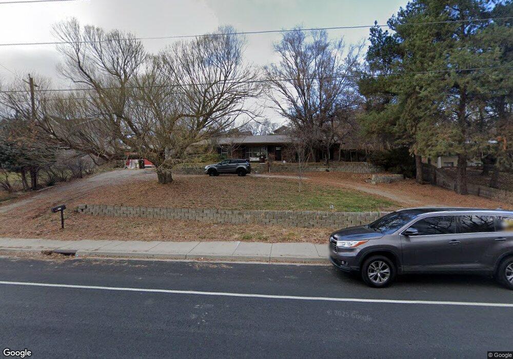
450 Westfield Rd Alpine, UT 84004
Estimated Value: $645,000 - $712,000
5
Beds
3
Baths
2,620
Sq Ft
$262/Sq Ft
Est. Value
About This Home
This home is located at 450 Westfield Rd, Alpine, UT 84004 and is currently estimated at $687,458, approximately $262 per square foot. 450 Westfield Rd is a home located in Utah County with nearby schools including Westfield School, Timberline Middle School, and Lone Peak High School.
Ownership History
Date
Name
Owned For
Owner Type
Purchase Details
Closed on
May 27, 2021
Sold by
Nix Alexis
Bought by
Nix Alexis
Current Estimated Value
Home Financials for this Owner
Home Financials are based on the most recent Mortgage that was taken out on this home.
Original Mortgage
$315,000
Outstanding Balance
$285,193
Interest Rate
2.9%
Mortgage Type
New Conventional
Estimated Equity
$402,265
Purchase Details
Closed on
Oct 9, 2013
Sold by
Tracy James F
Bought by
Nix Alexis
Home Financials for this Owner
Home Financials are based on the most recent Mortgage that was taken out on this home.
Original Mortgage
$217,800
Interest Rate
4.53%
Mortgage Type
New Conventional
Create a Home Valuation Report for This Property
The Home Valuation Report is an in-depth analysis detailing your home's value as well as a comparison with similar homes in the area
Home Values in the Area
Average Home Value in this Area
Purchase History
| Date | Buyer | Sale Price | Title Company |
|---|---|---|---|
| Nix Alexis | -- | Gt Title Services | |
| Nix Alexis | -- | North American Title |
Source: Public Records
Mortgage History
| Date | Status | Borrower | Loan Amount |
|---|---|---|---|
| Open | Nix Alexis | $315,000 | |
| Closed | Nix Alexis | $217,800 |
Source: Public Records
Tax History
| Year | Tax Paid | Tax Assessment Tax Assessment Total Assessment is a certain percentage of the fair market value that is determined by local assessors to be the total taxable value of land and additions on the property. | Land | Improvement |
|---|---|---|---|---|
| 2025 | $2,845 | $347,380 | -- | -- |
| 2024 | $2,845 | $331,540 | $0 | $0 |
| 2023 | $2,615 | $327,140 | $0 | $0 |
| 2022 | $2,727 | $331,375 | $0 | $0 |
| 2021 | $2,158 | $407,400 | $215,900 | $191,500 |
| 2020 | $2,003 | $370,100 | $187,700 | $182,400 |
| 2019 | $1,796 | $346,300 | $187,700 | $158,600 |
| 2018 | $1,758 | $335,000 | $180,200 | $154,800 |
| 2017 | $1,667 | $169,015 | $0 | $0 |
| 2016 | $1,656 | $156,585 | $0 | $0 |
| 2015 | $1,636 | $146,300 | $0 | $0 |
| 2014 | $1,513 | $133,870 | $0 | $0 |
Source: Public Records
Map
Nearby Homes
- 151 Glacier Lily Dr
- 259 Twin River Loop
- 30 S Main St
- 250 S Main St Unit 25
- 250 S Main St Unit 20
- 250 S Main St Unit 9
- 250 S Main St Unit 7
- 48 N 100 E
- 820 Eagleview Dr
- 522 N Pfeifferhorn Dr
- 591 N Pfeifferhorn Dr
- 475 Grove Dr
- 88 W Cascade Ave
- 5886 W Timber Ridge Ln
- 868 S Braddock Ln
- 19 E Elk Ct
- 512 Eastridge Cir
- 11852 Jupiter Cir
- 11987 N Cyprus Dr
- 6174 Apollo Way
- 458 Westfield Rd
- 426 Westfield Rd
- 466 Westfield Rd
- 225 N 400 W
- 400 Westfield Rd
- 451 Westfield Rd
- 457 Westfield Rd
- 381 W 200 N
- 481 Westfield Rd
- 257 N 400 W
- 484 Westfield Rd
- 3952 W Prospector Way
- 13040 N Prospector Way Unit 33
- 13070 N Prospector Way Unit 35
- 13124 N Prospector Way Unit 51
- 3940 W Prospector Way Unit 26
- 7 Long Dr
- 5 S Long Dr
- 4 N Long Dr Unit 17
- 540 W Dally Dr Unit 17
Your Personal Tour Guide
Ask me questions while you tour the home.