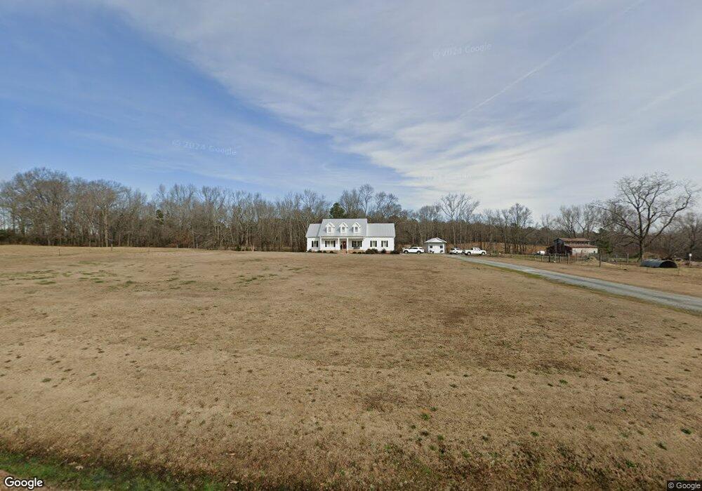
4500 Benson Hardee Rd Benson, NC 27504
Elevation NeighborhoodEstimated Value: $428,000 - $564,000
3
Beds
3
Baths
2,684
Sq Ft
$186/Sq Ft
Est. Value
About This Home
This home is located at 4500 Benson Hardee Rd, Benson, NC 27504 and is currently estimated at $498,492, approximately $185 per square foot. 4500 Benson Hardee Rd is a home with nearby schools including Benson Elementary School, Benson Middle School, and South Johnston High School.
Ownership History
Date
Name
Owned For
Owner Type
Purchase Details
Closed on
Feb 19, 2020
Sold by
Massey Jesse W and Massey Lauren W
Bought by
Massey Donald Ray and Massey Rachel
Current Estimated Value
Home Financials for this Owner
Home Financials are based on the most recent Mortgage that was taken out on this home.
Original Mortgage
$255,000
Outstanding Balance
$227,954
Interest Rate
3.75%
Mortgage Type
Construction
Estimated Equity
$270,538
Purchase Details
Closed on
Jan 8, 2018
Sold by
Lassiter Annie H
Bought by
Lassiter Marty R and Lassiter Ashley M
Create a Home Valuation Report for This Property
The Home Valuation Report is an in-depth analysis detailing your home's value as well as a comparison with similar homes in the area
Home Values in the Area
Average Home Value in this Area
Purchase History
| Date | Buyer | Sale Price | Title Company |
|---|---|---|---|
| Massey Donald Ray | -- | None Available | |
| Lassiter Marty R | -- | None Available |
Source: Public Records
Mortgage History
| Date | Status | Borrower | Loan Amount |
|---|---|---|---|
| Open | Massey Donald Ray | $255,000 |
Source: Public Records
Tax History
| Year | Tax Paid | Tax Assessment Tax Assessment Total Assessment is a certain percentage of the fair market value that is determined by local assessors to be the total taxable value of land and additions on the property. | Land | Improvement |
|---|---|---|---|---|
| 2025 | $1,755 | $512,580 | $92,230 | $420,350 |
| 2024 | $2,661 | $328,560 | $43,810 | $284,750 |
| 2023 | $2,522 | $323,310 | $43,810 | $279,500 |
| 2022 | $2,651 | $323,310 | $43,810 | $279,500 |
| 2021 | $2,586 | $323,310 | $43,810 | $279,500 |
| 2020 | $364 | $43,810 | $43,810 | $0 |
| 2019 | $364 | $43,810 | $43,810 | $0 |
| 2018 | $294 | $34,590 | $34,590 | $0 |
Source: Public Records
Map
Nearby Homes
- 323 Aquilla Rd Unit Z
- 471 Turlington Dr
- 28 Sea Stellars Ct
- 526 Aquilla Rd
- 28 Stellars Sea
- 109 Parkers Pointe Dr
- 27 Dalton Woods Dr
- 31 Dalton Woods Dr
- 35 Dalton Woods Dr
- 0 Memory Ln Unit 10135561
- 0 Memory Ln Unit 100543717
- 1471 Aquilla Rd
- 94 Starry Sky Dr
- 299 Starry Sky Dr
- 1144 Aquilla Rd
- 6441 Elevation Rd
- 6425 Elevation Rd
- 111 Fox Run Ct
- 205 Cider Ct
- 69 White Azalea Way
- 4456 Benson Hardee Rd
- 25 Aquilla Rd
- 4567 Benson Hardee Rd
- 4594 Benson Hardee Rd
- 4616 Benson Hardee Rd
- 108 Aquilla Rd
- 126 Ray St
- 126 Ray St Unit 3
- 4679 Benson Hardee Rd
- 122 Aquilla Rd
- 164 Aquilla Rd
- 144 Aquilla Rd
- 8101 Elevation Rd
- 190 Aquilla Rd
- 8045 Elevation Rd
- 150 Turlington Dr
- 229 Aquilla Rd
- 211 Turlington Dr
- 8148 Elevation Rd
- 8092 Elevation Rd
Your Personal Tour Guide
Ask me questions while you tour the home.