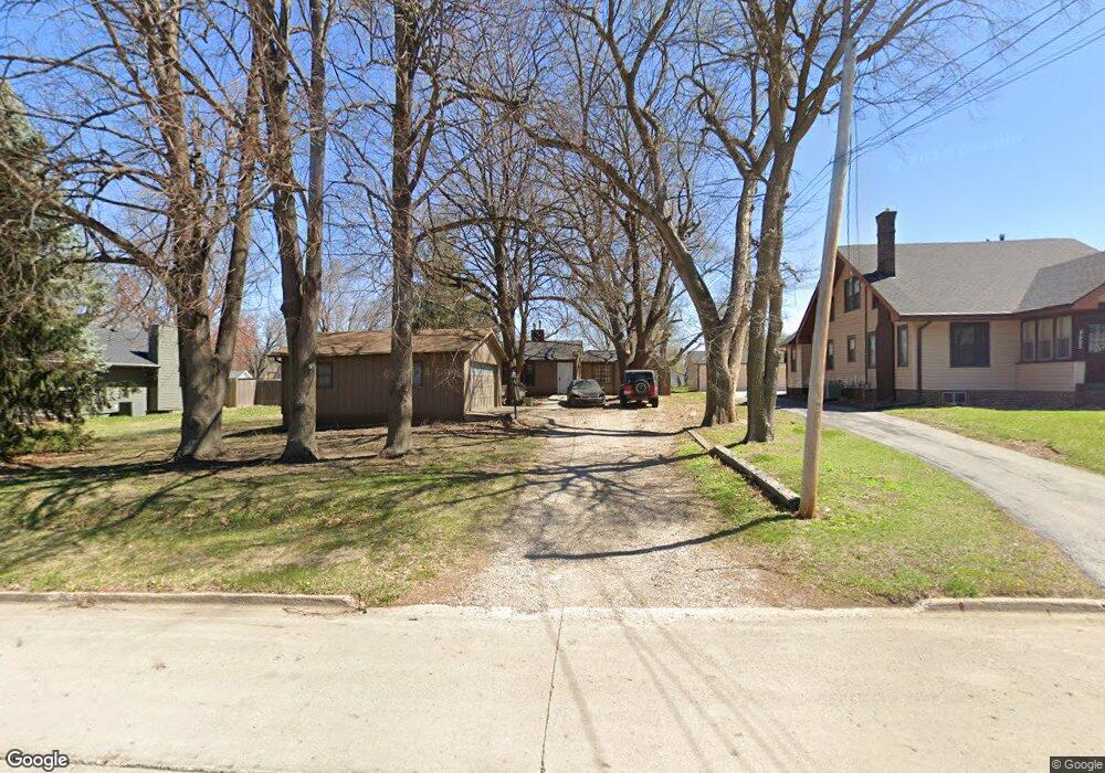
4501 SW 31st St Des Moines, IA 50321
Southwestern Hills NeighborhoodEstimated Value: $214,000 - $276,000
3
Beds
2
Baths
1,452
Sq Ft
$175/Sq Ft
Est. Value
About This Home
This home is located at 4501 SW 31st St, Des Moines, IA 50321 and is currently estimated at $254,739, approximately $175 per square foot. 4501 SW 31st St is a home located in Polk County with nearby schools including Jefferson Elementary School, Brody Middle School, and Lincoln High School.
Ownership History
Date
Name
Owned For
Owner Type
Purchase Details
Closed on
Jul 7, 2012
Sold by
Hollebrands Phyllis M and Hollebrands Curtis B
Bought by
Rosky Nick
Current Estimated Value
Home Financials for this Owner
Home Financials are based on the most recent Mortgage that was taken out on this home.
Original Mortgage
$87,200
Outstanding Balance
$60,262
Interest Rate
3.77%
Mortgage Type
New Conventional
Estimated Equity
$194,477
Purchase Details
Closed on
Sep 27, 2010
Sold by
Hollebrands Phyllis M
Bought by
Hollebrands Phyllis M and Hollebrands Curtis B
Purchase Details
Closed on
Oct 17, 2007
Sold by
Hollebrands Carroll E and Hollebrands Phyllis M
Bought by
Hollebrands Phyllis M
Create a Home Valuation Report for This Property
The Home Valuation Report is an in-depth analysis detailing your home's value as well as a comparison with similar homes in the area
Home Values in the Area
Average Home Value in this Area
Purchase History
| Date | Buyer | Sale Price | Title Company |
|---|---|---|---|
| Rosky Nick | $108,500 | None Available | |
| Hollebrands Phyllis M | -- | None Available | |
| Hollebrands Phyllis M | -- | None Available |
Source: Public Records
Mortgage History
| Date | Status | Borrower | Loan Amount |
|---|---|---|---|
| Open | Rosky Nick | $87,200 |
Source: Public Records
Tax History Compared to Growth
Tax History
| Year | Tax Paid | Tax Assessment Tax Assessment Total Assessment is a certain percentage of the fair market value that is determined by local assessors to be the total taxable value of land and additions on the property. | Land | Improvement |
|---|---|---|---|---|
| 2025 | $3,432 | $190,500 | $65,100 | $125,400 |
| 2024 | $3,432 | $174,500 | $59,300 | $115,200 |
| 2023 | $3,168 | $174,500 | $59,300 | $115,200 |
| 2022 | $3,144 | $134,400 | $47,500 | $86,900 |
| 2021 | $3,186 | $134,400 | $47,500 | $86,900 |
| 2020 | $3,310 | $127,700 | $42,800 | $84,900 |
| 2019 | $3,262 | $127,700 | $42,800 | $84,900 |
| 2018 | $3,230 | $121,400 | $39,400 | $82,000 |
| 2017 | $3,072 | $121,400 | $39,400 | $82,000 |
| 2016 | $2,994 | $113,600 | $36,300 | $77,300 |
| 2015 | $2,994 | $113,600 | $36,300 | $77,300 |
| 2014 | $3,060 | $115,200 | $36,100 | $79,100 |
Source: Public Records
Map
Nearby Homes
- 3110 Stanton Ave
- 4401 SW 29th St
- 2501 Mckinley Ave
- 3921 SW 29th St
- 4400 SW 23rd St
- 4420 SW 23rd St
- 4491 SW 23rd St
- 4537 SW 23rd St
- 4505 SW 23rd St
- 4555 SW 23rd St
- 4469 SW 23rd Stream
- 2401 Emma Ave
- 2371 Emma Ave
- 2390 Emma Ave
- 2350 Emma Ave
- 3619 SW 34th St
- 3618 SW 34th St
- 3700 SW 34th Place
- 3706 SW 36th St
- 3407 SW 31st St
- 4433 SW 31st St
- 4505 SW 31st St
- 4415 SW 31st St
- 4420 SW 31st St
- 4601 SW 31st St
- 4414 SW 31st St
- 4502 SW 31st St
- 3020 Stanton Ave
- 4504 SW 31st St
- 3030 Stanton Ave
- 3010 Stanton Ave
- 3000 Stanton Ave
- 4600 SW 31st St
- 4610 SW 31st St
- 2954 Stanton Ave
- 4501 SW 33rd St
- 4507 SW 33rd St
- 4425 SW 33rd St
- 4419 SW 33rd St
