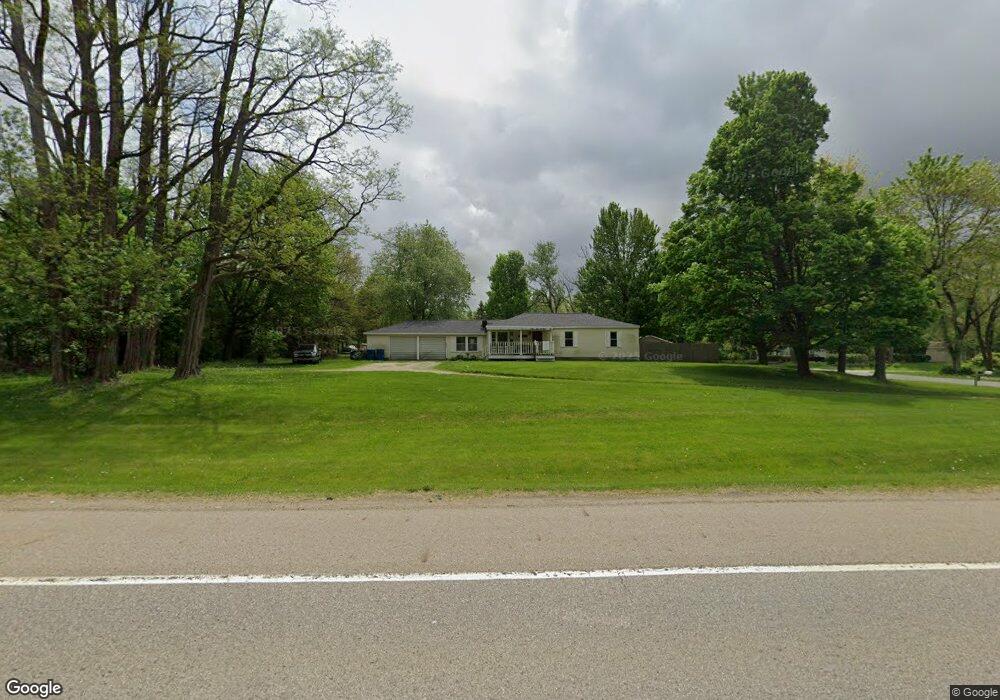
4503 Columbia Ave W Battle Creek, MI 49015
Rural Southwest Battle Creek NeighborhoodEstimated Value: $162,000 - $207,000
3
Beds
2
Baths
1,014
Sq Ft
$181/Sq Ft
Est. Value
About This Home
This home is located at 4503 Columbia Ave W, Battle Creek, MI 49015 and is currently estimated at $183,123, approximately $180 per square foot. 4503 Columbia Ave W is a home located in Calhoun County with nearby schools including Valley View Elementary School, Springfield Middle School, and Battle Creek Central High School.
Ownership History
Date
Name
Owned For
Owner Type
Purchase Details
Closed on
Oct 24, 2014
Sold by
Cummins Gary and Mendenhall Molly
Bought by
Hosking Ellen E
Current Estimated Value
Home Financials for this Owner
Home Financials are based on the most recent Mortgage that was taken out on this home.
Original Mortgage
$58,500
Interest Rate
4.21%
Mortgage Type
New Conventional
Purchase Details
Closed on
Dec 30, 2013
Sold by
Jones Clester E and Estate Of Clester C Jones
Bought by
Cummins Joe and Estate Of Carl Cummings Jr
Create a Home Valuation Report for This Property
The Home Valuation Report is an in-depth analysis detailing your home's value as well as a comparison with similar homes in the area
Home Values in the Area
Average Home Value in this Area
Purchase History
| Date | Buyer | Sale Price | Title Company |
|---|---|---|---|
| Hosking Ellen E | $65,000 | Chicago Title | |
| Cummins Joe | -- | None Available |
Source: Public Records
Mortgage History
| Date | Status | Borrower | Loan Amount |
|---|---|---|---|
| Previous Owner | Hosking Ellen E | $58,500 |
Source: Public Records
Tax History Compared to Growth
Tax History
| Year | Tax Paid | Tax Assessment Tax Assessment Total Assessment is a certain percentage of the fair market value that is determined by local assessors to be the total taxable value of land and additions on the property. | Land | Improvement |
|---|---|---|---|---|
| 2025 | -- | $70,900 | $0 | $0 |
| 2024 | $1,417 | $64,709 | $0 | $0 |
| 2023 | $1,620 | $52,026 | $0 | $0 |
| 2022 | $1,280 | $46,047 | $0 | $0 |
| 2021 | $1,528 | $42,729 | $0 | $0 |
| 2020 | $1,512 | $42,367 | $0 | $0 |
| 2019 | $1,432 | $37,092 | $0 | $0 |
| 2018 | $1,432 | $36,232 | $2,829 | $33,403 |
| 2017 | $1,388 | $38,325 | $0 | $0 |
| 2016 | $1,385 | $32,551 | $0 | $0 |
| 2015 | $1,574 | $29,921 | $9,825 | $20,096 |
| 2014 | $1,574 | $24,498 | $9,825 | $14,673 |
Source: Public Records
Map
Nearby Homes
- 263 Cedar Creek Dr Unit 14
- Lot#8 Cedar Creek Dr Unit 254
- 309 Waldon Dr
- 305 Waldon Dr
- 303 Waldon Dr
- Lot#7 Ridgeview Dr
- 315 Waldon Dr
- 209 Ridgeview
- 162 Stonegate Ct
- 170 Stonegate Ct
- 331 Waldon Dr
- 156 Stonegate Ct
- 176 Stonegate Ct
- 155 Stonegate Ct
- 163 Stonegate Ct
- 119 Stonegate Dr
- 124 Stonegate Dr
- 101 Stonegate Dr
- 106 Stonegate Dr
- 100 Stonegate Dr
- 184 Newtown Ave
- 178 Newtown Ave
- 174 Independence Ave
- 160 Newtown Ave
- 177 Newtown Ave
- 169 Newtown Ave
- 4521 Columbia Ave W
- 161 Newtown Ave
- 205 Newtown Ave
- 159 Newtown Ave
- 185 Newtown Ave
- 4563 Columbia Ave W
- 221 Newtown Ave
- 140 Newtown Ave
- 145 Newtown Ave
- 242 Newtown Ave
- 4421 W Columbia Ave
- 241 Newtown Ave
- 250 Newtown Ave
- 251 Newtown Ave