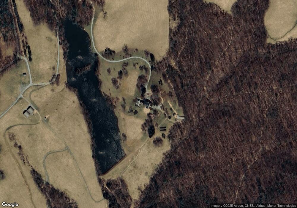
4503 Mount Air Farm Crozet, VA 22932
Estimated Value: $3,593,555 - $3,880,000
4
Beds
8
Baths
14,190
Sq Ft
$263/Sq Ft
Est. Value
About This Home
This home is located at 4503 Mount Air Farm, Crozet, VA 22932 and is currently estimated at $3,736,778, approximately $263 per square foot. 4503 Mount Air Farm is a home located in Albemarle County with nearby schools including Crozet Elementary School, Joseph T. Henley Middle School, and Western Albemarle High School.
Ownership History
Date
Name
Owned For
Owner Type
Purchase Details
Closed on
Nov 1, 2019
Sold by
Keller Forty Two Llc
Bought by
Pigeontop Llc
Current Estimated Value
Purchase Details
Closed on
Dec 8, 2010
Sold by
Keller William G and Keller Lois M
Bought by
Keller Forty Two Llc
Create a Home Valuation Report for This Property
The Home Valuation Report is an in-depth analysis detailing your home's value as well as a comparison with similar homes in the area
Home Values in the Area
Average Home Value in this Area
Purchase History
| Date | Buyer | Sale Price | Title Company |
|---|---|---|---|
| Pigeontop Llc | $6,500,000 | Old Republic Natl Ttl Ins Co | |
| Keller Forty Two Llc | -- | -- |
Source: Public Records
Tax History Compared to Growth
Tax History
| Year | Tax Paid | Tax Assessment Tax Assessment Total Assessment is a certain percentage of the fair market value that is determined by local assessors to be the total taxable value of land and additions on the property. | Land | Improvement |
|---|---|---|---|---|
| 2025 | $36,303 | $4,060,700 | $149,900 | $3,910,800 |
| 2024 | -- | $3,829,300 | $148,000 | $3,681,300 |
| 2023 | $36,719 | $4,299,600 | $148,800 | $4,150,800 |
| 2022 | $27,777 | $3,252,600 | $138,200 | $3,114,400 |
| 2021 | $25,330 | $2,966,000 | $132,300 | $2,833,700 |
| 2020 | $24,856 | $2,910,500 | $133,400 | $2,777,100 |
| 2019 | $24,901 | $2,915,800 | $133,500 | $2,782,300 |
| 2018 | $24,050 | $2,867,500 | $132,900 | $2,734,600 |
| 2017 | $24,041 | $2,865,400 | $114,900 | $2,750,500 |
| 2016 | $21,633 | $2,578,400 | $147,800 | $2,430,600 |
| 2015 | $19,785 | $2,415,700 | $149,900 | $2,265,800 |
| 2014 | -- | $2,411,900 | $149,700 | $2,262,200 |
Source: Public Records
Map
Nearby Homes
- Lot 2B Browns Gap Turnpike
- Lot 2A Browns Gap Turnpike
- 4430 Browns Gap Turnpike
- 5190 Sugar Ridge Rd
- TBD Sugar Ridge Rd
- 4749 Wesley Chapel Rd
- 3395 Brookside Dr
- 5418 Hill Top St
- 3065 Rambling Brook Ln
- 0A Wesley Chapel Rd
- 3228 Garth Rd
- TBD Lakeside Dr
- 2520 Ridge Rd
- 5860 Bearwood Rd
- 96 Acres Blackwells Hollow Rd
- Lot 2 Grand View Dr
- 6878 Chap Place Ln
- 0 Wesley Chapel Rd Unit 665078
- 4503 Mount Air Farm
- 4713 Mount Air Farm
- 4289 Blufton Rd
- 4795 Mount Air Farm
- 4799 Mount Air Farm
- 4796 Blufton Rd
- 4803 Mount Air Farm
- 4738 Blufton Rd
- 4738 Blufton Rd
- 4542 Doylesville Rd
- 4191 Blufton Rd
- 4290 Blufton Rd
- 4830 Blufton Rd
- 3921 Browns Gap Turnpike
- 3945 Browns Gap Turnpike
- 4548 Doylesville Rd
- 4334 Blufton Rd
- 4272 Blufton Rd
- 3896 Browns Gap Turnpike
- 3878 Browns Gap Turnpike