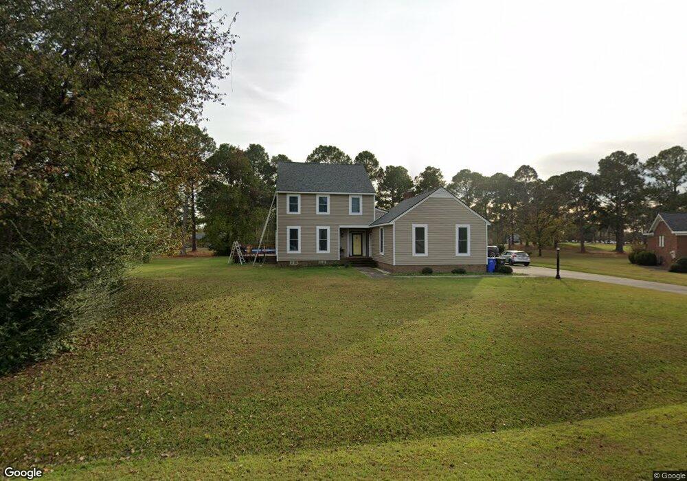
4503 St Andrews Cir Wilson, NC 27896
Estimated Value: $362,937 - $446,000
3
Beds
3
Baths
2,563
Sq Ft
$157/Sq Ft
Est. Value
About This Home
This home is located at 4503 St Andrews Cir, Wilson, NC 27896 and is currently estimated at $402,734, approximately $157 per square foot. 4503 St Andrews Cir is a home located in Wilson County with nearby schools including New Hope Elementary School, Elm City Middle School, and Fike High School.
Ownership History
Date
Name
Owned For
Owner Type
Purchase Details
Closed on
Jul 14, 2021
Sold by
Crawford Desmond P
Bought by
Whaley Brooke and Whaley Thane
Current Estimated Value
Home Financials for this Owner
Home Financials are based on the most recent Mortgage that was taken out on this home.
Original Mortgage
$251,910
Outstanding Balance
$228,569
Interest Rate
2.9%
Mortgage Type
New Conventional
Estimated Equity
$174,165
Purchase Details
Closed on
Nov 17, 2008
Sold by
Crawford Connie Headrick and Crawford Desmond P
Bought by
Crawford Desmond P
Purchase Details
Closed on
May 1, 2007
Sold by
Oettinger David and Pridgen Randall B
Bought by
Crawford Desmond P and Crawford Connie Headrick
Create a Home Valuation Report for This Property
The Home Valuation Report is an in-depth analysis detailing your home's value as well as a comparison with similar homes in the area
Home Values in the Area
Average Home Value in this Area
Purchase History
| Date | Buyer | Sale Price | Title Company |
|---|---|---|---|
| Whaley Brooke | $280,000 | None Available | |
| Crawford Desmond P | -- | None Available | |
| Crawford Desmond P | $215,000 | None Available |
Source: Public Records
Mortgage History
| Date | Status | Borrower | Loan Amount |
|---|---|---|---|
| Open | Whaley Brooke | $251,910 |
Source: Public Records
Tax History Compared to Growth
Tax History
| Year | Tax Paid | Tax Assessment Tax Assessment Total Assessment is a certain percentage of the fair market value that is determined by local assessors to be the total taxable value of land and additions on the property. | Land | Improvement |
|---|---|---|---|---|
| 2025 | $3,496 | $312,155 | $55,000 | $257,155 |
| 2024 | $3,496 | $312,155 | $55,000 | $257,155 |
| 2023 | $2,917 | $223,532 | $55,000 | $168,532 |
| 2022 | $2,917 | $223,532 | $55,000 | $168,532 |
| 2021 | $1,404 | $215,110 | $55,000 | $160,110 |
| 2020 | $0 | $215,110 | $55,000 | $160,110 |
| 2019 | $804 | $215,110 | $55,000 | $160,110 |
| 2018 | $954 | $215,110 | $55,000 | $160,110 |
| 2017 | $2,764 | $215,110 | $55,000 | $160,110 |
| 2016 | $2,764 | $215,110 | $55,000 | $160,110 |
| 2014 | $2,665 | $214,051 | $55,000 | $159,051 |
Source: Public Records
Map
Nearby Homes
- 4500 Saint Andrews Dr N
- 4506 Saint Andrews Dr N
- 4401 Country Club Dr N
- 4702 Nash St N
- 4710 Burning Tree Ln N
- 4800 Burning Tree Ln N
- 4206 Nantucket Dr NW
- 4322 Fawn Ct N
- 4014 Townes Ct
- 5317 Solaris Dr
- 3902 Redbay Ln
- 4511 Bobwhite Trail N
- 5010 Country Club Dr N
- 3645 Eagle Farm Dr N
- 4102 Huntsmoor Ln
- 4915 Country Club Dr N
- 4008 Huntsmoor Ln
- 3556 Jetstream Dr
- 3610 Arrowwood Dr N
- 4121 Little John Dr N
- 4503 Saint Andrews Cir N
- 4505 Saint Andrews Cir N
- 4501 Saint Andrews Cir N
- 4501 Saint Andrews Dr N
- 4502 St Andrews Cir
- 4502 To Be Added
- 4502 Saint Andrews Cir N
- 4504 Saint Andrews Cir N
- 4404 Saint Andrews Dr N
- 4503 Saint Andrews Dr N
- 4317 Country Club Dr N
- 4315 Country Club Dr N
- 4319 Country Club Dr N
- 4319 Country Club Dr N
- 4321 Country Club Dr N
- 4509 Saint Andrews Dr N
- 4502 Saint Andrews Dr N
- 4505 Saint Andrews Dr N
- 4313 Country Club Dr N
- 4504 Saint Andrews Dr N