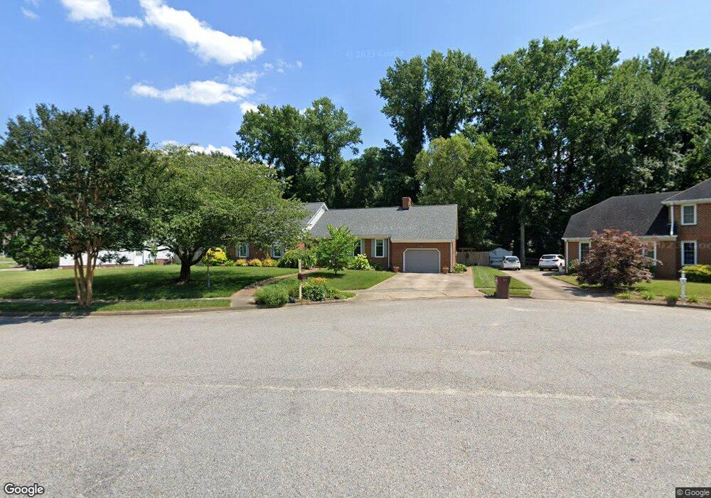
4505 Michael Thomas Ct Chesapeake, VA 23321
Western Branch NeighborhoodEstimated Value: $508,000 - $546,000
5
Beds
3
Baths
2,861
Sq Ft
$186/Sq Ft
Est. Value
About This Home
This home is located at 4505 Michael Thomas Ct, Chesapeake, VA 23321 and is currently estimated at $532,703, approximately $186 per square foot. 4505 Michael Thomas Ct is a home located in Chesapeake City with nearby schools including Western Branch Primary School, Western Branch Intermediate School, and Western Branch Middle School.
Ownership History
Date
Name
Owned For
Owner Type
Purchase Details
Closed on
Feb 28, 2002
Sold by
Frankos John W
Bought by
Boothe David S
Current Estimated Value
Home Financials for this Owner
Home Financials are based on the most recent Mortgage that was taken out on this home.
Original Mortgage
$120,000
Outstanding Balance
$49,598
Interest Rate
6.91%
Mortgage Type
FHA
Estimated Equity
$483,105
Create a Home Valuation Report for This Property
The Home Valuation Report is an in-depth analysis detailing your home's value as well as a comparison with similar homes in the area
Home Values in the Area
Average Home Value in this Area
Purchase History
| Date | Buyer | Sale Price | Title Company |
|---|---|---|---|
| Boothe David S | $210,000 | -- |
Source: Public Records
Mortgage History
| Date | Status | Borrower | Loan Amount |
|---|---|---|---|
| Open | Boothe David S | $120,000 |
Source: Public Records
Tax History Compared to Growth
Tax History
| Year | Tax Paid | Tax Assessment Tax Assessment Total Assessment is a certain percentage of the fair market value that is determined by local assessors to be the total taxable value of land and additions on the property. | Land | Improvement |
|---|---|---|---|---|
| 2025 | $4,727 | $493,400 | $150,000 | $343,400 |
| 2024 | $4,727 | $468,000 | $150,000 | $318,000 |
| 2023 | $4,289 | $424,700 | $140,000 | $284,700 |
| 2022 | $4,073 | $403,300 | $130,000 | $273,300 |
| 2021 | $3,838 | $365,500 | $105,000 | $260,500 |
| 2020 | $3,678 | $350,300 | $100,000 | $250,300 |
| 2019 | $3,602 | $343,000 | $100,000 | $243,000 |
| 2018 | $3,658 | $331,600 | $95,000 | $236,600 |
| 2017 | $3,658 | $348,400 | $100,000 | $248,400 |
| 2016 | $3,482 | $331,600 | $95,000 | $236,600 |
| 2015 | $3,482 | $331,600 | $95,000 | $236,600 |
| 2014 | $3,363 | $320,300 | $95,000 | $225,300 |
Source: Public Records
Map
Nearby Homes
- 4429 Pepper Ridge Ct
- 4310 Brighton Ln
- 3300 Laxey Ct
- 4215 Munford Ln
- 4362 Oneford Place
- 112 Columbus Ave
- 2816 Ashwood Dr
- 3331 Golden Oaks Ln
- 3440 Clover Rd E
- 3304 Michelle Ct
- 3232 Bruin Dr
- 3549 Clover Meadows Dr
- 3133 Dunworken Dr
- 4601 Longleaf Place
- 3217 Bangor Dr
- 4706 Mahogany Run
- 3113 Woodbaugh Dr
- 4611 Longleaf Place
- 4413 McCaan Quay
- 4219 Foxxglen Run
- 4501 Michael Thomas Ct
- 4509 Michael Thomas Ct
- 4510 Michael Thomas Ct
- 4502 Michael Thomas Ct
- 4504 Michael Thomas Ct
- 4508 Michael Thomas Ct
- 3032 Peppercorn Dr
- 3016 Peppercorn Dr
- 3035 Peppercorn Dr
- 2825 Crossings Dr
- 2827 Crossings Dr
- 2821 Crossings Dr
- 4509 Casey Martin Ct
- 4431 Pepper Ridge Ct
- 4505 Casey Martin Ct
- 4415 Pepper Ridge Ct
- 2829 Crossings Dr
- 4433 Pepper Ridge Ct
- 3036 Peppercorn Dr
- 4417 Pepper Ridge Ct