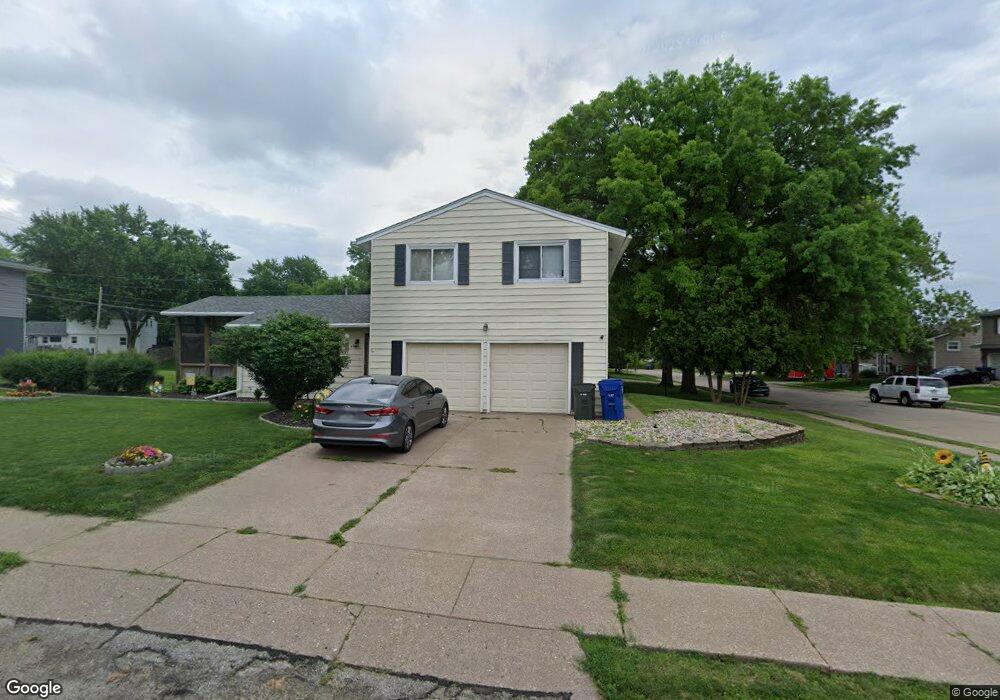
4505 N Main St Davenport, IA 52806
North Side NeighborhoodEstimated Value: $211,008 - $236,000
3
Beds
2
Baths
1,288
Sq Ft
$171/Sq Ft
Est. Value
About This Home
This home is located at 4505 N Main St, Davenport, IA 52806 and is currently estimated at $220,502, approximately $171 per square foot. 4505 N Main St is a home located in Scott County with nearby schools including Cumberland Hall School, Harrison Elementary School, and Academy Of Continuing Education.
Ownership History
Date
Name
Owned For
Owner Type
Purchase Details
Closed on
May 18, 2007
Sold by
Olson Donald R and Olson Penelope
Bought by
Tilala Niral H and Tilala Tejas R
Current Estimated Value
Home Financials for this Owner
Home Financials are based on the most recent Mortgage that was taken out on this home.
Original Mortgage
$26,400
Interest Rate
6.2%
Mortgage Type
Purchase Money Mortgage
Purchase Details
Closed on
Sep 9, 2005
Sold by
Corrigan Karen R and Corringan David M
Bought by
Olson Donald R and Olson Penelope
Home Financials for this Owner
Home Financials are based on the most recent Mortgage that was taken out on this home.
Original Mortgage
$25,000
Interest Rate
7.87%
Mortgage Type
Adjustable Rate Mortgage/ARM
Purchase Details
Closed on
Jun 23, 2005
Sold by
Corrigan Karen R and Corrigan David M
Bought by
Corrigan Karen R
Create a Home Valuation Report for This Property
The Home Valuation Report is an in-depth analysis detailing your home's value as well as a comparison with similar homes in the area
Home Values in the Area
Average Home Value in this Area
Purchase History
| Date | Buyer | Sale Price | Title Company |
|---|---|---|---|
| Tilala Niral H | $132,000 | None Available | |
| Olson Donald R | $125,000 | None Available | |
| Corrigan Karen R | -- | None Available |
Source: Public Records
Mortgage History
| Date | Status | Borrower | Loan Amount |
|---|---|---|---|
| Closed | Tilala Niral H | $26,400 | |
| Open | Tilala Niral H | $105,600 | |
| Previous Owner | Olson Donald R | $25,000 | |
| Previous Owner | Olson Donald R | $100,000 |
Source: Public Records
Tax History Compared to Growth
Tax History
| Year | Tax Paid | Tax Assessment Tax Assessment Total Assessment is a certain percentage of the fair market value that is determined by local assessors to be the total taxable value of land and additions on the property. | Land | Improvement |
|---|---|---|---|---|
| 2025 | $3,254 | $201,470 | $36,760 | $164,710 |
| 2024 | $3,176 | $182,100 | $36,760 | $145,340 |
| 2023 | $3,486 | $182,100 | $36,760 | $145,340 |
| 2022 | $3,502 | $163,160 | $26,740 | $136,420 |
| 2021 | $3,502 | $163,160 | $26,740 | $136,420 |
| 2020 | $3,282 | $151,050 | $26,740 | $124,310 |
| 2019 | $3,242 | $144,450 | $26,740 | $117,710 |
| 2018 | $3,004 | $144,450 | $26,740 | $117,710 |
| 2017 | $761 | $136,750 | $26,740 | $110,010 |
| 2016 | $2,874 | $131,250 | $0 | $0 |
| 2015 | $2,874 | $137,370 | $0 | $0 |
| 2014 | $3,050 | $137,370 | $0 | $0 |
| 2013 | $2,998 | $0 | $0 | $0 |
| 2012 | -- | $123,880 | $33,520 | $90,360 |
Source: Public Records
Map
Nearby Homes
- 4505 Sheridan St
- 4610 N Ripley St
- 405 Westerfield Rd
- 4717 N Harrison St
- 315 Colony Dr
- 611 Northbrook Dr
- 7 Vista Ct
- 710 Northbrook Dr
- 4449 Royal Oaks Dr
- 825 Northbrook Dr
- 4612 Warren St Unit 5
- 4942 Brown St
- 4804 Northwest Blvd
- 3546 Fair Ave
- 4757 Willow Cir
- 4743 Willow Cir
- 235 W 32nd St
- 4618 Fillmore Ln
- 1336 W 38th Place
- 515 W 31st St
- 4506 N Main St
- 4417 N Main St
- 4521 N Main St
- 217 Westerfield Rd
- 4516 N Main St
- 232 Westerfield Rd
- 0 N Main St
- 4418 N Main St
- 4516 Sheridan St
- 209 Westerfield Rd
- 4524 Sheridan St
- 4506 Sheridan St
- 4522 N Main St
- 4530 Sheridan St
- 4527 N Main St
- 231 Westerfield Rd
- 238 Westerfield Rd
- 4418 Sheridan St
- 4536 Sheridan St
- 237 Westerfield Rd