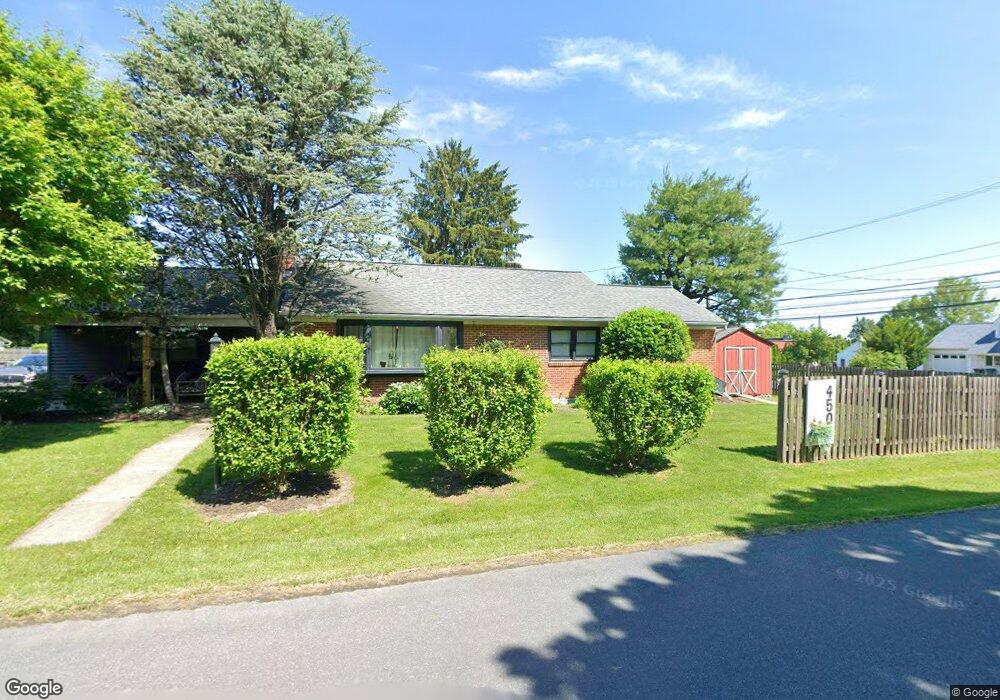
4507 Daisy Ave Orefield, PA 18069
Estimated Value: $301,515 - $336,000
3
Beds
2
Baths
1,362
Sq Ft
$236/Sq Ft
Est. Value
About This Home
This home is located at 4507 Daisy Ave, Orefield, PA 18069 and is currently estimated at $321,379, approximately $235 per square foot. 4507 Daisy Ave is a home located in Lehigh County with nearby schools including Schnecksville School, Orefield Middle School, and Parkland High School.
Ownership History
Date
Name
Owned For
Owner Type
Purchase Details
Closed on
Aug 21, 2003
Sold by
Gruber Clarence G and Gruber Susan F
Bought by
Tatkovsky John and Tatkovsky Elizabeth
Current Estimated Value
Home Financials for this Owner
Home Financials are based on the most recent Mortgage that was taken out on this home.
Original Mortgage
$123,600
Outstanding Balance
$54,032
Interest Rate
5.52%
Mortgage Type
Purchase Money Mortgage
Estimated Equity
$267,347
Purchase Details
Closed on
Apr 17, 1998
Sold by
Smith Carl R
Bought by
Gruber Clarence G and Gruber Susan F
Purchase Details
Closed on
Mar 31, 1992
Sold by
Reitz Thomas and Ciocco Louis T
Bought by
Smith Carl R
Purchase Details
Closed on
Feb 14, 1991
Bought by
Reitz Thomas and Ciocco Louis T
Purchase Details
Closed on
Dec 14, 1978
Bought by
Bruch Wayne Alfred
Create a Home Valuation Report for This Property
The Home Valuation Report is an in-depth analysis detailing your home's value as well as a comparison with similar homes in the area
Home Values in the Area
Average Home Value in this Area
Purchase History
| Date | Buyer | Sale Price | Title Company |
|---|---|---|---|
| Tatkovsky John | $123,600 | -- | |
| Gruber Clarence G | $89,000 | -- | |
| Smith Carl R | $87,000 | -- | |
| Reitz Thomas | $44,000 | -- | |
| Bruch Wayne Alfred | -- | -- |
Source: Public Records
Mortgage History
| Date | Status | Borrower | Loan Amount |
|---|---|---|---|
| Open | Tatkovsky John | $123,600 |
Source: Public Records
Tax History
| Year | Tax Paid | Tax Assessment Tax Assessment Total Assessment is a certain percentage of the fair market value that is determined by local assessors to be the total taxable value of land and additions on the property. | Land | Improvement |
|---|---|---|---|---|
| 2025 | $3,099 | $139,600 | $22,500 | $117,100 |
| 2024 | $2,915 | $139,600 | $22,500 | $117,100 |
| 2023 | $2,831 | $139,600 | $22,500 | $117,100 |
| 2022 | $2,819 | $139,600 | $117,100 | $22,500 |
| 2021 | $2,819 | $139,600 | $22,500 | $117,100 |
| 2020 | $2,819 | $139,600 | $22,500 | $117,100 |
| 2019 | $2,745 | $139,600 | $22,500 | $117,100 |
| 2018 | $2,690 | $139,600 | $22,500 | $117,100 |
| 2017 | $2,651 | $139,600 | $22,500 | $117,100 |
| 2016 | -- | $139,600 | $22,500 | $117,100 |
| 2015 | -- | $126,900 | $22,500 | $104,400 |
| 2014 | -- | $126,900 | $22,500 | $104,400 |
Source: Public Records
Map
Nearby Homes
- 3465 Wolf Pack Dr Unit 162
- 4403 Wolfs Crossing Rd
- 3486 Lil Wolf Dr
- 4250 Jaguar Ct
- 4748 York Dr
- 3955 Coplay Creek Rd
- 4131 Orefield Rd
- 2695 Apple Valley Estates Dr
- 4377 Astor Dr
- 2507 Rachael Ln
- 4408 Valley Green Dr
- 2213 Village Rd
- 4828 Huckleberry Rd
- 4473 Valley Green Dr Unit 38
- 4482 Valley Green Dr Unit 37
- 4497 Valley Green Dr Unit 41
- 4498 Valley Green Dr Unit 34
- 4117 Grape St
- 4450 Maple St Unit 2
- Folino Plan at Greenleaf Fields at Parkland
- 3422 Pennsylvania 309
- 4515 Daisy Ave
- 4506 Daisy Ave
- 3430 Pa Route 309
- 3422 Route 309
- 3430 Route 309
- 4512 Daisy Ave
- 3417 Pennsylvania 309
- 3411 Pennsylvania 309
- 4518 Daisy Ave
- 3417 Route 309
- 3411 Pa Route 309
- 3411 Route 309
- 3370 Route 309
- 3375 Route 309
- 4524 Daisy Ave
- 3429 Route 309
- 3425 Route 309
- 3367 Route 309
- 4530 Daisy Ave
Your Personal Tour Guide
Ask me questions while you tour the home.