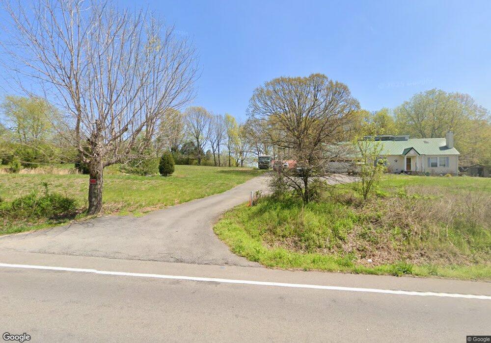
4507 Highway 48 Cumberland Furnace, TN 37051
Estimated Value: $222,000 - $344,000
--
Bed
2
Baths
1,227
Sq Ft
$224/Sq Ft
Est. Value
About This Home
This home is located at 4507 Highway 48, Cumberland Furnace, TN 37051 and is currently estimated at $275,351, approximately $224 per square foot. 4507 Highway 48 is a home located in Montgomery County with nearby schools including Montgomery Central Elementary School, Montgomery Central Middle School, and Montgomery Central High School.
Ownership History
Date
Name
Owned For
Owner Type
Purchase Details
Closed on
Apr 11, 2017
Sold by
Muldoon Gerard Paul
Bought by
Muldoon Lori Ann
Current Estimated Value
Purchase Details
Closed on
Oct 31, 2016
Sold by
Thorington Perry
Bought by
Muldoon Lori Ann and Muldoon Gerard Paul
Home Financials for this Owner
Home Financials are based on the most recent Mortgage that was taken out on this home.
Original Mortgage
$90,000
Interest Rate
3.42%
Mortgage Type
VA
Purchase Details
Closed on
Jan 15, 1998
Sold by
Reeves Rayburn
Bought by
Thorington Perry
Home Financials for this Owner
Home Financials are based on the most recent Mortgage that was taken out on this home.
Original Mortgage
$94,113
Interest Rate
7.07%
Create a Home Valuation Report for This Property
The Home Valuation Report is an in-depth analysis detailing your home's value as well as a comparison with similar homes in the area
Home Values in the Area
Average Home Value in this Area
Purchase History
| Date | Buyer | Sale Price | Title Company |
|---|---|---|---|
| Muldoon Lori Ann | -- | -- | |
| Muldoon Lori Ann | $90,000 | -- | |
| Thorington Perry | $92,268 | -- |
Source: Public Records
Mortgage History
| Date | Status | Borrower | Loan Amount |
|---|---|---|---|
| Previous Owner | Muldoon Lori Ann | $90,000 | |
| Previous Owner | Thorington Perry | $94,113 |
Source: Public Records
Tax History Compared to Growth
Tax History
| Year | Tax Paid | Tax Assessment Tax Assessment Total Assessment is a certain percentage of the fair market value that is determined by local assessors to be the total taxable value of land and additions on the property. | Land | Improvement |
|---|---|---|---|---|
| 2024 | $1,444 | $68,750 | $0 | $0 |
| 2023 | $1,444 | $39,750 | $0 | $0 |
| 2022 | $1,189 | $39,750 | $0 | $0 |
| 2021 | $1,189 | $39,750 | $0 | $0 |
| 2020 | $1,189 | $39,750 | $0 | $0 |
| 2019 | $1,189 | $39,750 | $0 | $0 |
| 2018 | $1,141 | $32,675 | $0 | $0 |
| 2017 | $1,141 | $37,150 | $0 | $0 |
| 2016 | $1,141 | $37,150 | $0 | $0 |
| 2015 | $1,105 | $37,150 | $0 | $0 |
| 2014 | $1,085 | $36,475 | $0 | $0 |
| 2013 | $949 | $30,200 | $0 | $0 |
Source: Public Records
Map
Nearby Homes
- 3551 State Highway 48
- 4776 Highway 48
- 4801 Highway 48
- 0 Highway 48 N Unit RTC2987557
- 286 Martha Morgan Way
- 4510 Akin Rd
- 644 Highway 13
- 4862 Louise Rd
- 1551 Buck Ridge Ct
- 1534 Buck Ridge Ct
- 1541 Buck Ridge Ct
- 213 Attaway Rd
- 225 Attaway Rd
- 3830 Vernon Creek
- 251 Seven Mile Ferry Rd
- 5479 Louise Rd
- 5495 Louise Rd
- 3846 Vernon Creek
- 315 Seven Mile Ferry Rd
- 887 Harvey Rd
- 4481 Highway 48
- 4465 Old Highway 48
- 4465 Old Highway 48
- 4465 Highway 48
- 4466 Highway 48
- 4545 Highway 48
- 4501 Highway 48
- 4473 Highway 48
- 4510 Highway 48
- 4420 Highway 48
- 4516 Highway 48
- 4511 Highway 48
- 4520 Highway 48
- 5 Southside Rd
- 151 Southside Rd
- 157 Southside Rd
- 159 Southside Rd
- 171 Southside Rd
- 155 Southside Rd
- 4264 Station Rd